Good evening, everyone. We are getting closer to our major winter storm blasting the Bluegrass State as Winter Storm Warnings are now out. This storm is likely to shut down the region later Saturday into Sunday.
Here’s a look at the Winter Storm Warning and the soon to be upgraded Winter Storm Watch…

By tomorrow, the entire region will be under a Warning.
My First Call For Ice and Snowfall has a lot to digest as all forms of winter precipitation will be likely…
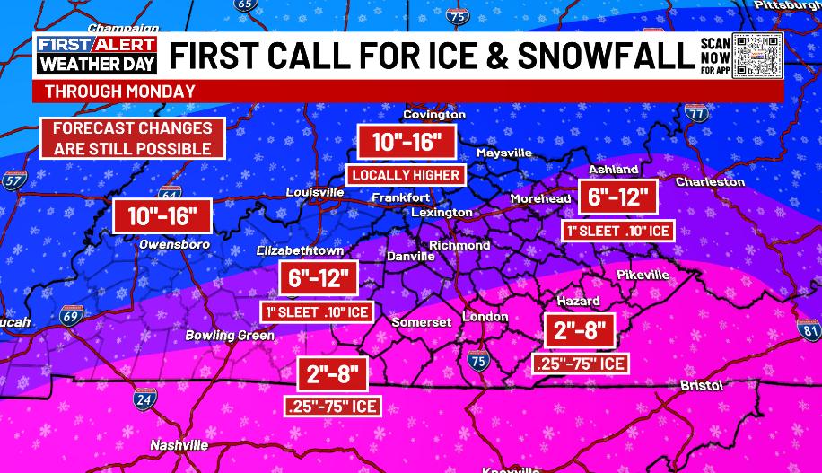
I will be updating this tonight and Friday as we are still a ways away from this storm impacting Kentucky. The southern portion of that map is of particular concern for a possible Ice Storm. That would come after initial heavy snows then would end as some snow.
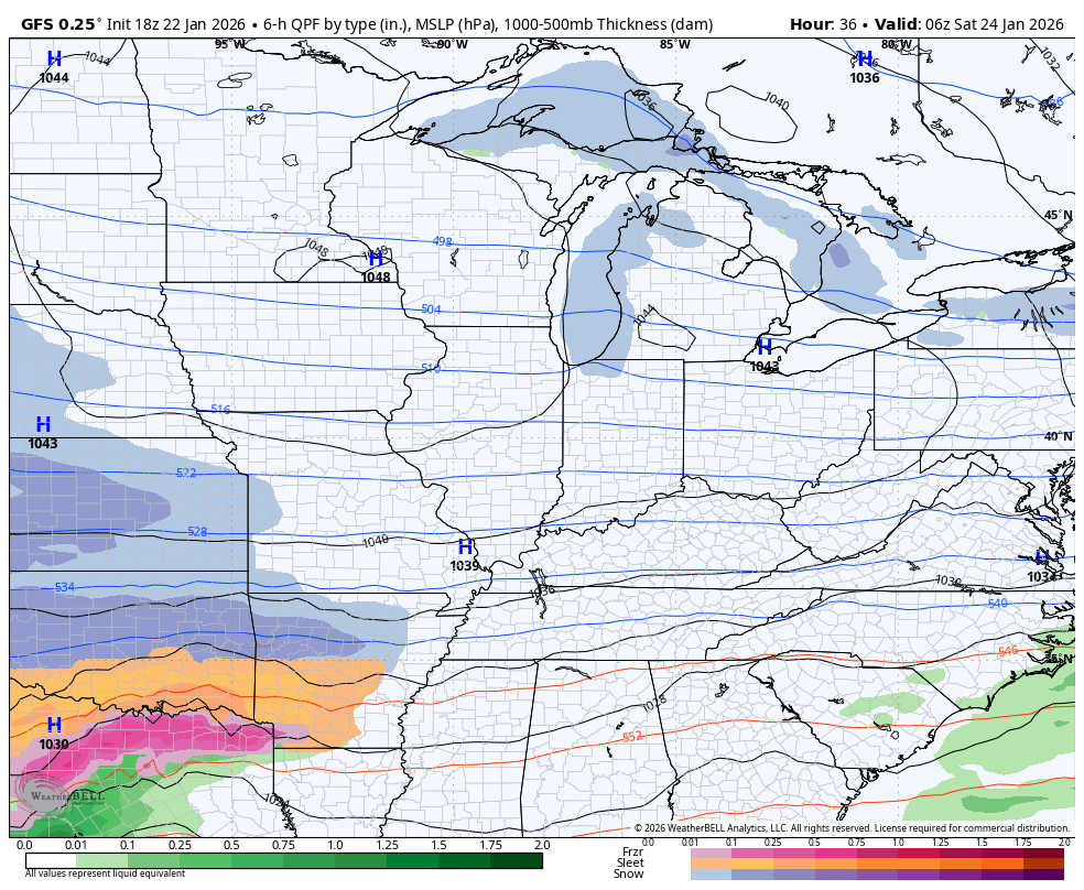
As far as what the NWS is forecasting, they aren’t too different from what I have out…


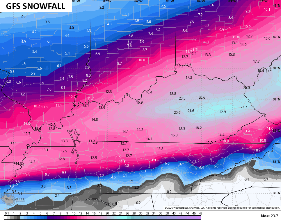
If you’re a snow lover or hater, you need to be cheering on the GFS. Why? Because it is actually a colder model that’s more snow than ice for the entire state…
The snowfall map continues to be wild…
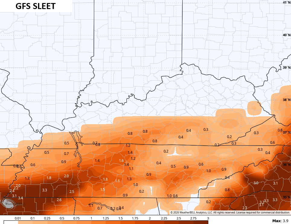
Here’s the sleet forecast…
It is still spitting out enough ice for a major event across the far southeast…
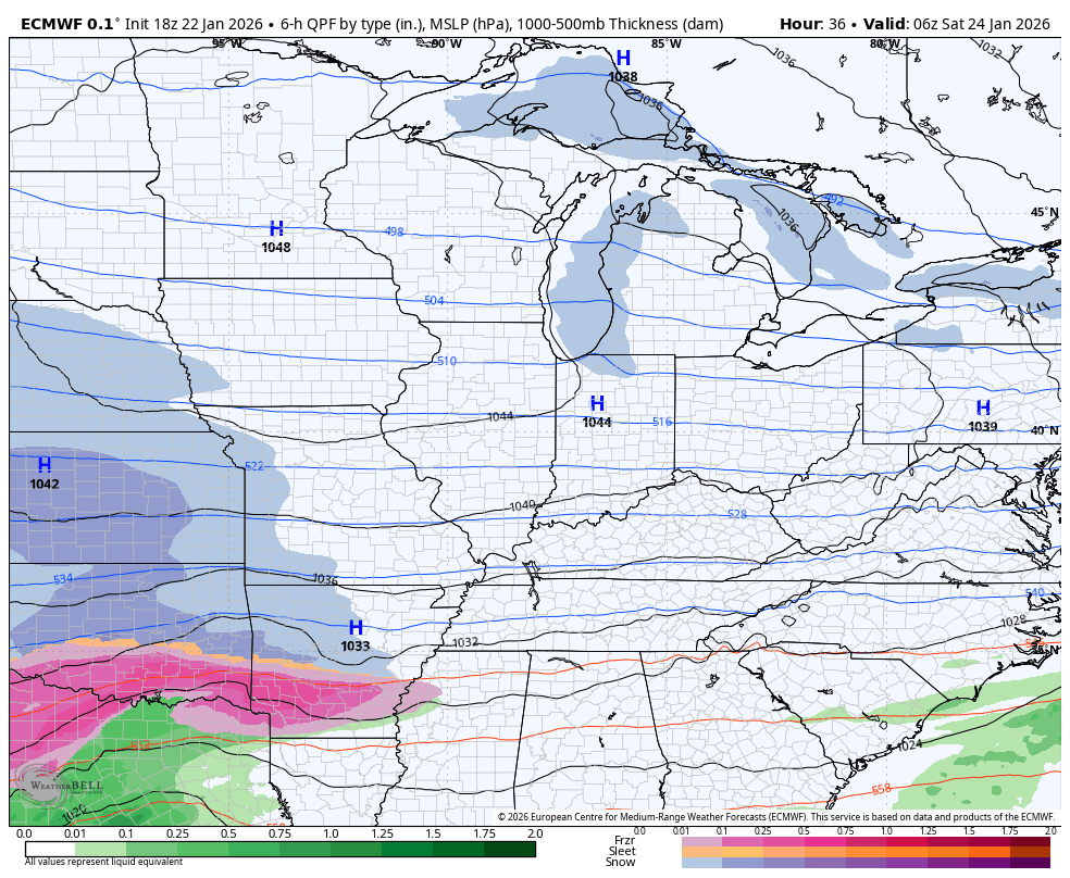
Contrast that with the late day EURO which now bring a full blown ice storm into the southern half of Kentucky…
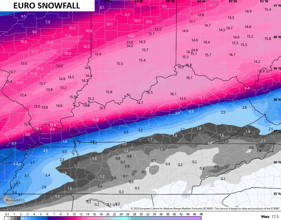
Notice the significant snows and the sharp cutoff in the south…
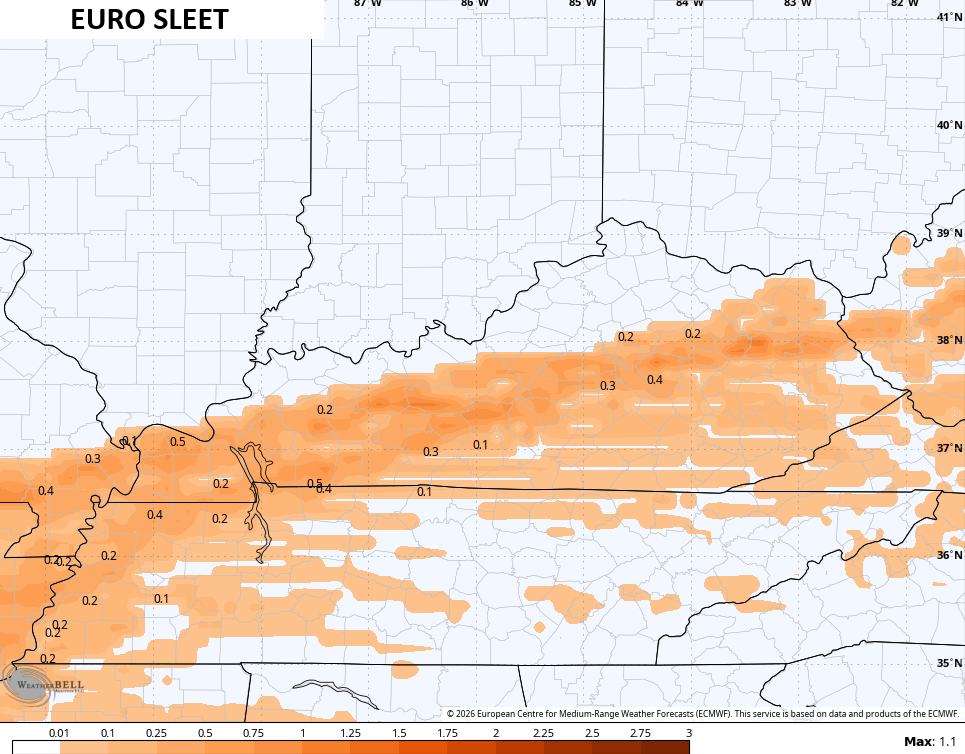
The sleet is small but notable…
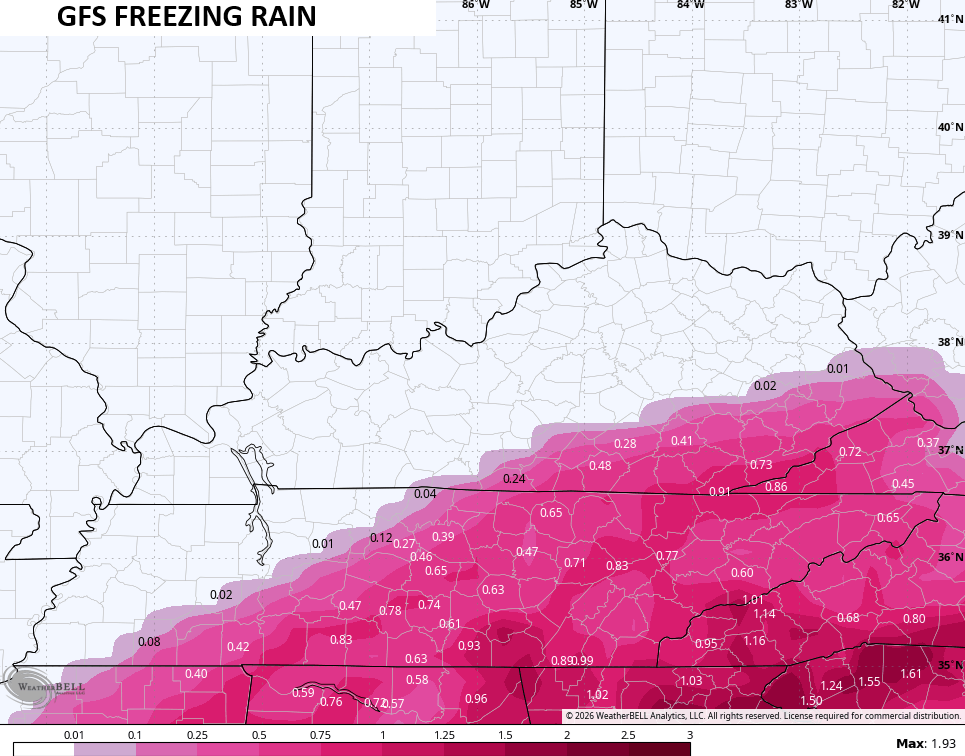
The freezing rain is scary…
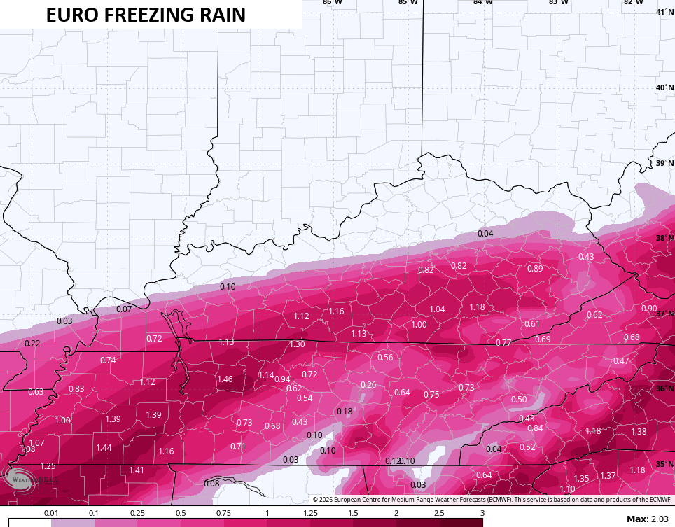
We want no part of that, folks. None. Nada.
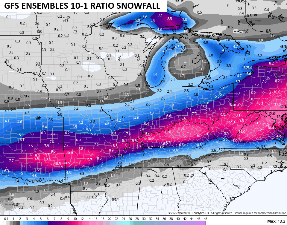
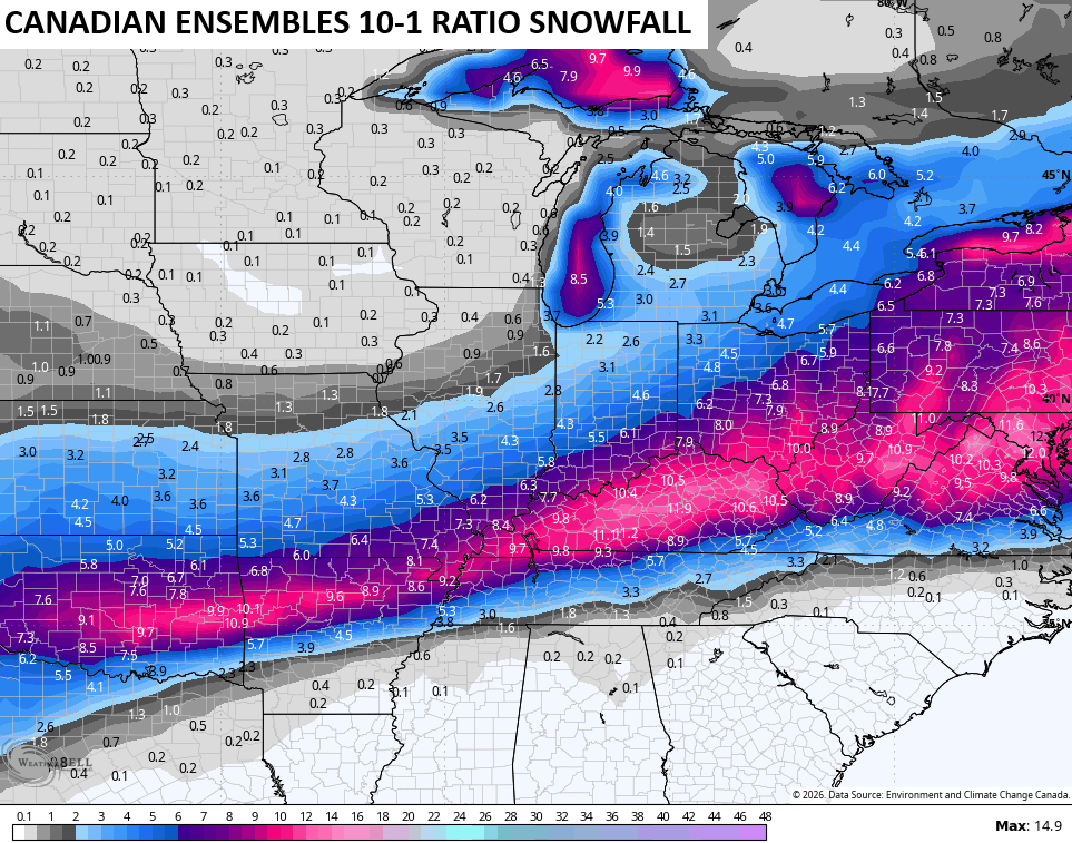
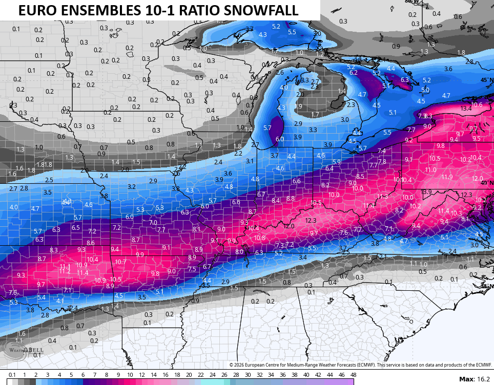
Here’s what the Ensembles are seeing for snow…
Brutal cold follows this Monday and Tuesday with another snow threat and arctic air lurking by the middle and end of next week.
The full update comes your way later tonight and I’ll I’ll also have a few updates on my Meteorologist Chris Bailey Facebook Page
Until then, here are your tracking tools for the day…


Make it a great Thursday and take care.
