Good Friday, everyone. Our major winter storm is still on pace to cause all kinds of issues as we head into the weekend. This is a storm that will effectively shut the region down with significant amounts of snow, sleet and freezing rain. Bitterly cold temps will surge in, too.
By the time most of you are reading this, the entire area is under a Winter Storm Warning for the weekend…

Here’s the breakdown of this massive storm:
SATURDAY
- Light to moderate snow arrives in western and southern Kentucky during the morning.
- Snow expands across the rest of the state during the afternoon.
- Moderate to heavy snow covers the whole commonwealth by late afternoon.
- Several inches of snow will show up for many by evening.
- Bitterly cold temps mean the fluff factor will be very high.
- Wind chills will be well below zero to start the day with generally single digit wind chills most of the day.
SATURDAY NIGHT
- Heavy snow continues for much of the state.
- Several more inches of snow will be likely for areas staying all snow.
- Sleet and freezing rain show up across southern Kentucky.
- How far north the ice line gets will a tough call.
- Significant amounts of sleet and freezing rain will be possible where this occurs.
SUNDAY
- Heavy snow keeps rolling for the northern half of the state with several more inches.
- I’m becoming more concerned about the freezing rain line coming farther north across the eastern half of the state.
- The ice storm potential is a little higher now than it was yesterday.
- It’s during this time period we will really need to watch for power outages for areas getting in on the freezing rain.
SUNDAY NIGHT
- Moderate to heavy snows pull away.
- Light snow is rather common across much of central and eastern Kentucky.
- Total snow accumulations of double digits are more than possible for many areas.
- For any one location, the more sleet and/or freezing rain you have, the lower the snow totals.
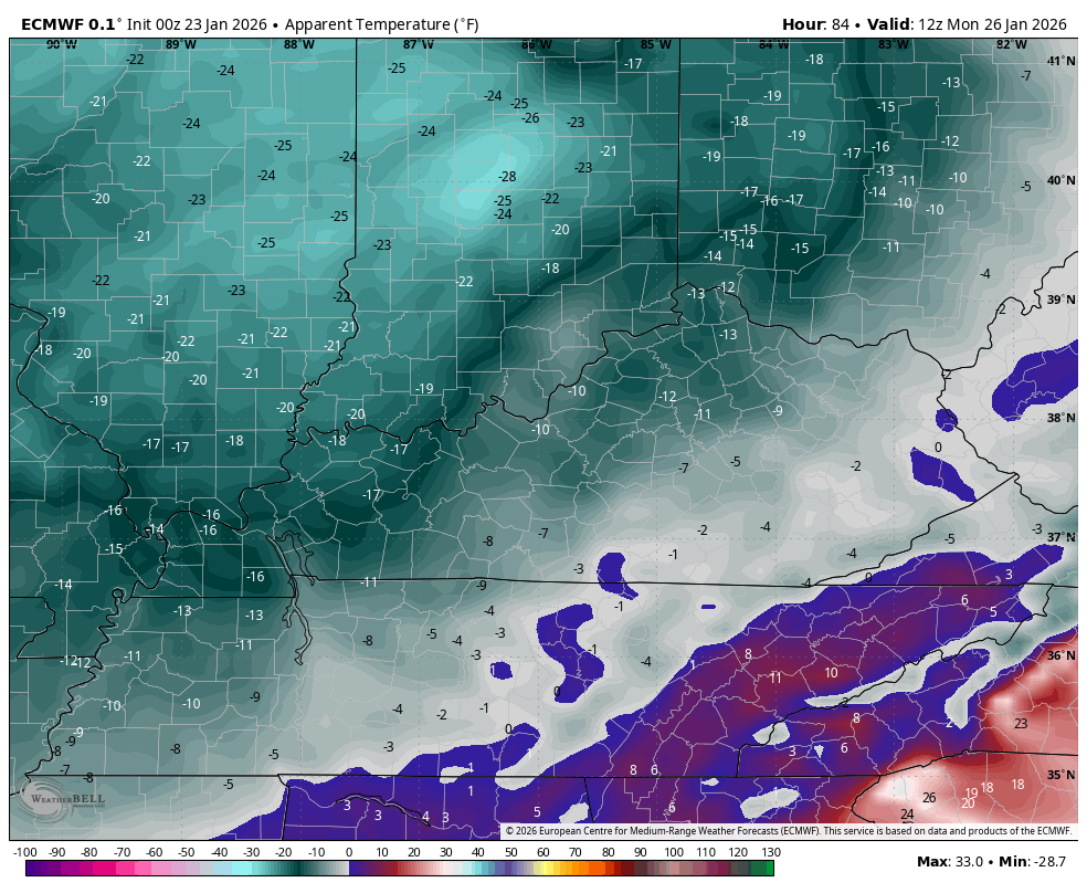
- Bitterly cold temps surge back in and may go below zero by Monday morning.
- Wind chills reach -10 to -15.
MONDAY
- Some light snow and flurries will be possible across central and eastern Kentucky.
- The big story now turns to the brutal cold. Temps may not get out of the single digits through the day.
- Lows again go below zero Monday night and Tuesday morning.
- Wind chills may reach -20 to -25.
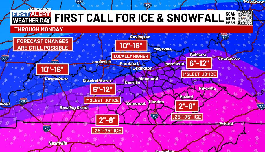
Given everything I’m seeing, I know some changes are coming to the First Call Map, but I’m riding with the OG for the moment…
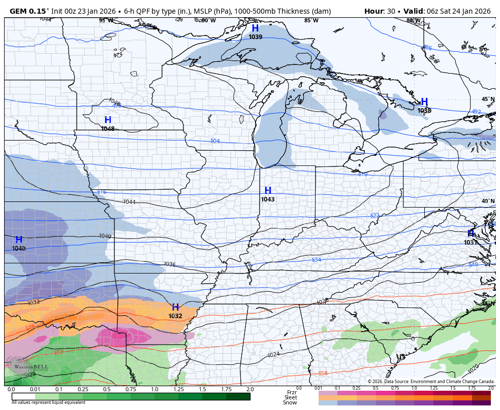
The EURO model is very concerning as it shows both a snowstorm and an ice storm with some areas getting in on both…
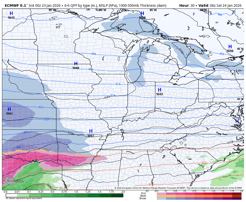
Here’s the snow map from that run…
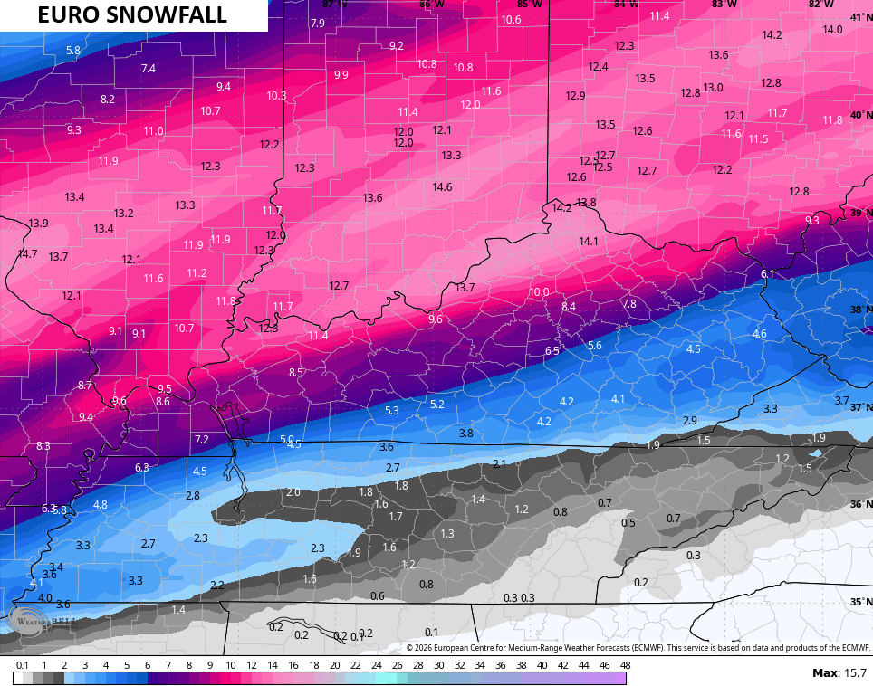
It has limited sleet and I like the idea of limited sleet…
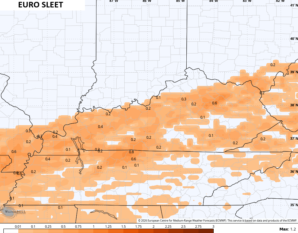
It is, unfortunately, raising the bar for a significant ice storm. My initial reaction is this is too far north and a bit overdone…
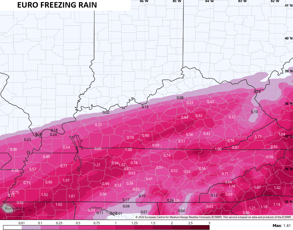
We REALLY need for that to be overdone or that’s a whole lot of hurt that we simply do not need.
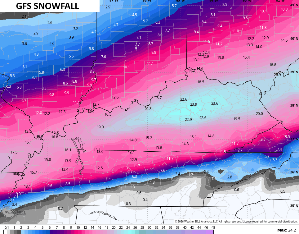
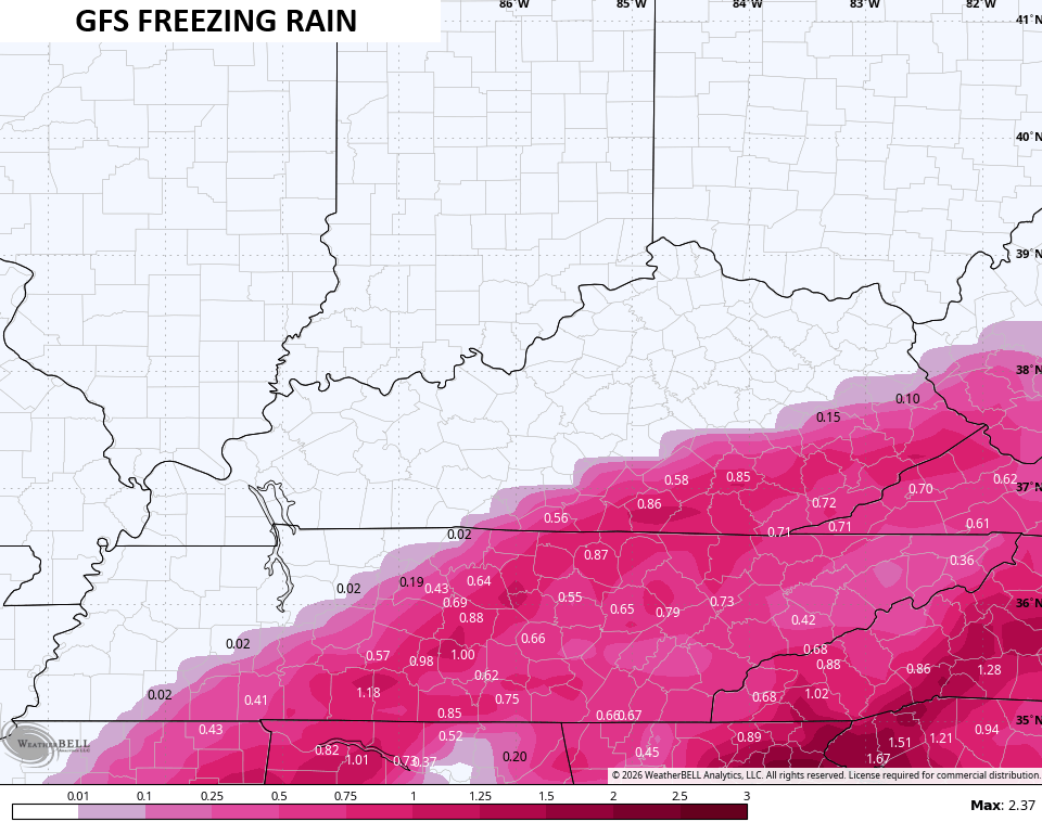
The GFS is on the flipside and continues to run colder with much more snow…
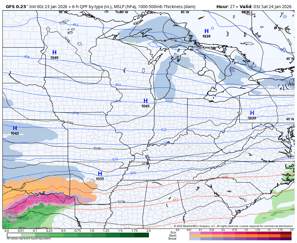
The snow maps from the GFS have been consistently higher and farther south than any other model…
Here’s the sleet…
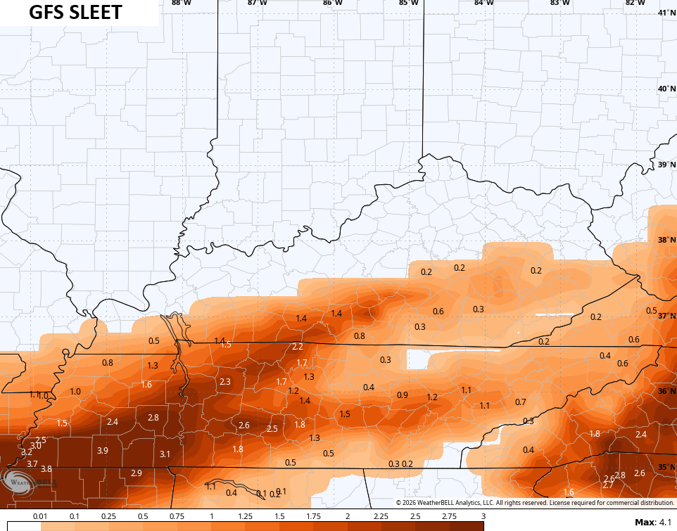
It is seeing the ice storm potential in the southeast…
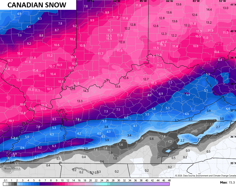
The Canadian is in between the GFS and EURO…
Snowfall from the Canadian…
And the sleet forecast…
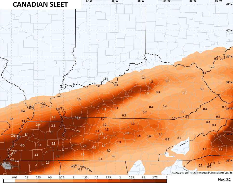
It’s also a little more amped with the freezing rain…
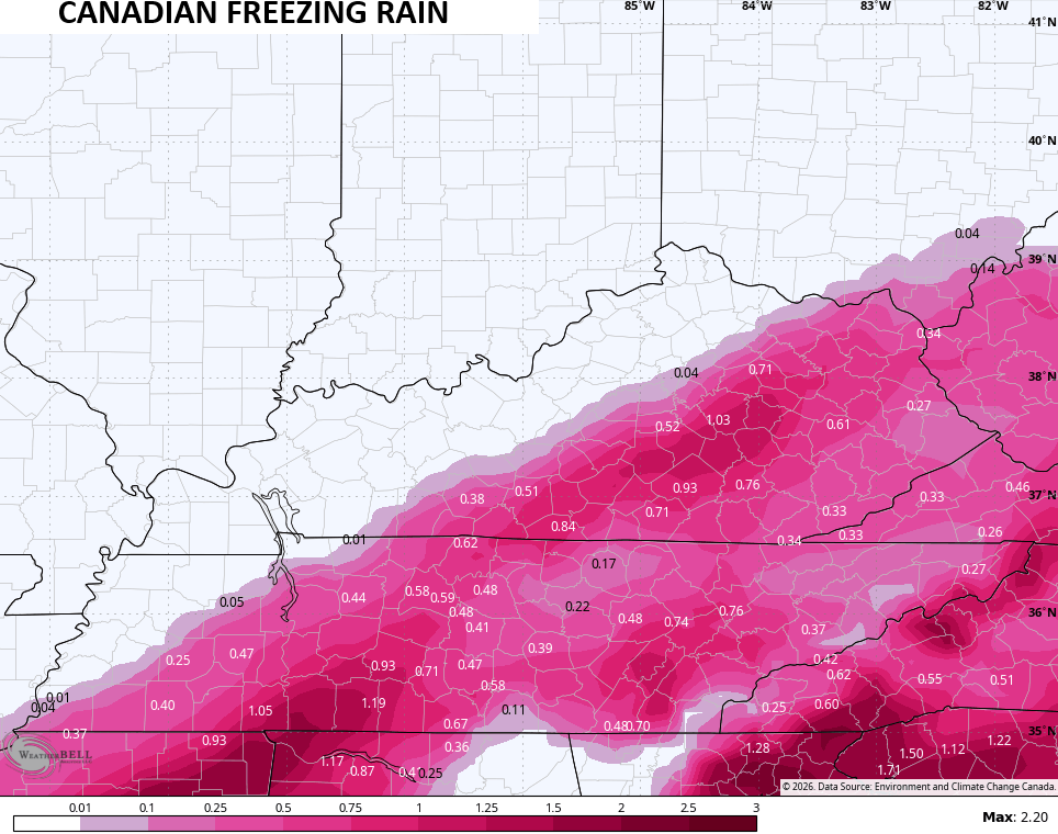
The amount of precipitation with this storm is absolutely nuts and we REALLY need for the bulk of it to fall as snow and sleet. The increased freezing rain signal on all of the models is concerning. If that trend continues today, an out and out ice storm will be possible for some areas and that would be AFTER several inches of snow fall. That could get super nasty, so please stay alert to any changes to the forecast.
The bitterly cold air sends lows below zero Monday and Tuesday with wind chills that can reach -20 or lower…
Updates come your way later today, so check back. I’ll also have a few updates on my Meteorologist Chris Bailey Facebook Page
Until then, here are your tracking tools for the day…


Make it a fantastic Friday and take care.

Bleh
No no no ice storm not that
JKL has Corbin wedged in between 2-5 or 5-10 & 0.25 – 0.50 freezing rain. Looking at modeling this morning, seems it really could go either way.
Doesn’t Look Like Any Of The Models Are Agreeing. Forecast Still Up In The Air. No Pun Intended.
Interesting Euro showing rain at the end of it’s run into East Ky..Hopefully it’s all rain..But a difference in a few degrees could be more freezing rain..
Here in the Chicago Metro Area, we are in the brutal cold with an Extreme Cold Warning. At 9 AM CST at Chicago’s O’Hare Airport, it’s 11 below zero with a wind chill of 31 below. At the NWS Forecast Office in the SW Suburbs, it’s 9 below zero with a wind chill of 26 below.
At least it’s sunny out, but that sure isn’t warming things up at all. Temperatures are predicted to stay below zero all day here.
Looks like the GFS is coming in line with other models..Zr amount went up in East Ky