Good evening, everyone. A major winter storm continues to target the region this weekend and it’s going to shut down the entire region. This brings significant amounts of snow, sleet and freezing rain that will be followed by brutally cold temps.
A Winter Storm Warning continues for the entire region…

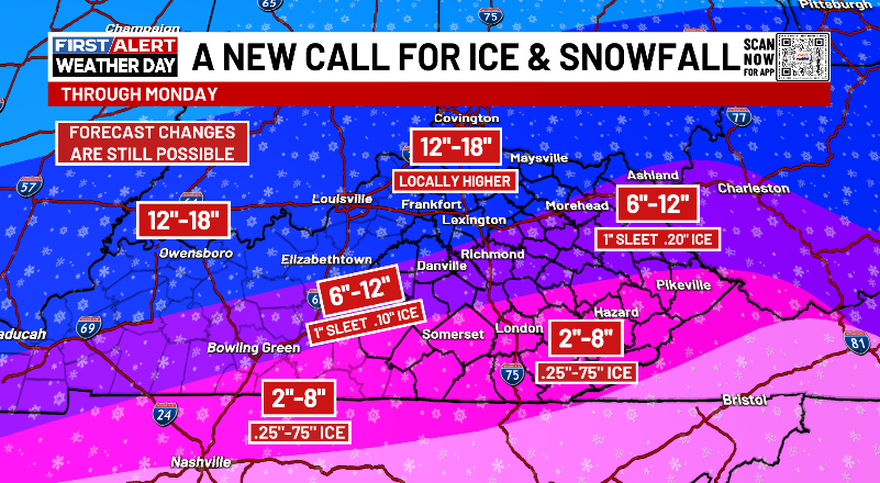
My New Call for Ice and Snowfall upped the snow totals but also increased the freezing rain chances just a bit. I’m VERY concerned with some of our region getting a snowstorm then a full blown ice storm on top of it…
The new run of the Short Range Canadian Model likes my forecast…
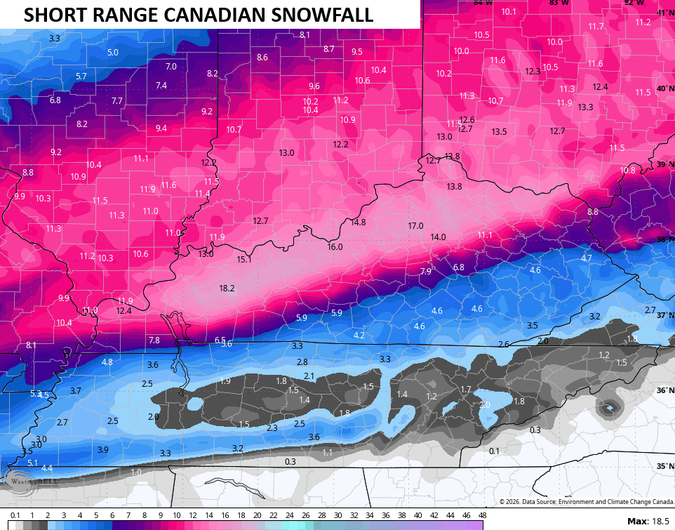
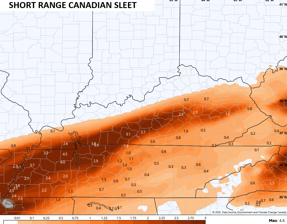
It’s still pretty amped up with the sleet…
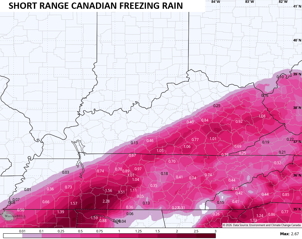
The freezing rain part of this continues to increase a bit, lending validity to my fears about a snowstorm to an ice storm for some in the south and east…
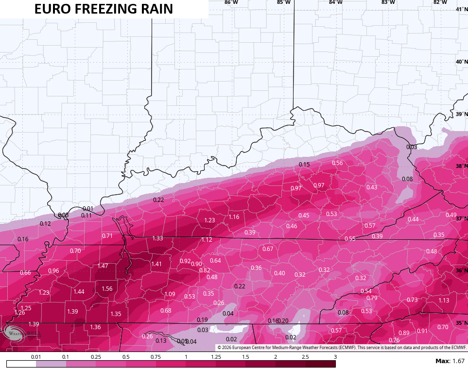
The late day run of the European Model is pretty similar…
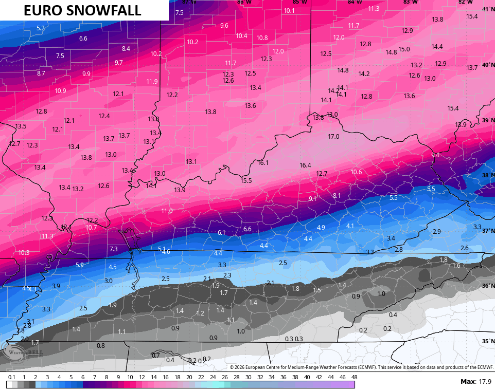
It does have less sleet…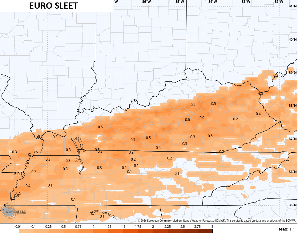
And it’s a tad farther north with the freezing rain and it’s even scarier with the ice potential…
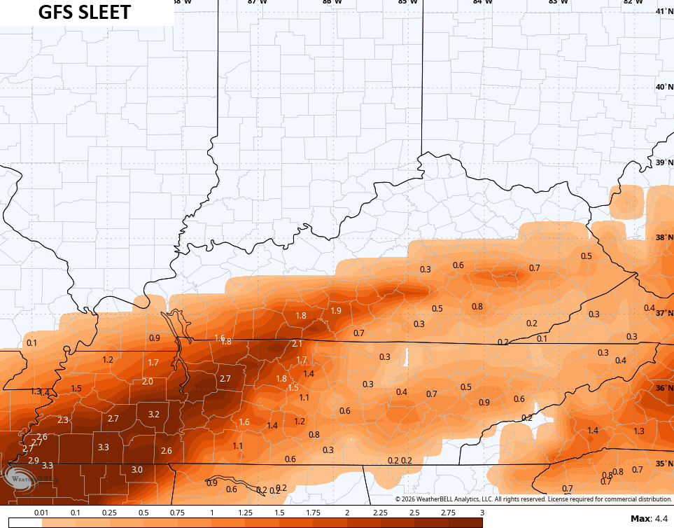
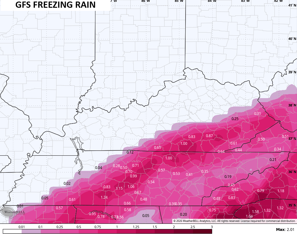
The GFS continues to be the model we hope verifies because it has more snow for most folks…
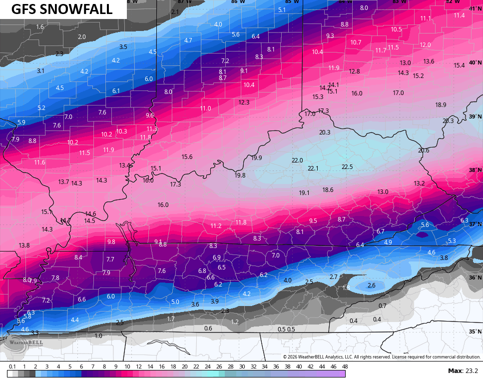
It is seeing a stripe of heavy sleet…
It’s also now showing higher freezing rain totals than before, but it has this farther south than the other two models…
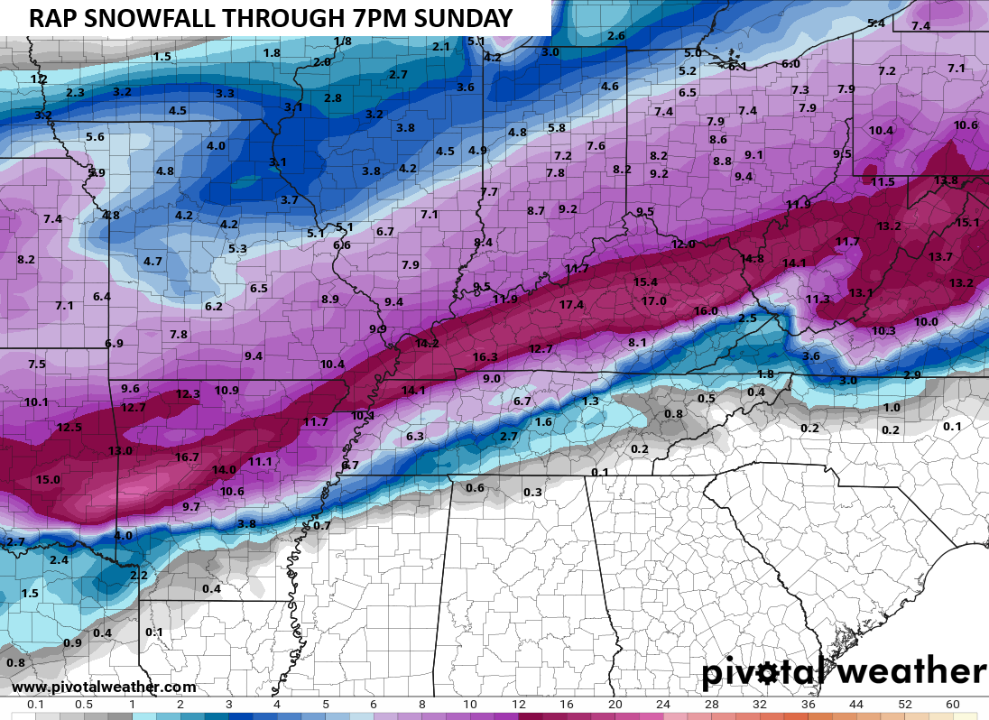
We are getting within range of the RAP so it’s time to look at it a little more. The latest run of the model is pretty far south with the heaviest snow through 7pm Sunday…
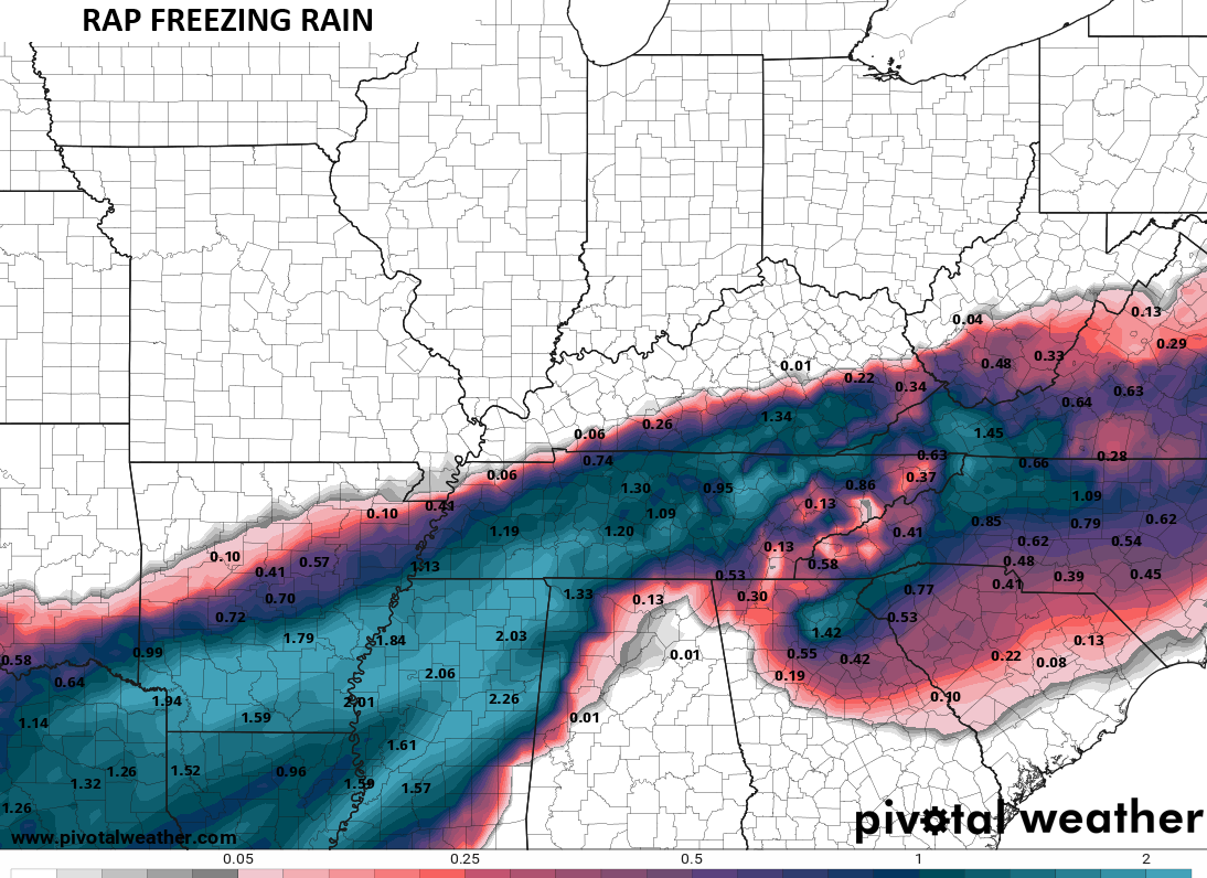
It also has an ice storm into parts of the south and southeast…
This is a life-threatening winter storm and it will be followed by life-threatening bitterly cold temps. Please have a plan for if you lose power or get stranded on a road.
The lates comes your way on WKYT on the CW Lexington at 10pm and on WKYT at 11. I’ll also have a few updates on my Meteorologist Chris Bailey Facebook Page
Until then, here are your tracking tools for the day…


Make it a fantastic Friday and take care.

Can’t wait to see how this plays out. If the GFS is verbatim it will be the biggest snow fall for Louisville in over 20 years and break a one day total record.
It’s just it’s just another random boring weather day in this comment section. Wow how times have changed.
Yep..Sadly it all about social media and who can get the most clicks..Posting model runs weeks out showing blizzards..Money talks in this social media age..