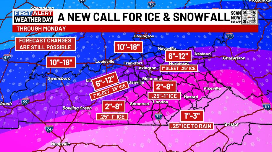
Good evening, everyone. The chance for a significant ice storm is increasing across parts of Kentucky. This is a high impact winter storm hitting Kentucky with the worst yet to come later tonight and Sunday.
Here’s the Winter Storm Warning that continues…

Much of Kentucky has already picked up 1″-4″ of snow as of this writing. The snow is in the process of switching to freezing rain across the south and that moves northward through the night. This freezing rain will then move all the way to the interstate 64 corridor tonight. That means several inches of snow will then be covered in a significant amount of ice and then get covered by a little more snow Sunday afternoon and night.
I think the original analog of last January’s storm I came up with turned out to be the one that’s winning out.
This is a VERY dangerous setup tonight and Sunday…
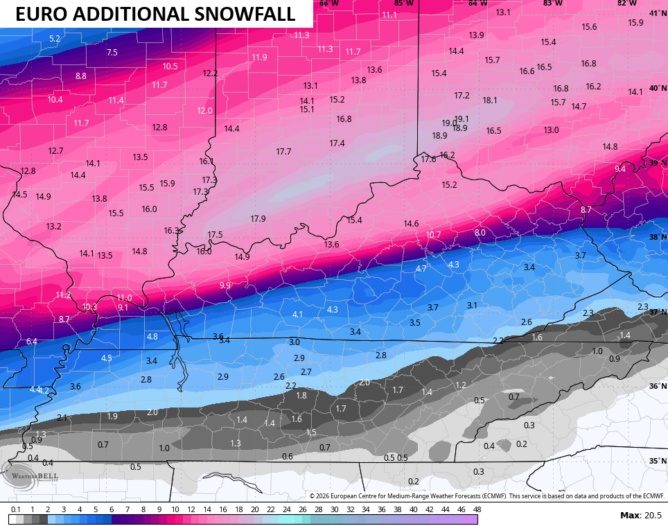
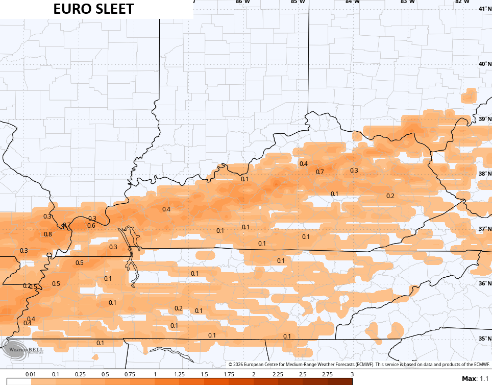
Significant snow and ice are showing up on radar with just some sleet. The one model that had less sleet was the EURO and here’s what the late day run of the model is showing…
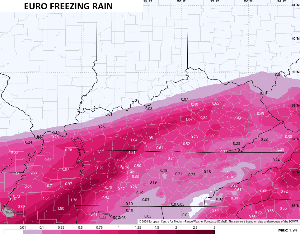
The freezing rain signature is scary. Power outages are likely with bitterly cold air coming in behind it all.
I’m on WKYT-TV all weekend, including tonight. I’ll also have updates on my Meteorologist Chris Bailey Facebook Page
Until then, here are your tracking tools for the day…


Make it a great Saturday and take care.

Well the snow is a bust for WKY
We Just Received About One And A Half Inches Here In Maple. Been Snowing Very Lightly Since Noon. Hoping All Of This Is Out Of Here Before Noon Tomorrow. Dew Points Are Too Low For A Big Snow. Temperatures Tomorrow May Be Above Freezing To Change the Freezing Rain To Just Plain Rain. I Hope.
Thank you so much for all you do CB! Our family is split between east Louisville and Lexington, with our daughter at UK. Your information along with the updates from the campus puts our parent hearts at ease! We are all well informed and feel safe. ❄️♥️❄️♥️