Good evening, everyone. A State of Emergency continues for the entire state as our massive winter storm starts to move away. Unfortunately, life-threatening cold is settling in and looks to remain through next weekend, at least.
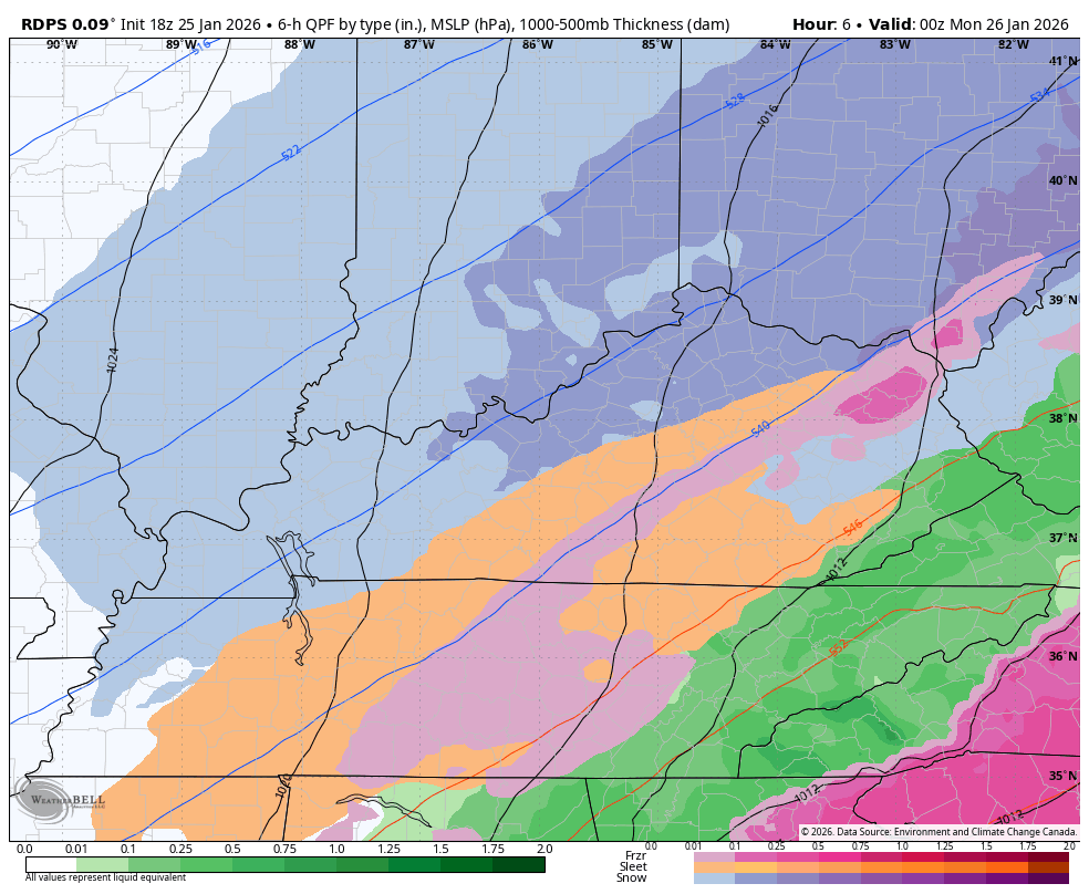
Our Winter Storm Warning continues for the state but the light snow is slowing down…

As the winter storm moves away tonight, areas of light snow, snow showers and flurries will continue to push in from the northwest…
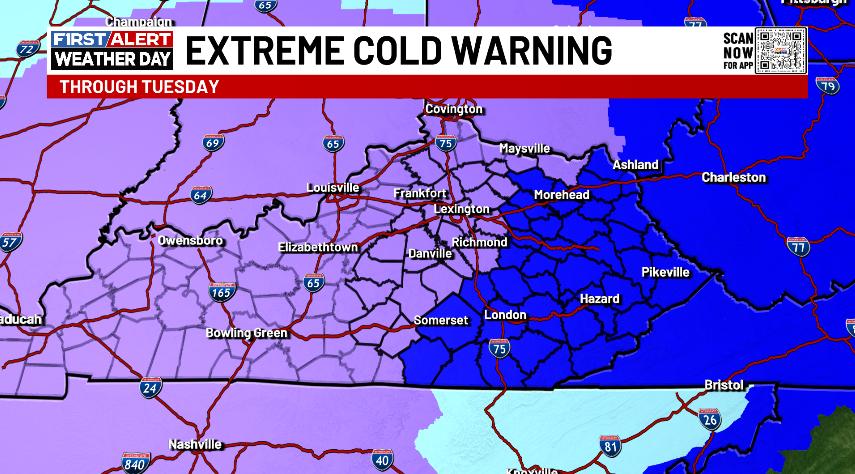
The bitter cold is the story with a rare Extreme Cold Warning out for much of Kentucky through Tuesday…
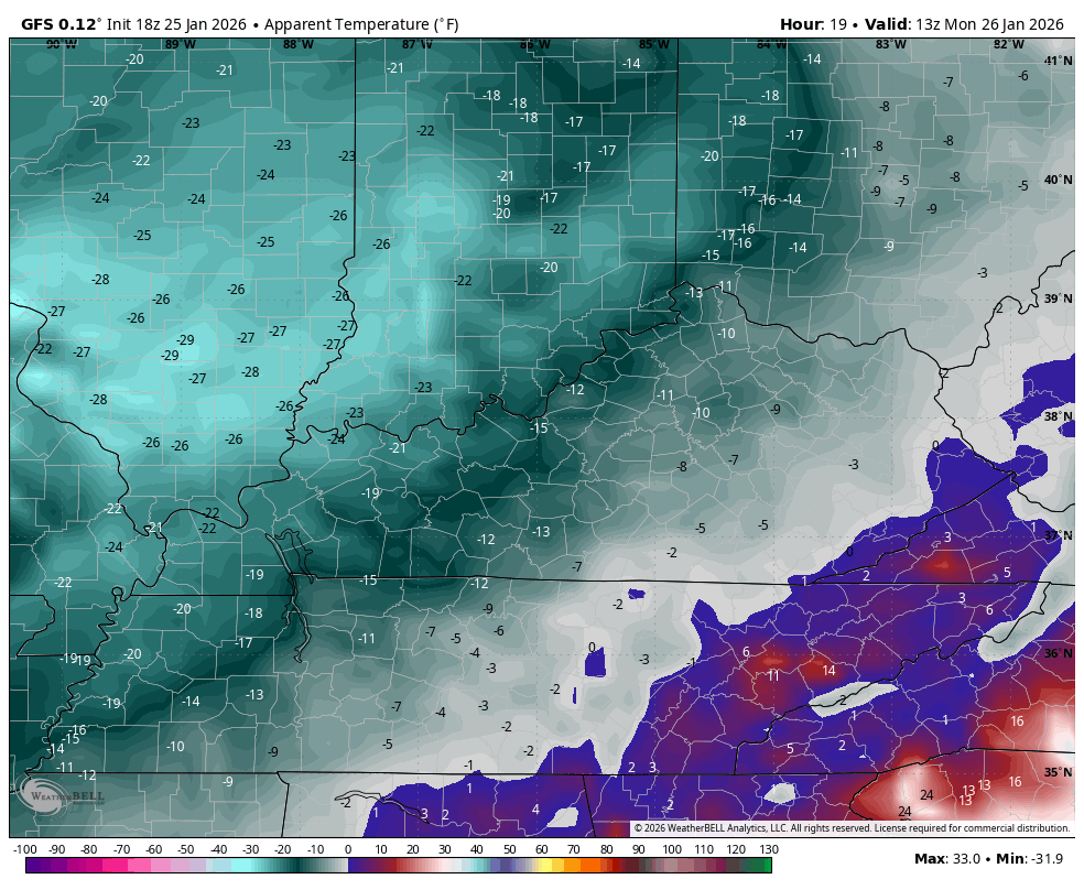
Wind chills are just brutal starting later tonight. This animation shows wind chill readings from Monday morning through Tuesday morning…
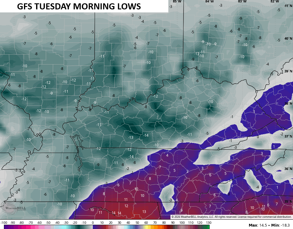
Actual low temps may drop to well below zero later Monday into Tuesday morning…
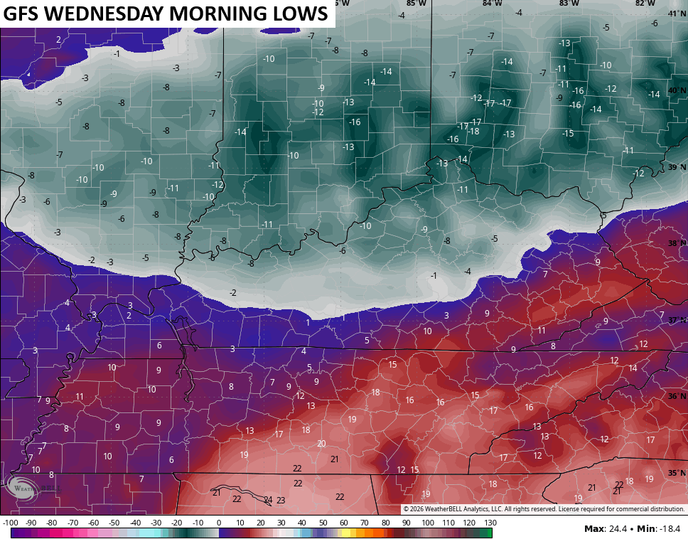
It doesn’t stop there with snow and ice on the ground, temps can drop below zero again Wednesday…
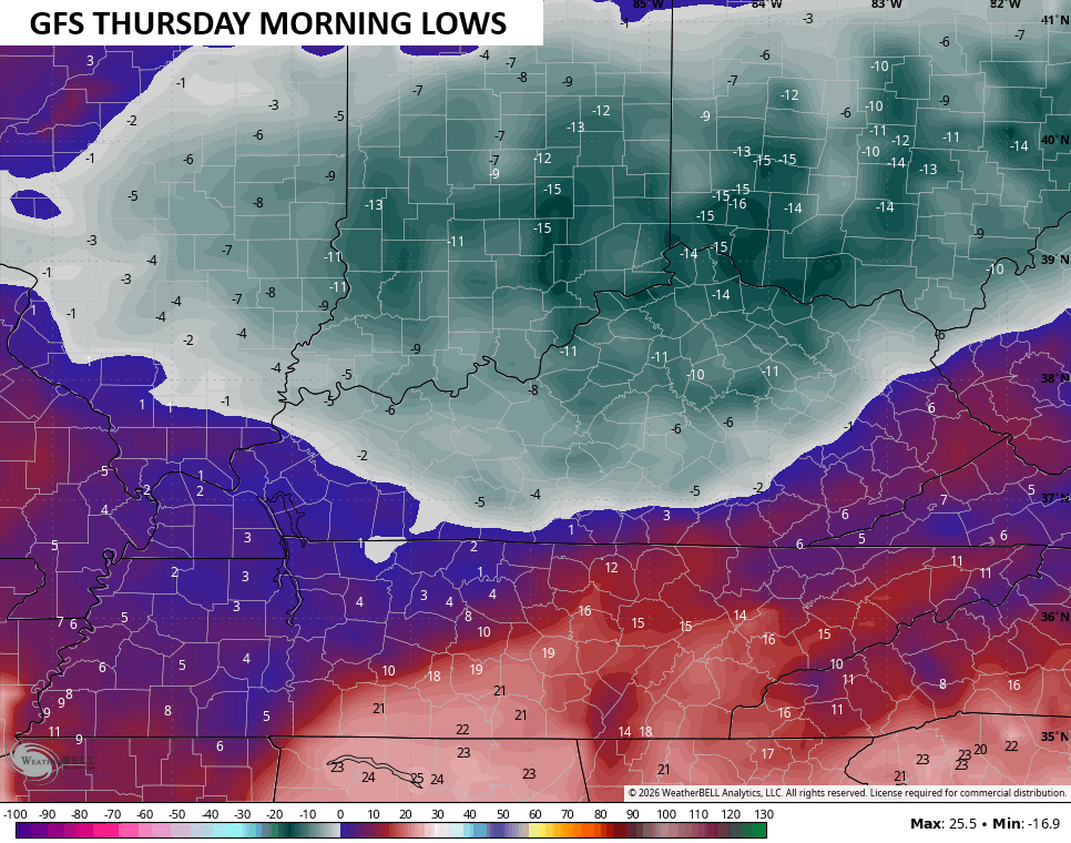
And Thursday…
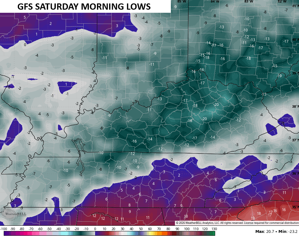
Then fresh arctic air mass surges in by next weekend and sends temps even lower…
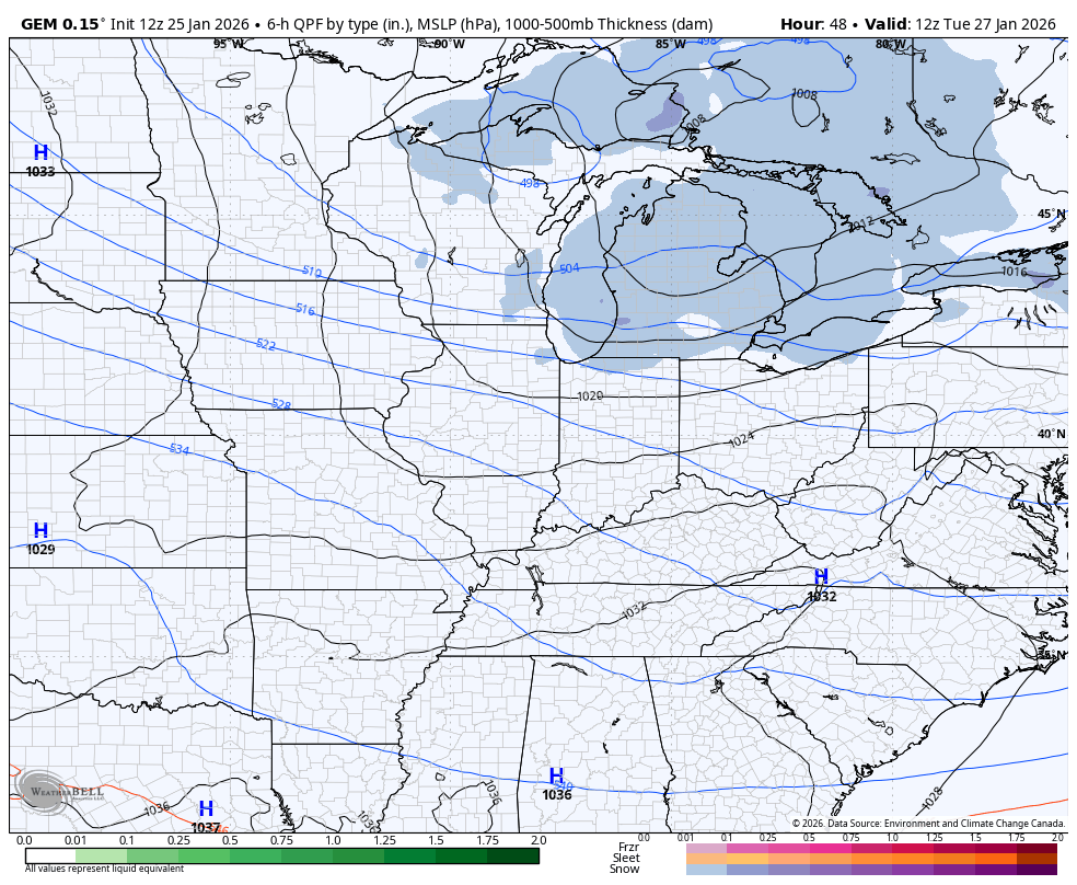
This setup will feature periodic light snows and snow showers all week. One of these systems dropping in from the northwest may really crank at some point…
A full update comes later tonight. I’ll also have updates on my Meteorologist Chris Bailey Facebook Page
Until then, here are your tracking tools for the day…


Make it a great Sunday and take care.

This won’t last.
Thanks for all you do CB!!! Really appreciate your dedication. Now get some rest!
We’re a winde gust away from losing power here, the .50 definitely verified in Corbin