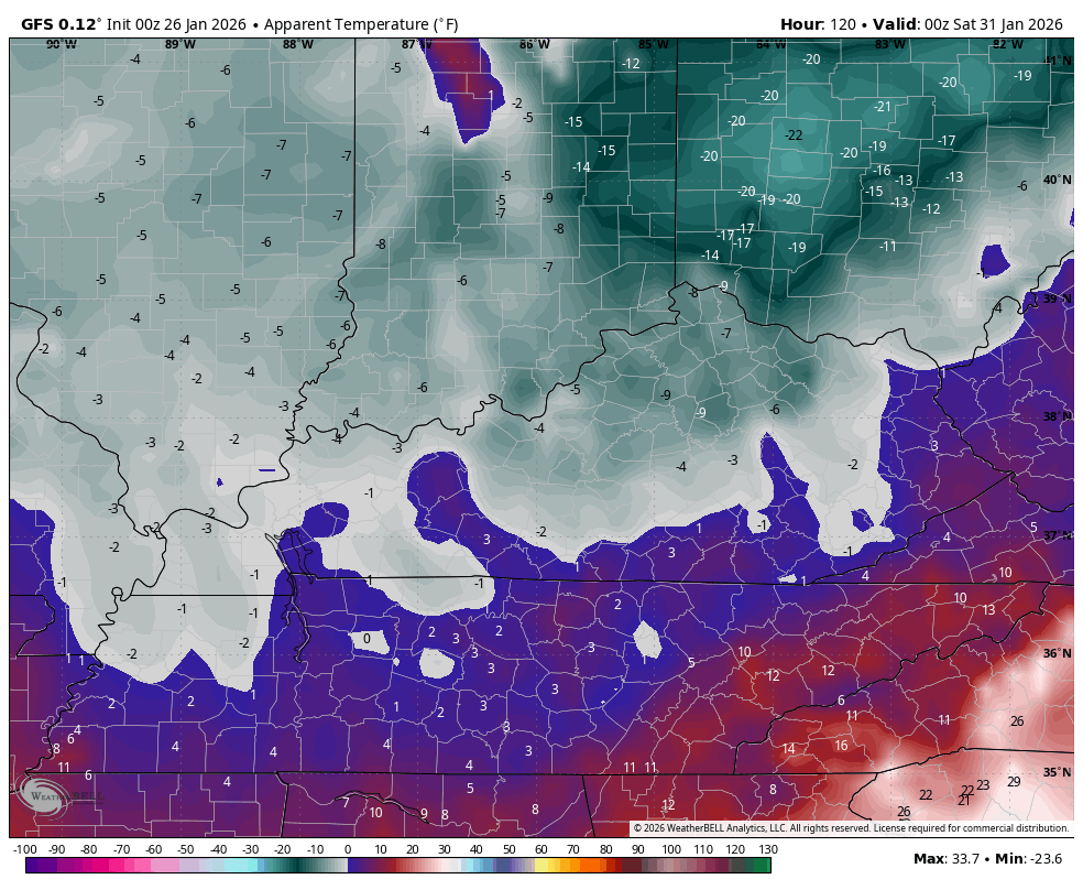
Good Monday, everyone. It’s a brutally cold close to the month of January and this likely holds into early February, at least. We are also dealing a rounds of light snow this week with the potnetial for a deeper system by the end of the week or weekend.
An Extreme Cold Warning is out for much of the region through Tuesday. Bitterly cold temps are out there today with some area starting the day from -5 to 5 above. Highs today only reach the high single digits to middle teens. As skies clear a bit tonight, lows drop toward zero or below once again.
Wind chills are dangerously cold and will drop well below zero. This animation shows wind chills from this morning through Tuesday morning…
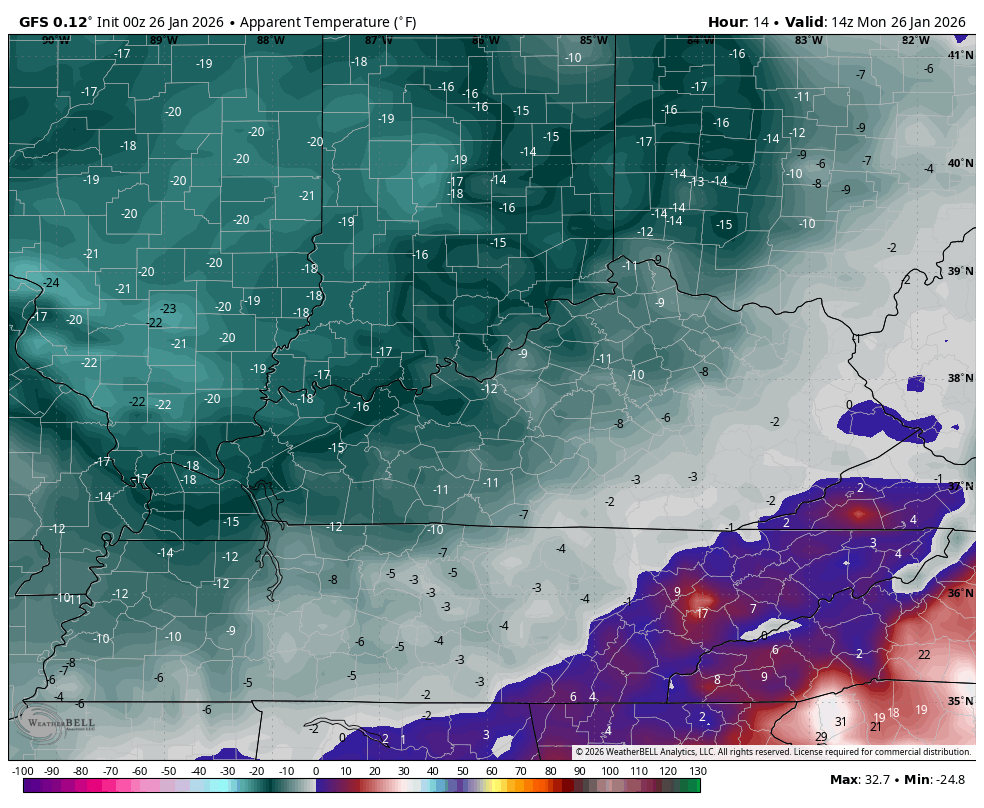
With thousands of people still without power, those numbers are life-threatening so please check on your friends, family and neighbors in this harsh time.
Light snow and snow showers will continue out there today in central and eastern Kentucky. This will continue to put down some light accumulations, adding to the significant snow and ice pack already in place.
This arctic air dropping in from the northwest will have another burst or two of light snow late Tuesday through Wednesday…
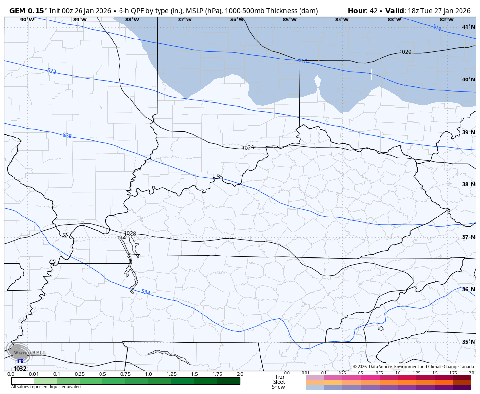
This flow will have a system by Friday and Saturday that can ramp up into something more in the eastern US. The GFS and EURO are both east and southeast with this system, but that’s right where you want them if you’re a local snow lover. Here’s the GFS…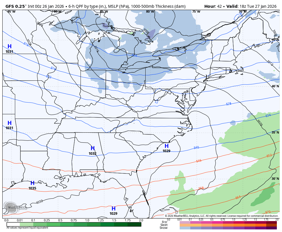
Here’s the EURO…
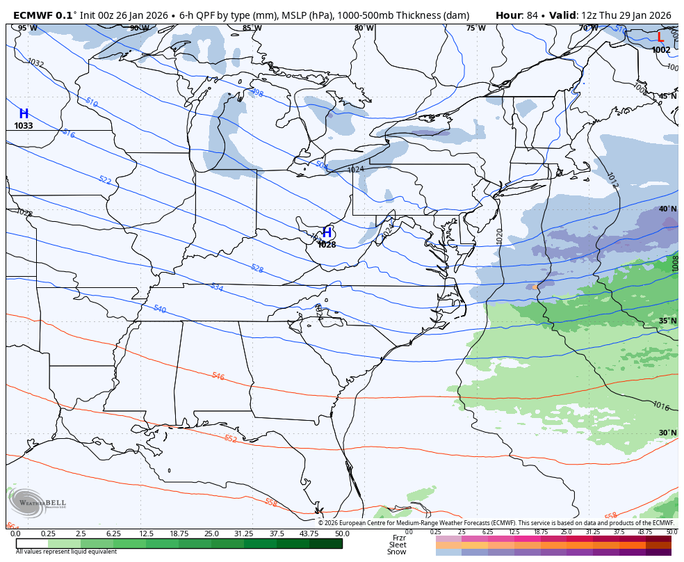
The models are bringing another surge of bitter cold with this and take wind chills back to similar levels as the next few days…
I finally had time to look down the road into February. We know it starts with a deep system in the east and that’s likely a trend for the month into early March. The EURO Weeklies have “the look” again from mid-February to mid-March…
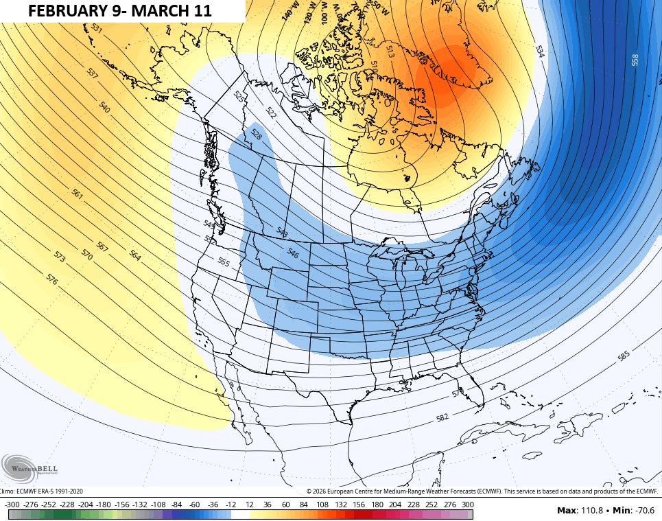
Not gonna lie, I was hoping for a fast start to spring.
Updates come your way later today. I’ll also have updates on my Meteorologist Chris Bailey Facebook Page
Until then, here are your tracking tools for the day…


Make it a great Monday and take care.

Looks like upslope flow has dropped an inch or two already this morning. I wouldn’t be surprised if it continues all day today; the models around here usually underplay it. I kind of figured the snow forecast would be a bust for me, as most of the heavy snow we get usually falls within 20 miles or so of the Pine/Black mountain ranges, with nothing else for the rest of the state.
Sorry for rambling, hope everyone is enjoying their ice and snow cake!
With the models failing on the snow for the just departing system, my skepticism remains.
Thanks Chris. Update On My Snowfall Totals For Maple. Three Inches Of Very Light Snow, Plus Two Inches Of Sleet, And A glazing Of Freezing Rain To Top It Off. My Local Forecast Calls For An ” Uneventful ” Seven Days. Just Cold And Dry, But Sunny Days Ahead.
Groundhog Phil, May See His Shadow. Six More Weeks Of Winter, But Only A Forty % Chance According To NOAA.
Glad you didn’t lose power Schroeder. I think someone needs to concrete over that rodent hole so Punxsutawny Phil doesn’t get out to see his shadow! lol
Customers of Warren RECC in Warren and Simpson counties were very fortunate, as only 3,500 customer lost power on Sunday, most of those for a maximum of 2 hours. The power cooperative has been aggressively trimming branches that impinge on their lines, and that work really paid dividends in keeping the lights on.
(The real reason our lights stayed on was because I purchased and filled 2 additional six gallon gas cans for my generator!)
Joe, I’m Going To Purchase A Whole House Generator. I Can No Longer take The Anxiety Everytime We Have These Ice Events. The Reason Kentucky Had More Ice Than Snow Is Because The Main Low Pressure System Tracked Through The Middle Of The State Of Kentucky. If The Track Was South Of The Tennessee Line, We Would Have Had All Snow, Like Indiana. I Know I’ve Type This 1,000 Times, But I Blame La Nina, Which Is Amplifying The Southeast Ridge.
Keep filling up those gas cans Joe. 😉
If next weekend system corrects itself like this weekend, then that storm is going to be a true noreaster and no where near us – at least not in my area of KY, BG.
Your Right. We Can’t Have A Snowstorm, If A Nor’Easter Is In Place. Major Snowstorms Do Not Come To Kentucky, With A Northwest Flow. Only These Clipper Systems. Now, If One Lives On The Lee Side Of the Great Lakes, And If Not Frozen Over. Huge Snowfalls Results.
Here is the link for the summary of the bitter cold temperatures the Chicago Metro Area and Northern IL experienced this past Friday and Saturday morning. https://weather.gov/lot/2026_01_23-24_Cold
Also, here is the link for the summary of the snow/ice accumulations from the major winter storm that hit KY over the weekend. https://weather.gov/lmk/WinterStormJanuary24_262026
Mike, Thanks For Sharing The Links. The Cold Air Is Much Deeper In Chicago, And More Shallow Here In Kentucky.