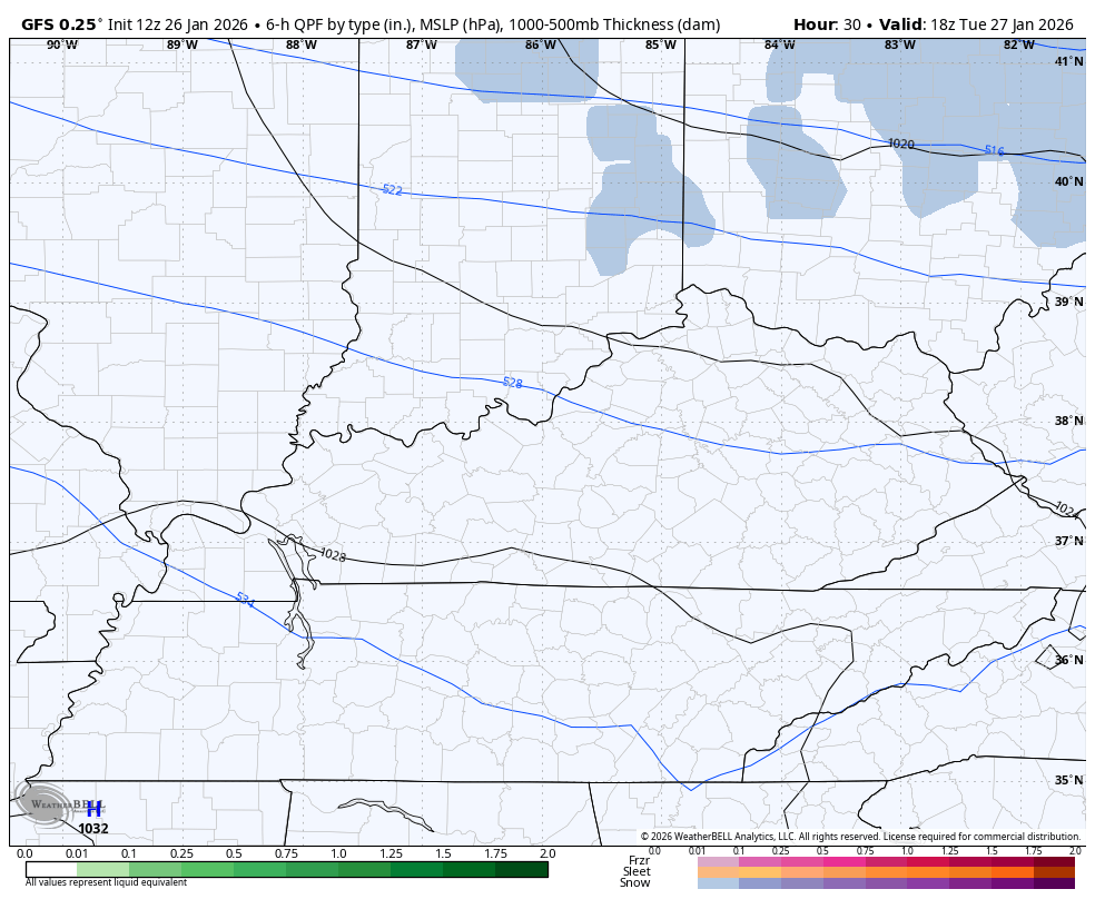
Good afternoon, everyone. It’s a brutally cold start to a brutally cold week as more light snows work across the region. Additional light accumulations will be likely over the next few days with a bigger system by the weekend.
We know the bitterly cold air is out there and this is life-threatening cold with wind chills reaching -20 to -25 at times. Light snows continue to put down light accumulations today with the potential for more the next few days.
Two systems drop in from the northwest from late Tuesday through Thursday morning. Each of these, combined with the arctic temps in place, can drop an inch or two of snow.
GFS
SHORT RANGE CANADIAN

The system dropping in late this week into the weekend has the potential to slow down and develop into something much bigger. The middle of the night run of the EURO is trying to crank this…
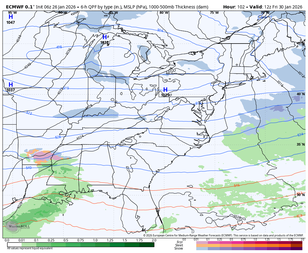
The GFS has it east…
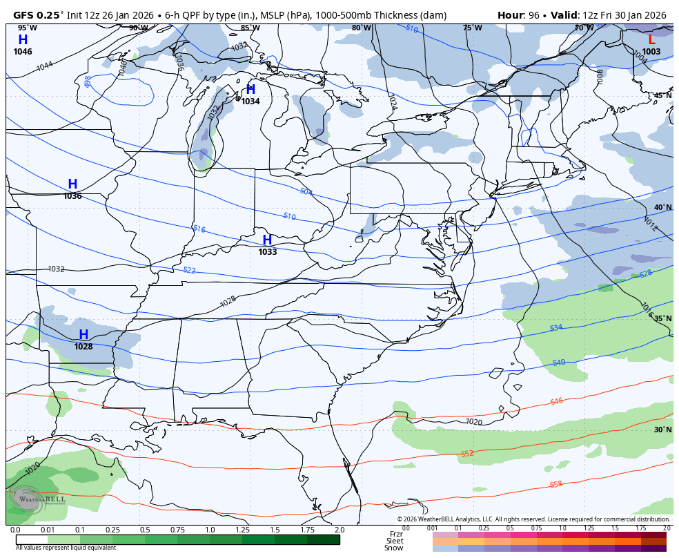
The northwest trend will try to ride again with this storm. Considering how rough things are in Kentucky already, I’m not sure any of us really want that to happen.
Updates come your way later today. I’ll also have updates on my Meteorologist Chris Bailey Facebook Page
Until then, here are your tracking tools for the day…


Make it a great Monday and take care.

According to the Euro, looks like a huge snowstorm for the NE this weekend, which the GFS isn’t showing. I would not trust the GFS though, considering how it failed spectacularly with the way over-inflated snow amounts it predicted for KY this past weekend.
And That’s The American Model.
I don’t trust the Euro either. It was so wrong too. Not “as” wrong the GFS.
I don’t trust any model.
Use To Be The Best Model For Predicting Snowstorms
European Model
When I Was Growing Up In The 1950’s And 60’s. Meteorologist Made Their Own Forecast, Never Gave Snowfall Totals In Advance Of The Storm, And It Was A Three Day Forecast, Not A 7 Day Forecast. Now, Every Aspects Of Meteorology Has Changed, And We Will Have To Live With That.
Latest From The Climate Impact Company : )
https://climateimpactcompany.com/daily-feature-historic-ao-strengthening-nao-cold-pattern-does-not-break-instead-expect-expansion-in-february-2/
A Meteorologist In Evansville, Indiana Told Me Before, That If All The Models Are Not In Agreement, He Would Not Give Any Model Forecast. A Good Example Of This Was In December, 2004. All The Models, Came In Agreement That A Snowstorm Is Going To Happen On The 23rd. Up To Two Feet Of Snow Accumulated In Two Separate Snow Events. It Was The Best White Christmas I Ever Experience.
Moral Of The Story, If All the Models Don’t Agree On A Snowstorm, Don’t Mention It Until All Of the Models Agree. Then Make The Forecast.
Our family appreciates all of your hard work Chris! I know weather persons are not Gods and can’t get it right all the time. No one got it right. Nevertheless, you worked hard to keep us notified and that is appreciated so thank you!