Good Tuesday, folks. It’s a bitterly cold day out there with many thermometers going below zero with wind chills well into the life-threatening category. This arctic air hangs tough through the next week with light snows moving through and the chance for a bigger system by the weekend.
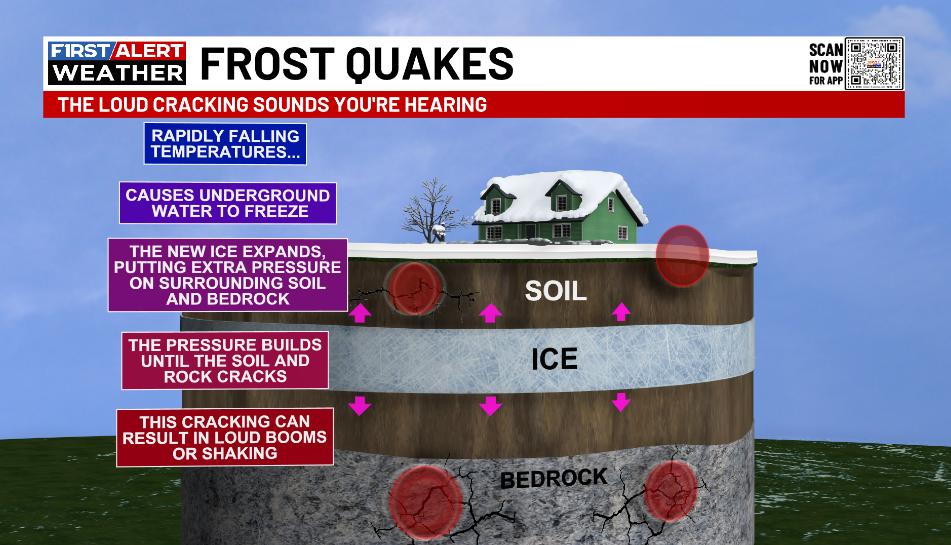
It’s so cold out there that we are getting frost quakes. Those loud booms and cracks you’re hearing can be jarring, but they’re harmless. Here’s a look what how these form…
Another arctic front drops in today, bringing a period of light snow to central and eastern Kentucky from late this afternoon into tonight…
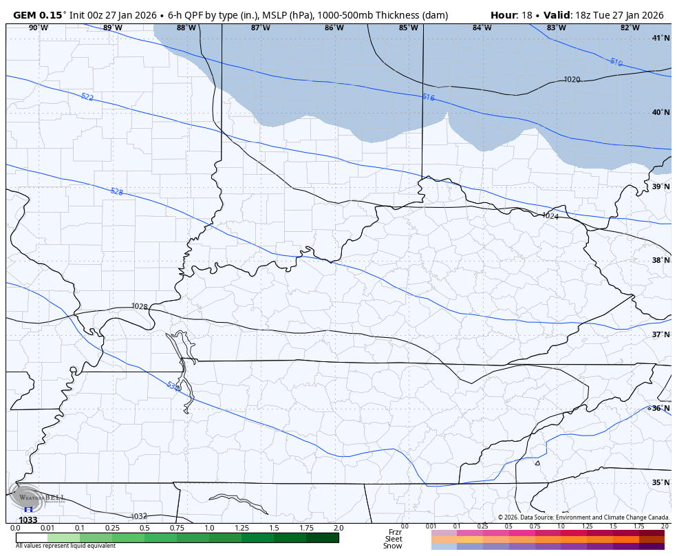
This may cause some light accumulations that can cover roads once again in the east. Another light system is possible late Wednesday as bitterly cold temps continue.
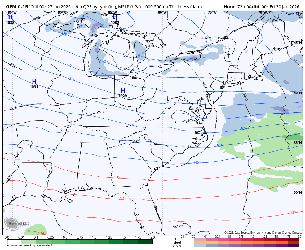
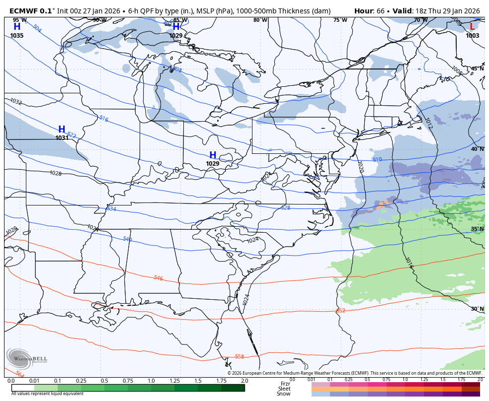
A bigger system then drops in Thursday night and Friday with the chance for some light snow with an outside shot at something a little more, especially in the east. A strong upper level system moves in and spawns a strong coastal storm. Can these two come far enough west for this to get more attention? Maybe.
The Canadian is closest with snow in eastern Kentucky. It also shows a system coming in behind it early next week…
The EURO is similar…
The GFS is, of course, the farthest east…
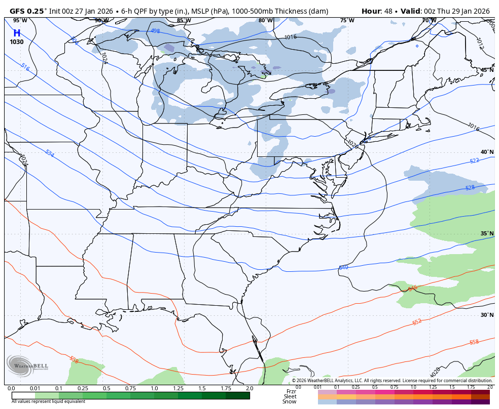
Let’s see if this continues to trend west in the days ahead.
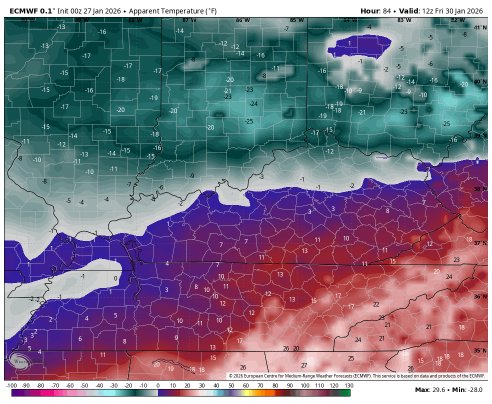
Regardless, this is another round of bitterly cold temps for the weekend. This wind chill animation goes from Friday morning through Saturday morning…
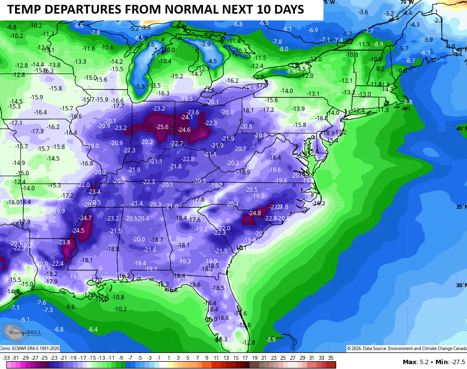
This keeps the bitterly cold air into early February. The temperature departures from normal for the next 10 days is crazy cold…
Your normal updates will be on later today. I’ll also have updates on my Meteorologist Chris Bailey Facebook Page
Until then, here are your tracking tools for the day…


Make it a terrific Tuesday and take care.

Thanks Chris. This Harsh Winter Weather Pattern Is Starting To Remind Me Of The Winter Of 1962 – 1963, Which Was One Of The Coldest On Record In Indiana, And The Longest Significant Snow Cover, That Lasted Until Early March, 1963.
I Never Heard Of ” Frost Quakes ” Or Ever Experience The Impact. Very Interesting. I Will Have To Look That Up.
I Wonder If All The Models Will Agree On The Impending Nor’ Easter’s In The Coming Days ? I Hope This Doesn’t Happen, As It Would Bring More Colder / Drier Weather For Our Part Of The Country.
frost quakes, i was wondering what the hell was going on with the loud noise and shaking. bailey how come this the first i ever saw you mentioning this. u supposed to be the man on all things weather.
He is the best.