Good afternoon, everyone. Wind chills were near -20 across parts of the state and as the bitter cold rolls on, we track a little light snow tonight with a bigger system lurking for Friday into the weekend. The westward trend is starting to show on that one.
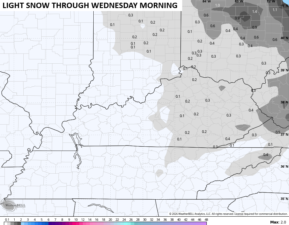
The light snow moving in later today into tonight is just that… Light. Light accumulations are a good bet across central and eastern Kentucky…
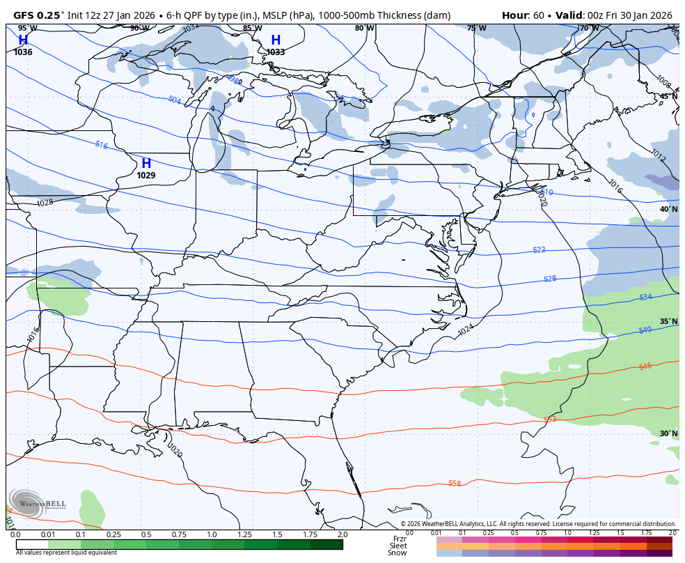
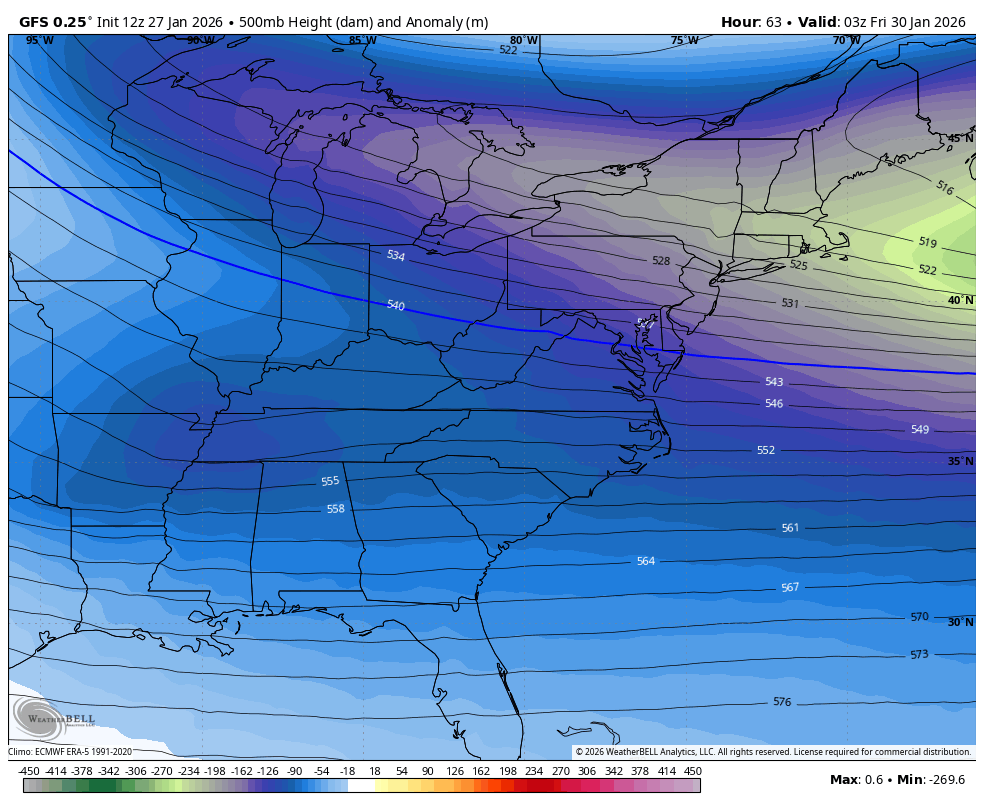
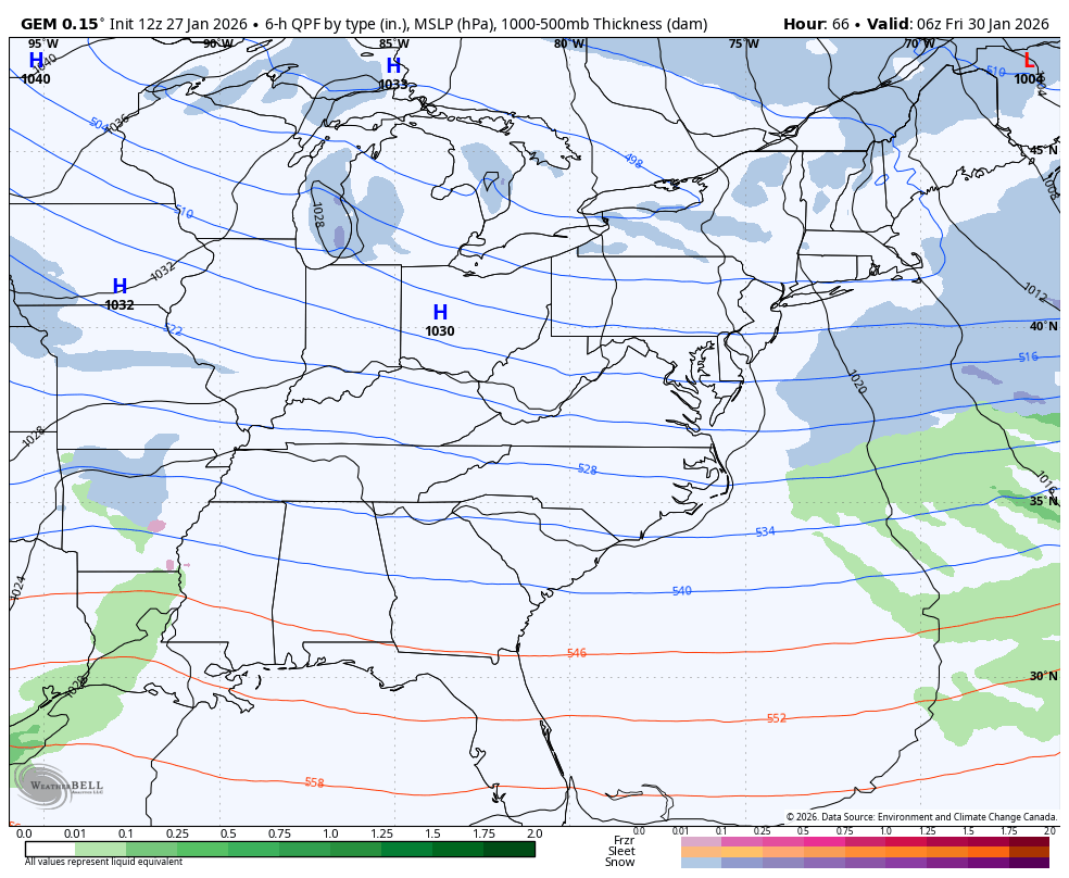
Bitterly cold temps continue behind this system as we watch the setup for Friday into the weekend. The famed west/northwest trend appears to be underway on the GFS. It brings a light accumulating snow across the state Friday before blowing up the upper low and a major storm on the east coast…
For Kentuckians who want snow, you want this upper low to cut off faster and farther northwest…
The Canadian is still a bit east with this system..
The latest comes your way on WKYT-TV starting at 4pm today and I’ll have additional updates here on KWC. I’ll also have updates on my Meteorologist Chris Bailey Facebook Page
Until then, here are your tracking tools for the day…


Make it a terrific Tuesday and take care.

Thanks Chris. Here’s Some Information On That Potential Nor’ Easter. Confidence Is Increasing On A Major Snowstorm Along The East Coast, Or The Low Goes Out To Sea. Not Quite There Yet.
https://www.google.com/search?q=Is+There+any+agreement+In+The+Weather+models+For+a+nor%27+easter&sca_esv=a87a460474998c14&sxsrf=ANbL-n6IuUoyWAMHDZh_lhiKjgIq7mFhyw%3A1769532470856&source=hp&ei=Nux4aYS-Mt6sur8PwfOYmAs&iflsig=AFdpzrgAAAAAaXj6Rr1gwSrSjJethHfgwOcUcunZx0nO&ved=0ahUKEwiEsd6SlqySAxVelu4BHcE5BrMQ4dUDCCA&oq=Is+There+any+agreement+In+The+Weather+models+For+a+nor%27+easter&gs_lp=Egdnd3Mtd2l6Ij5JcyBUaGVyZSBhbnkgYWdyZWVtZW50IEluIFRoZSBXZWF0aGVyIG1vZGVscyBGb3IgYSBub3InIGVhc3RlckjU5ANQAFiCtQNwAHgAkAEAmAGcAqAB30GqAQY2LjUyLjS4AQzIAQD4AQGYAjygAohCwgIKEAAYgAQYQxiKBcICDhAAGIAEGLEDGIMBGIoFwgIQEC4YgAQY0QMYQxjHARiKBcICCxAAGIAEGLEDGIMBwgIFEC4YgATCAg4QLhiABBixAxjRAxjHAcICERAuGIAEGLEDGNEDGIMBGMcBwgILEAAYgAQYkQIYigXCAgUQABiABMICCBAAGIAEGLEDwgIIEC4YgAQYsQPCAhEQABiABBiRAhixAxiDARiKBcICBBAAGAPCAgsQABiABBixAxiKBcICBhAAGBYYHsICCxAAGIAEGIYDGIoFwgIFEAAY7wXCAgUQIRigAcICBRAhGKsCwgIHECEYoAEYCpgDAJIHBjIuNTQuNKAH1t0CsgcGMi41NC40uAeIQsIHCTYuMzkuMTQuMcgHhwGACAA&sclient=gws-wiz
Schroeder my sister in Indiana got 13-14 inches of snow but has bitter cold. She sent pictures. It was so cold last night I am ready for summer lol. Those frost quakes I had never heard of either but last night people were reporting hearing them the loud noise didn’t know what it was now we all know.
Where I Grew Up In Indiana, They Received 17 Inches. I Remember Those Major Snows, And We Had Many. I’ve Never Heard Any Loud Booms Here In Maple. I Think Our Bedrock Is Deep, Because Our Soil Has Very Good Drainage.
Chris, I Remember When Meteorologist Only Gave The Actual Temperature.
I think Kentucky only gets accumulation in the east if that.
Here’s Some Information On The Impending Nor’Easter. If It Happens To Form, It Will Bring More Cold / Dry Arctic Air In Our Direction : )
https://climateimpactcompany.com/daily-report-active-east-pacific-mjo-ao-nao-atlantic-coast-weekend-snowstorm-2/