Good evening, everyone. It’s another bitterly cold night ahead as some light snow drops into the region. This is along and ahead of another arctic cold front moving through here. From there, we focus on a system that can play a bigger role in our weather by Friday and Saturday.
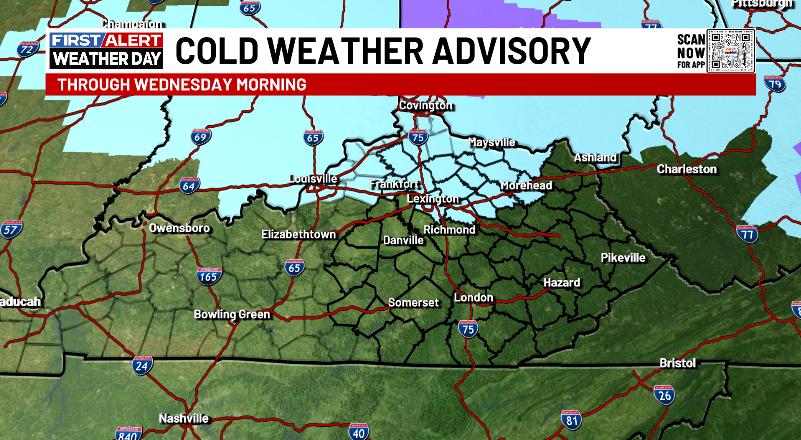
A Cold Weather Advisory is out for areas along and north of Interstate 64 for wind chills reaching -5 to -10 tonight…
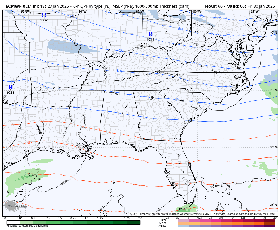
The system moving in for the weekend is one to watch as an arctic system drops in from the north and brings, at least, some light snow across Kentucky. This may very well spin up into something greater in terms of a stout upper low cutting off as the surface low fires up along the coast.
If that happens, there’s a better chance for snow around here with eastern Kentucky having a better shot.
The EURO is close to being a bigger hit…
The GFS, oddly enough, continues to have a farther west scenario…
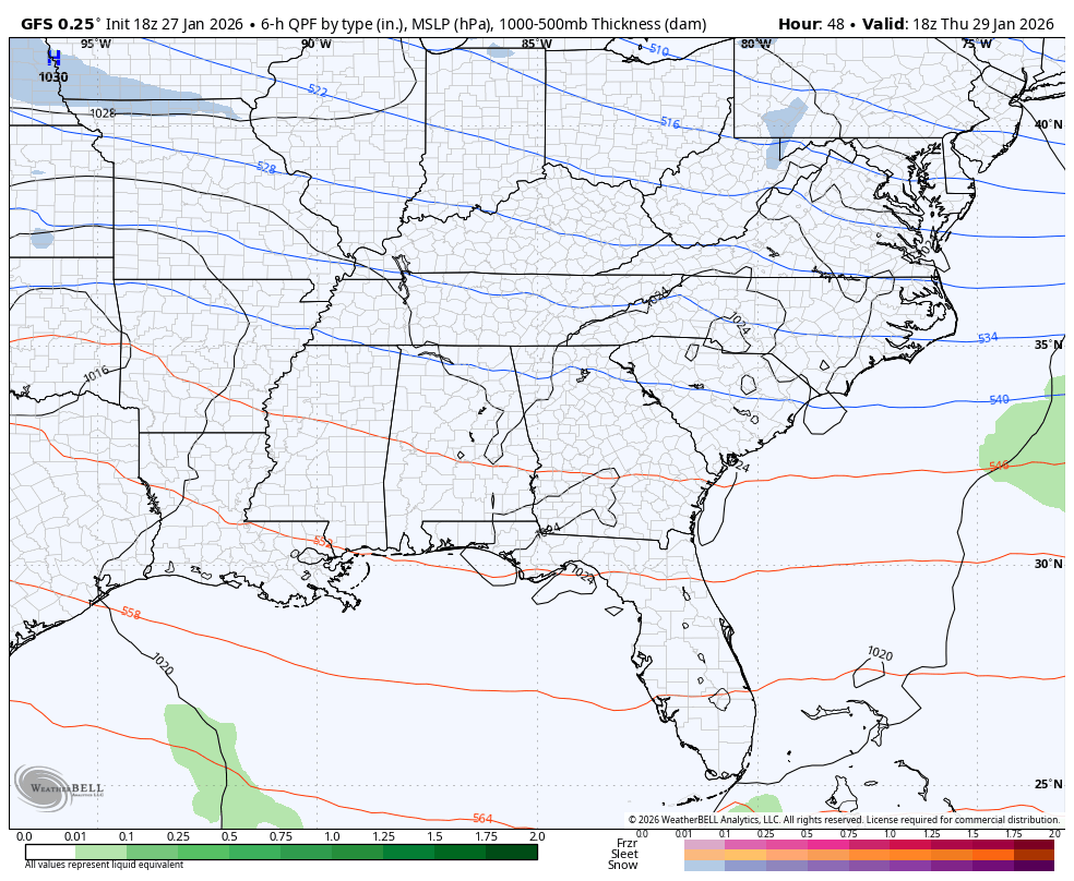
That fact the GFS is usually too far east is something to watch.
The Short Range Canadian Model only goes through 1am Saturday but has a definitive farther west look with everything…
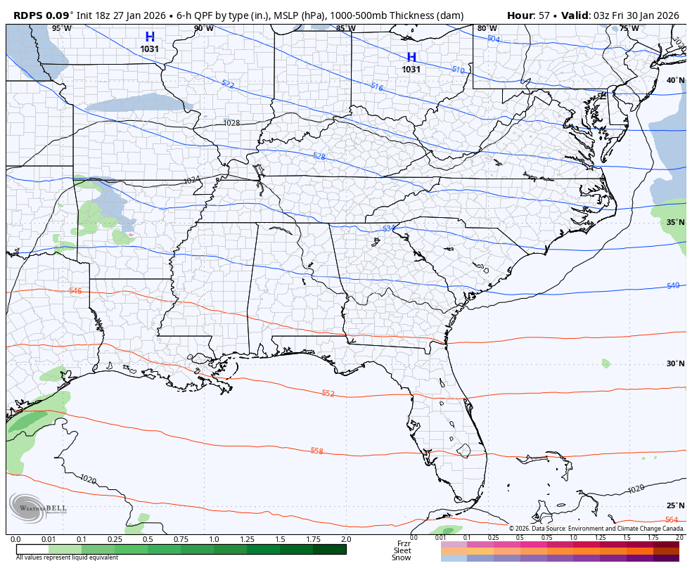
Again, it’s just something to watch for as every winter weather system winds up farther west and northwest than what the forecast models say in advance.
I’ll see you crazy kids back here later tonight for the full update. I’ll also have updates on my Meteorologist Chris Bailey Facebook Page
Until then, here are your tracking tools for the day…


Make it a terrific Tuesday evening and take care.

What the hell is cold weather advisory never heard such thing. Just make it plain and simple going to be cold