Good afternoon, everyone. It’s another bitterly cold day in Kentucky and we have a lot more of the bitter on the way. I’m also growing more concerned about the snow potential Friday into the upcoming weekend.
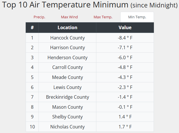
Lows this morning went below zero in some areas, marking the 3rd straight day of doing so. Here’s a look at the Top 10 coldest from the Kentucky Mesonet…
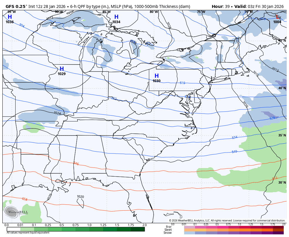
The potential for another major winter storm in the eastern US continues to rise for the weekend. We have a massive upper low dropping in from the north and this will bring light snow across Kentucky Friday. How fast and how far west this upper low closes off is the key to getting more snow in here Saturday and Sunday. This system will pop a strong surface low along the Carolina Coast and this will likely produce monster snows for the Mid-Atlantic.
Here’s my current Heavy Snow Potential map…

I’ll be updating that later today.
The GFS continues to be farthest west and would bring Winter Storm snows into southeastern Kentucky with lighter amounts farther west…
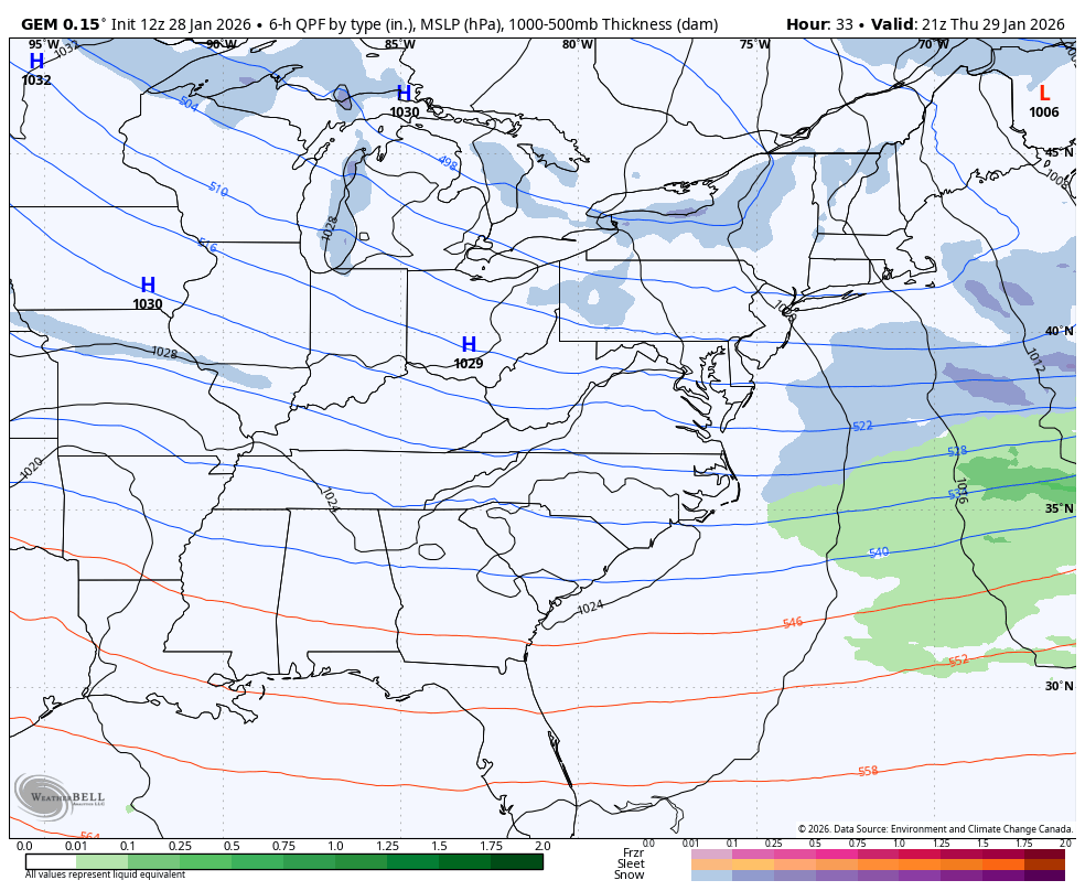
The Canadian continues to correct west with the whole setup…
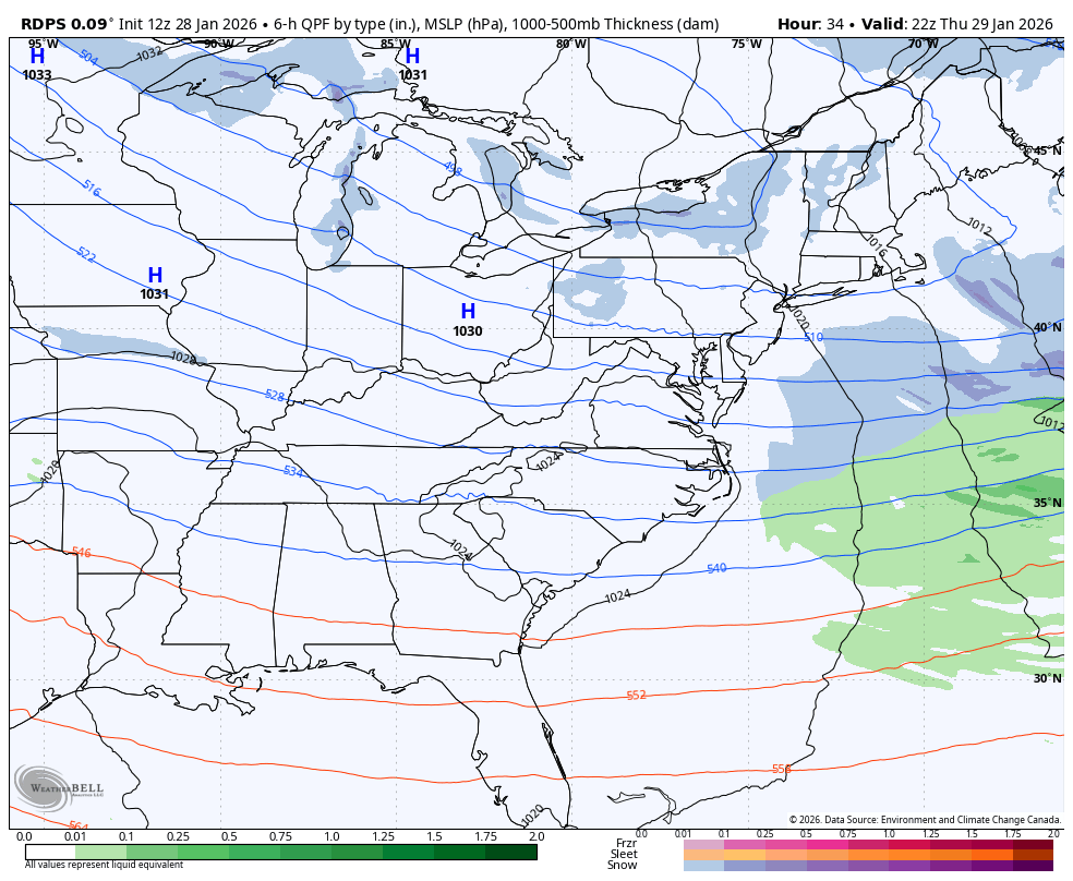
The Short Range Canadian only goes through Saturday at 7pm, but it’s trending in that same direction…
Another update comes your way later today. I’ll also have updates on my Meteorologist Chris Bailey Facebook Page
Until then, here are your tracking tools for the day…


Make it a wonderful Wednesday and take care.

that just about does it by the vioce this afternoon song.
Good song for the cold lol Good to see you on Rolo.
Kentucky will get festive flurries at best.