Good afternoon, everyone. Let’s upgrade to a Winter Storm THREAT for far southeastern Kentucky where we have an increasing likelihood of 4″ or more of snow through the upcoming weekend. This system will put down lighter snows for the rest of the state with bitterly cold air again.
I don’t have a lot of time and will be updating things several times today and on WKYT-TV starting at 4pm, but here is your First Call for Snowfall…
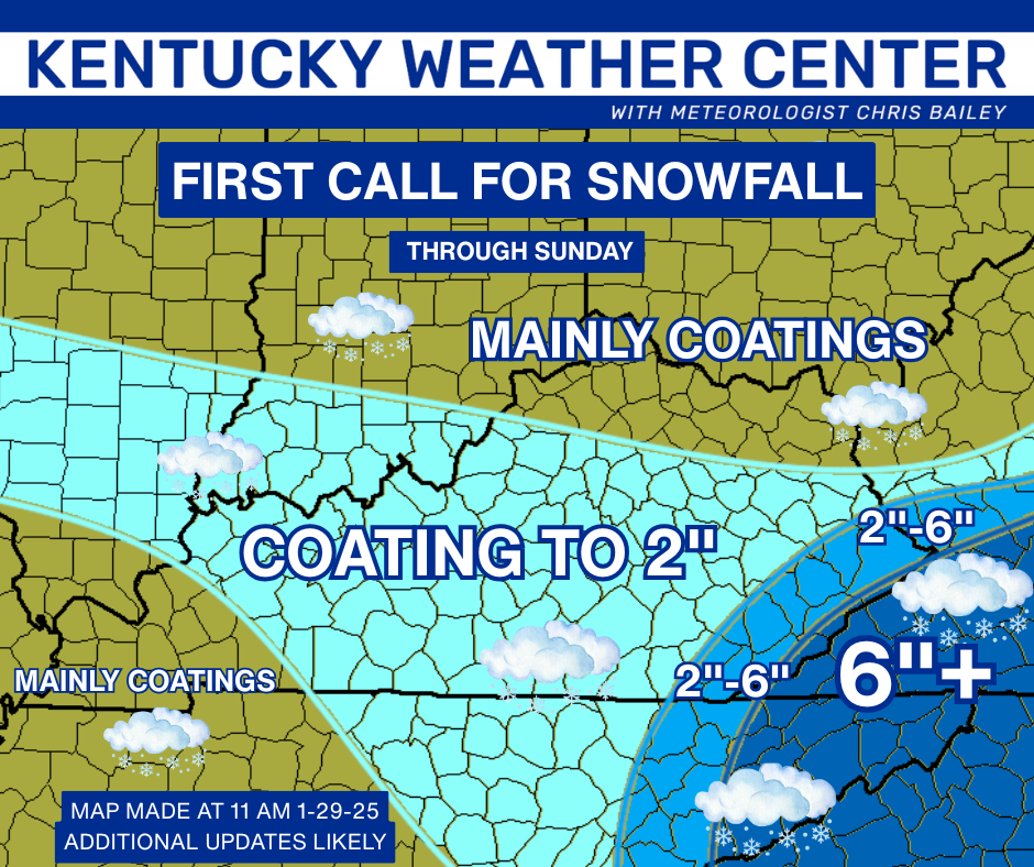
There is no chance for freezing rain or ice to complicate this forecast, so that’s always a good thing. I may wind up making the action in the southeast just a little more expansive because of the strong upslope flow later Saturday into Sunday. This can do some work in the southeast.
The area of “Coating to 2″” may also have some pockets in there that overachieve if we can pop a few snow squalls Saturday.
I expect Winter Storm Watches/Warnings to go up in the southeast with a Winter Weather Advisory for many…

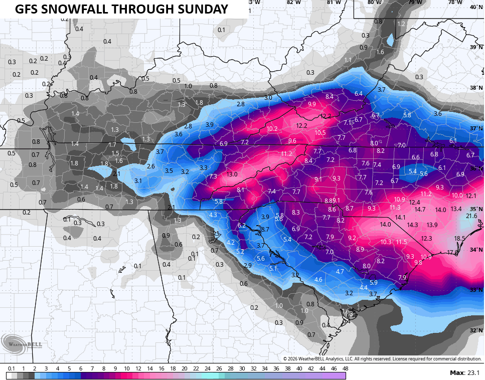
The GFS has a much more expansive snow map in the southeast…
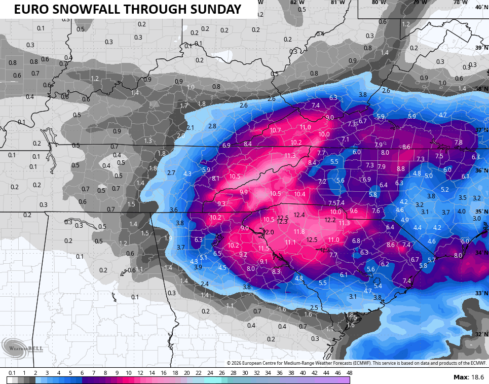
The EURO likes that idea, too…
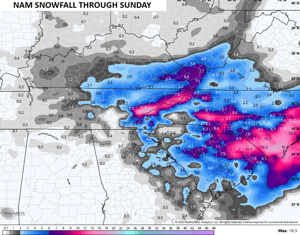
The NAM is getting there…
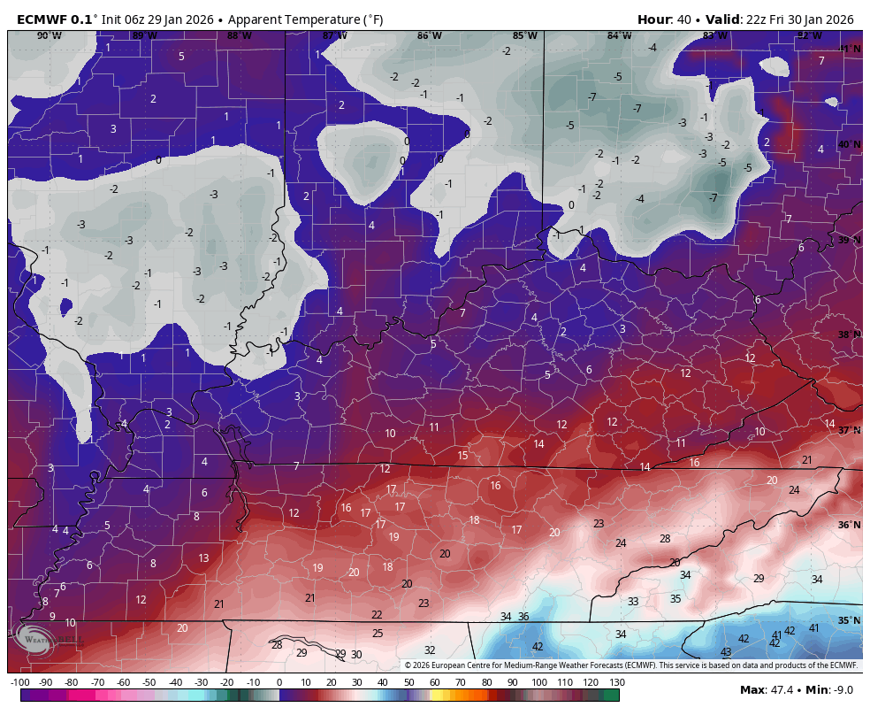
Brutally cold air crashes in behind the initial light snow system on Friday. Wind chills go back into the life-threatening category Friday night and early Saturday…
Updates come your way later today. I’ll also have updates on my Meteorologist Chris Bailey Facebook Page
Until then, here are your tracking tools for the day…


Make it a great Thursday and take care.

Central KY may get festive flurries at best.