Good evening, everyone. Our Winter Storm THREAT continues for far southeastern Kentucky with lighter snows for the rest of the state. All of this unleashes another round of life-threatening cold for the weekend.
The NWS has opted for a Winter Weather Advisory in the southeast, but I’ll make the argument for a Winter Storm Warning along the Virginia border counties…

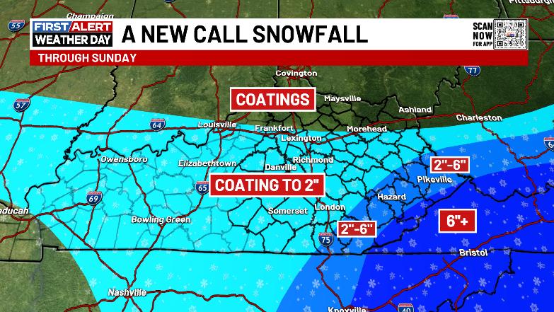
The counties from Pike down to Bell have the chance for several inches of snow, especially in the high mountains. For the rest of us, much lighter accumulations will be noted from the light snow zipping through early Friday then the snow showers and squalls Saturday…
Brutally cold air comes in behind this and I’m concerned this Cold Weather Advisory is too weak of a headline from the NWS…
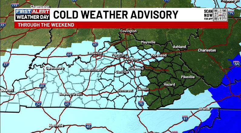
This needs to be another Extreme Cold Warning, especially when you see wind chills -10 to -20 for parts of the region Friday night and Saturday morning…
Those wind chills remain brutal Saturday into Sunday morning…
Updates come your way later today. I’ll also have updates on my Meteorologist Chris Bailey Facebook Page
Until then, here are your tracking tools for the day…


Make it a great Thursday and take care.
