Good Friday, everyone. It’s a Winter Storm ALERT now for far southeastern Kentucky where 4″ or more of snow look to fall through the weekend. This setup is bringing another round of brutally cold temps into Kentucky and surrounding areas.
Here’s how this setup looks to play out:
- A period of light snow is working along and south of the Interstate 64 corridor early today.
- This puts down light accumulations along the way.
- This band of snow will intensify as it hits southeastern Kentucky.
- That continues into tonight and Saturday with several inches likely in the far southeast.
- A strong north to northwest wind flow will bring widespread snow showers, squalls and flurries Saturday and Saturday night. The Great Lakes will be busy.
- The highest totals of 6″ or more will show up along the highest elevations along the Virginia order.
- The snow showers and squalls will put down some it and run light accumulations for any one location.
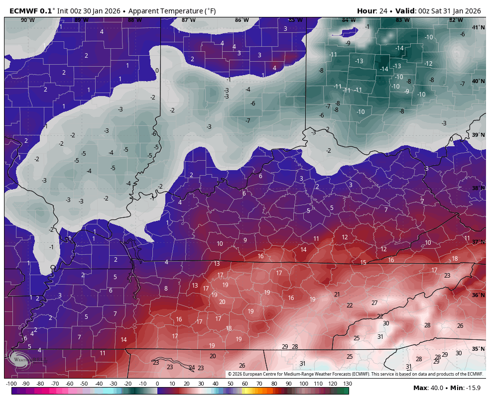
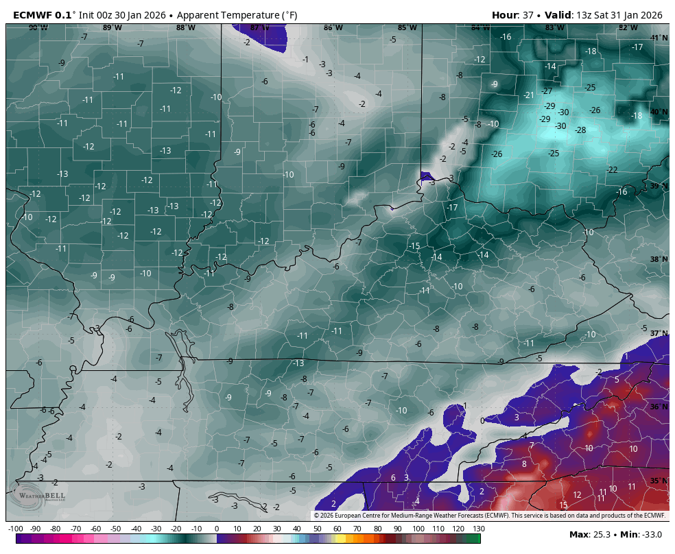
- Life-threatening cold air surges in over the weekend. Lows can drop to -5 to 5 above Saturday morning, Sunday morning then again Monday morning.
- Wind chills will drop into the -10 to -20 range for some areas over the next few mornings.
Here’s a look at the current Winter Weather Alerts for Kentucky…

I’m rolling with my OG Call for Snowfall…
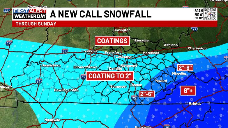
It will be interesting to see ow far northwest the cutoff is to the heaviest snow in the southeast.
The future radar from the NAM seems to be doing a good job in trying to capture the amount of snow showers and squalls developing. This animation starts this evening and goes through Sunday morning…

Wind chills are brutal this weekend and will be into the Life-threatening range for anyone caught outside for an extended period or for those without proper heating sources.
This animation shows wind chills approaching -20 in the north late tonight…
The wind chills for the rest of Saturday into Sunday morning continue to be way down there…
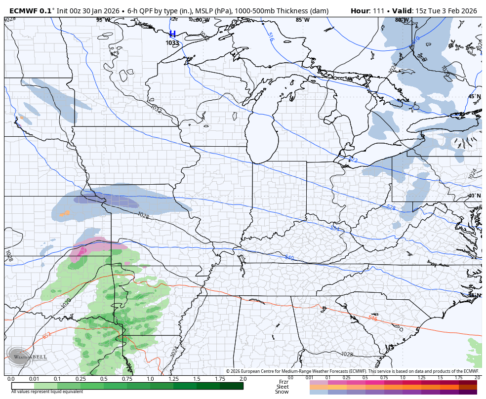
A few light snow showers and flurries are possible Monday with a bigger storm system setting up late Tuesday into Wednesday. The storm track will be crucial with that one as another big arctic blast looks to follow it up later next week…
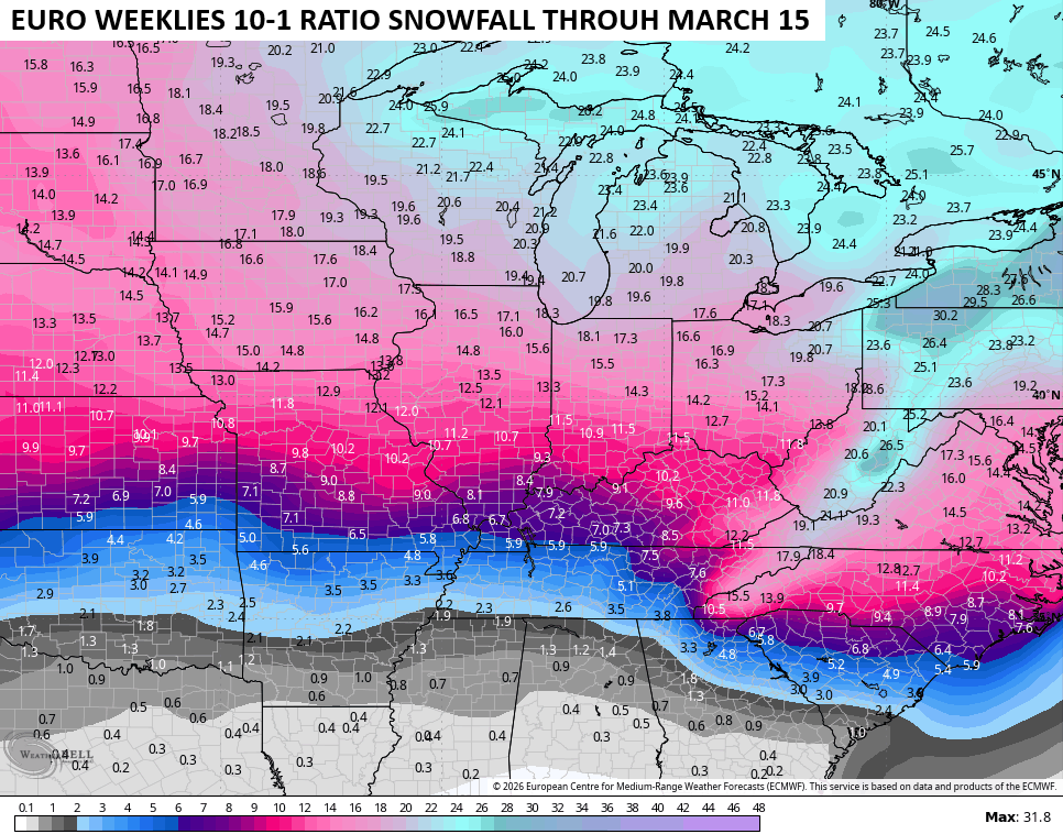
The EURO Weeklies continue with a strong winter signal as far as they go out into the middle of March. This is ugly for those of us who want an early spring…
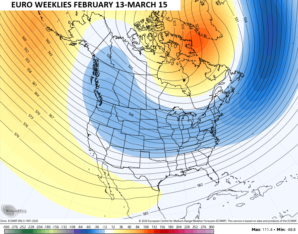
That’s a cold and likely snowy setup, folks. The Weeklies give us one heck of a late season snow signal…
Updates come your way later today. I’ll also have updates on my Meteorologist Chris Bailey Facebook Page
Until then, here are your tracking tools for the day…


Make it a great Friday and take care.

The EURO weeklies are lying.
You mean you hope its lying Jeff. Looks like We wont be bringing our shorts and tank tops out until later than sooner.
Incorrect
Thanks Chris. The European Weeklies You Displayed This Morning Does Show An ” Ugly Pattern ” Setting Up From Now To Mid- March. Hoping After That, We Will Warm Up To Spring, But Some Of The Largest Snowfalls Have Occurred In February Into Mid – March. That Large Area Of Stratospheric Warming Over The North Pole, Will Weaken The Polar Vortex, and All That Frigid Arctic Air Will Invade The lower 48. No Wonder The Teleconnections Are All Tanking. Especially The Arctic Oscillation.
Hurricane Force Winds Are Now Forecast For The Coastal Areas Of The Southeast. A Blizzard Warning May Be Issued Later Today ? The Intense / Phased Surface Low Pressure, May Become A ” Bomb Cyclone, ” And effect The Coastal Areas Of The Northeast As Well. A Very Interesting Storm To Track.
Never trust long distance models
Here’s The Latest Link On The Impending Storm In The Southeast U. S. ( From The Climate Impact Company : )
https://climateimpactcompany.com/u-s-early-notes-gfs-continues-to-back-off-northeast-u-s-coastal-snowfall-although-maintains-high-wind-alberta-clippers-ahead-2/