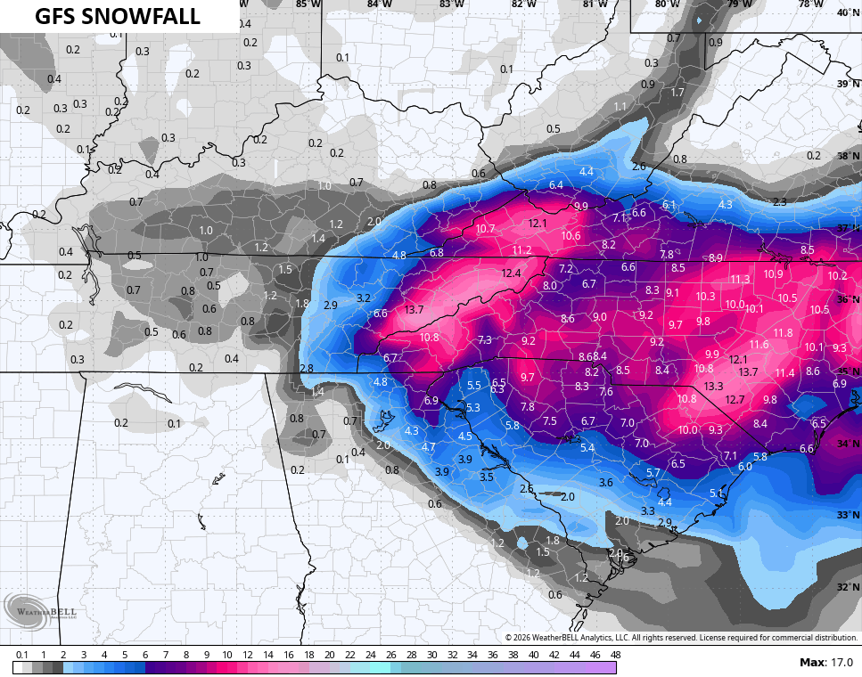
Good afternoon, everyone. Light snow continues to break out across the southern half of Kentucky with a Winter Storm ALERT across the far southeast. That’s where several inches of snow will fall ahead of bitterly cold temps and wind chills this weekend.
A Winter Weather Advisory continues for southeastern Kentucky but no Winter Storm Warning for the Virginia border counties as of this writing…

The setup continues to favor those counties with at least 4″ of snow through the weekend…
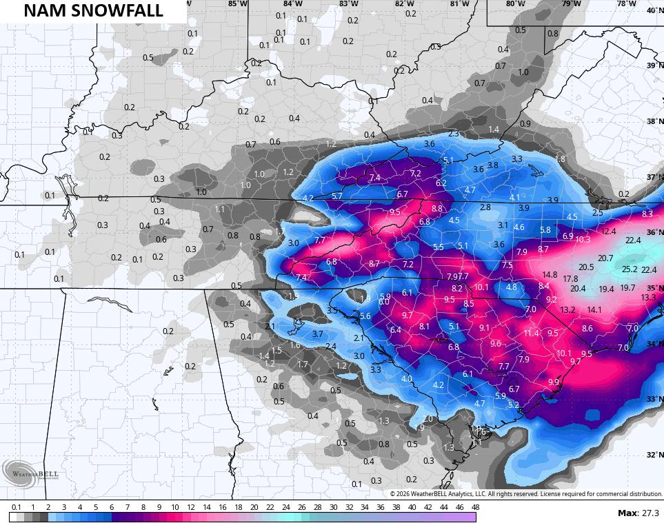
The rest of the state will be picking up much lighter accumulations from snow showers and snow squalls on Saturday.
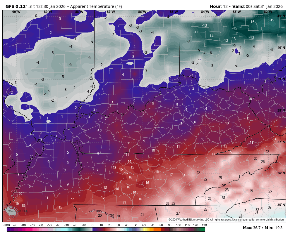
The bitter cold is the main story as wind chills tonight drop into the -10 to -20 range for some. This animation starts at 7pm and goes through 8am Saturday…

The rest of Saturday into Sunday morning look equally as ugly…
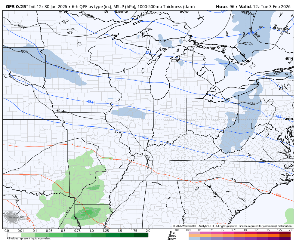
There are two systems next week already getting my attention. The first is a storm system rolling through the Tennessee Valley Tuesday and Wednesday. The other is another big blast of arctic air that may have a wave of low pressure along it that tries to ramp up about a week from now…
Updates come your way later today. I’ll also have updates on my Meteorologist Chris Bailey Facebook Page
Until then, here are your tracking tools for the day…


Make it a great Friday and take care.

diggin up bones randy travis.
Finally issued the winter storm warning for Pike, Letcher , and Harlan