Good Sunday and welcome to February. It’s the third and final month of Meteorological Winter and it’s starting out just like January ended… Brutal. While the extreme cold eases in the coming days, we still have snow threats.
Today is frigid with morning temps ranging from -5 to 5 above with a wind chill nearing -10 at times. Highs range from the upper teens to low 20s with the wind chill much colder.
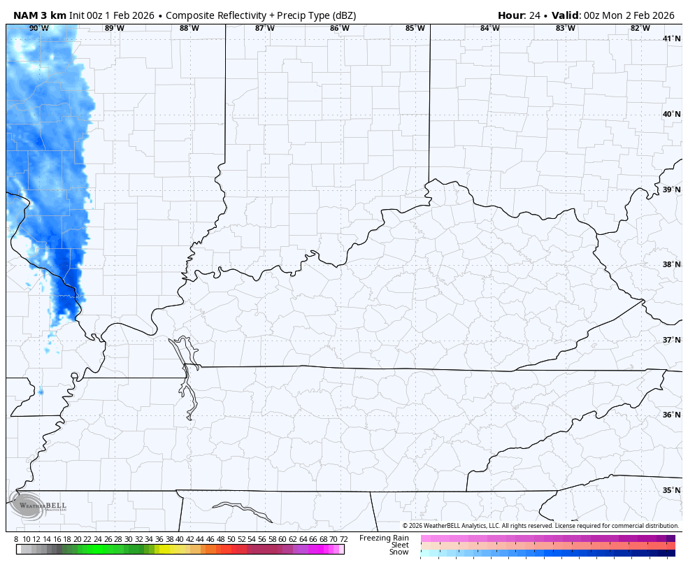
Groundhog Day finds the chance for a little bit of light snow and flurries working across the state. I can’t rule out some very light accumulations from this action showing up on the future radar from the Hi Res NAM. This animation starts late this evening and goes through Monday evening…
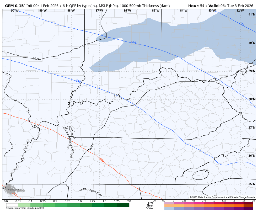
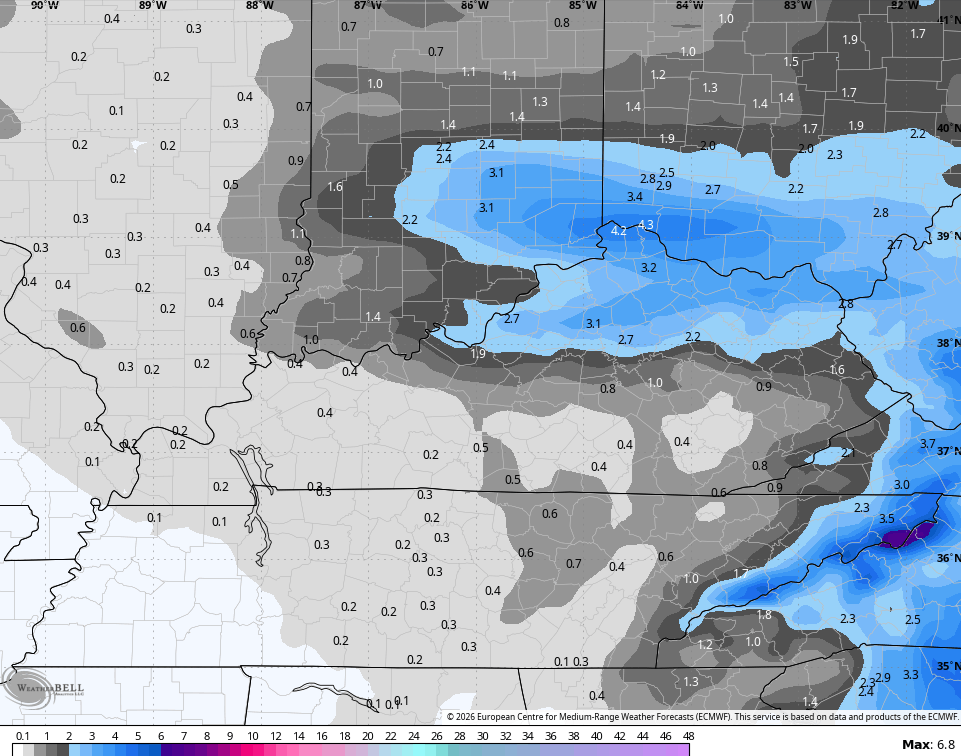
This is ahead of a weak storm system that looks to slide to our south Tuesday into Wednesday. That will have a swath of accumulating snow along and north of the track. This system has some room to slow down and turn into something a little bigger than the models have been suggesting.
Actually, we are beginning to see them slowing this system down some as they fire up a slightly stronger low in the southern Appalachian Mountains.
The future radar from the NAM only goes through 7am Wednesday and you can see a more prolonged band of snow…
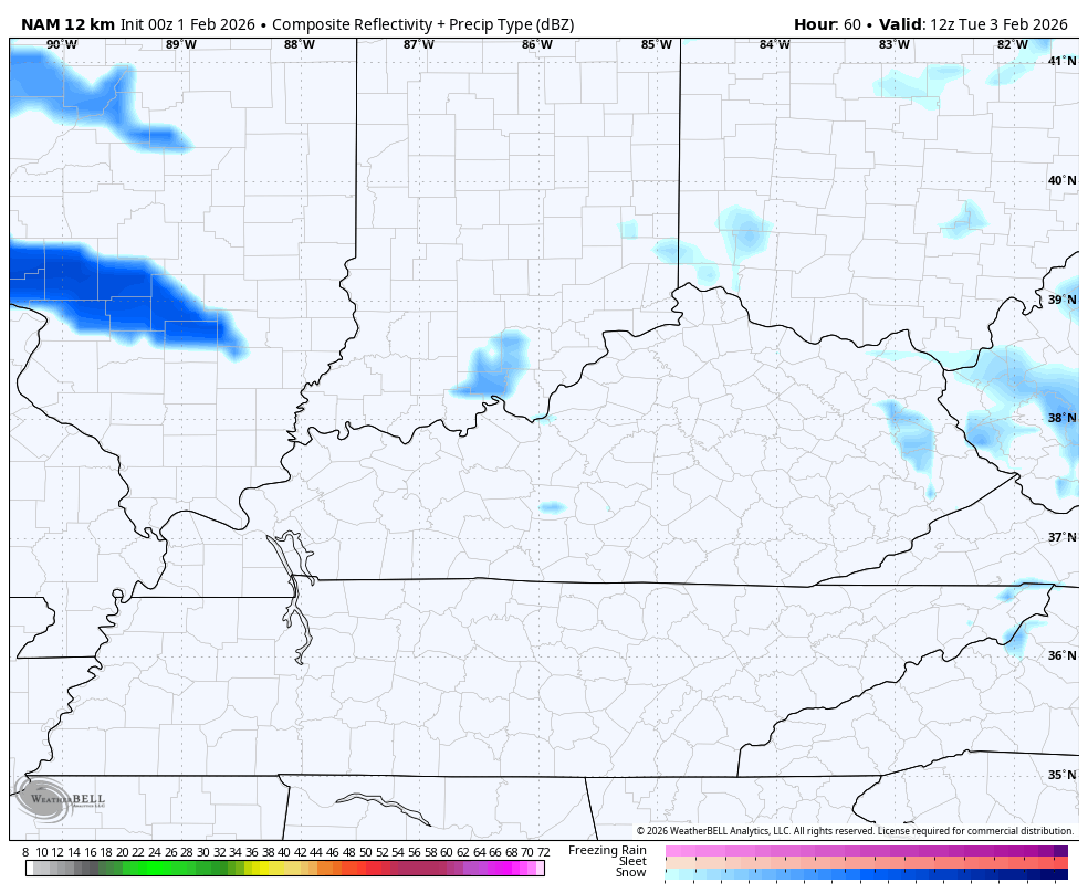
The Canadian out farther in time and sees this slowing down through Wednesday…
The GFS is starting to see it, too…

The EURO is the speediest with this snowmaker…
I’ll have a First Call out later today in all likelihood.
As I’ve been talking about, February is likely to be another much colder than normal month across our region and the eastern half of the country. The models are on board for the coldest anomalies across North America are on top of us and northeast…
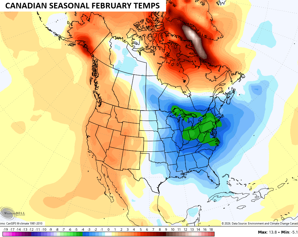
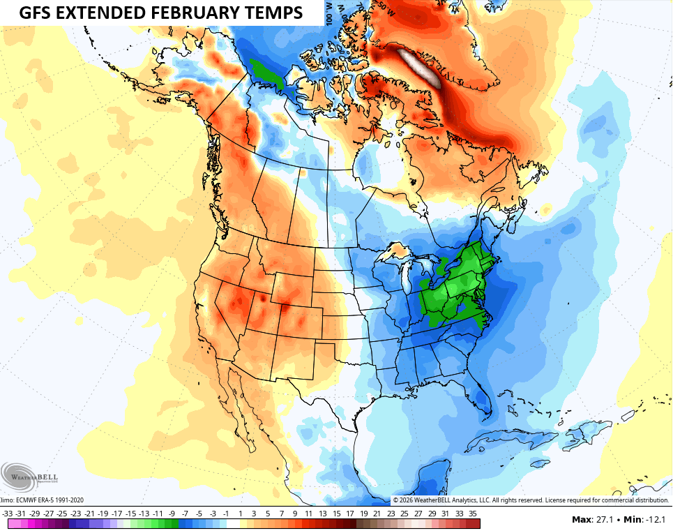
This is essentially a continuation of the overall pattern we’ve been in over the past few weeks. It’s also the one we had in the first half of December. Plenty of snow chances will come along for the ride, so the kiddos still have a lot of snow days left in the tank.
Updates come later today. I’ll also have updates on my Meteorologist Chris Bailey Facebook Page
Until then, here are your tracking tools for the day…


Make it a great Sunday and take care.

I don’t see much more this winter.
how BOUT THEM WILDCATS!!!!!!!!!!!!!!!!!!!!!!!!!!!!!!!!!!!!!!!!!!!!!!!!!!!!!
Thanks Chris. As Long As We Have The Sudden Stratospheric Warming Occurring Around The North Pole, The Polar Vortex Will Continue To Weaken, And The Frigid Arctic Air Will Move South Into The Eastern Part Of CONUS, But There May Be A Change, As The Pacific North American Oscillation ( PNA ) Is Forecast To Go Negative In And Around Mid- Month. Will Shift To Cooler / Wetter Weather For The West Coast, And Bring Milder Weather To The Eastern Part Of The CONUS. Hoping This Scenario Plays Out, And Gives Us All A Late Winter Reprieve.
Here’s the Link To The Information Above : )
https://climateimpactcompany.com/u-s-sunday-report-surprise-warmer-pattern-change-during-days-11-15-2/