Good evening, everyone. Our brutally cold weekend is wrapping up with a little light sow and flurry action moving in from the west as we get set for another storm system. This arrives Tuesday and takes us into early Wednesday, likely causing travel issues for several areas.
Light snow and flurries will work in from the west tonight into Groundhog Day. Some hit and run coatings are possible in a few places, especially across the north.
I didn’t get the chance to make a First Call map, but I’ll get that out later tonight.
My earlier thoughts remain unchanged…

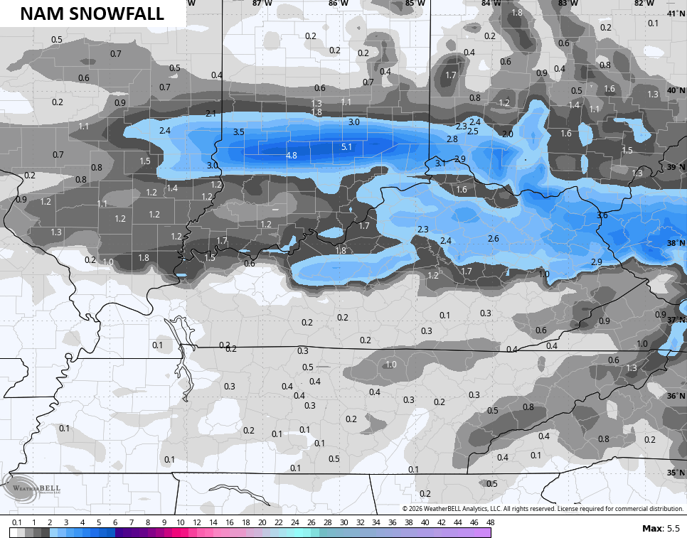
As far as the models go, they are mostly in line with my overall thought process. The NAM is pretty generous with a 2″-4″ swath of snow showing up…
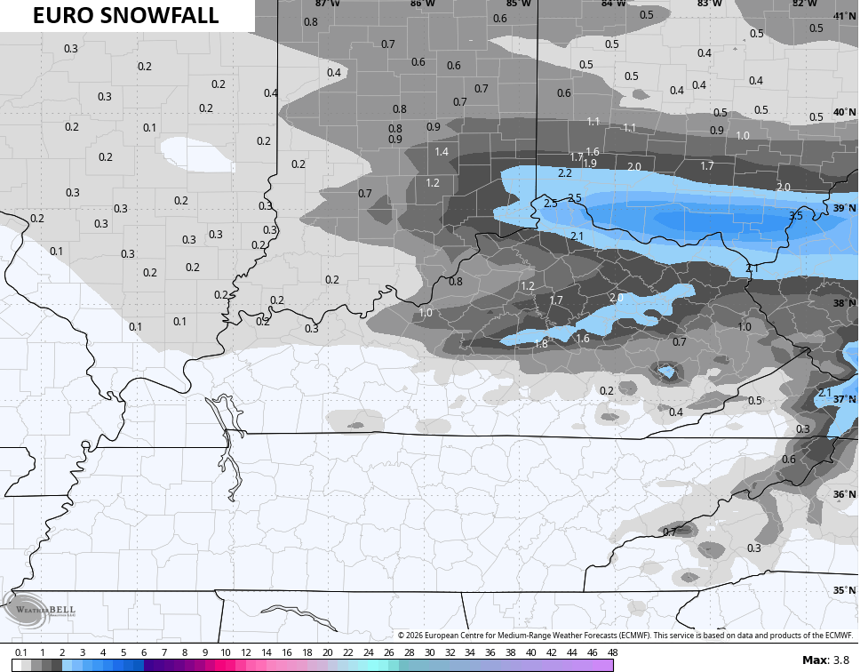
The EURO is starting to go that way…
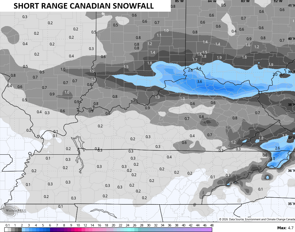
The Short-Range Canadian is a little choppier with the snows and has the best concentration along and north of Interstate 64…
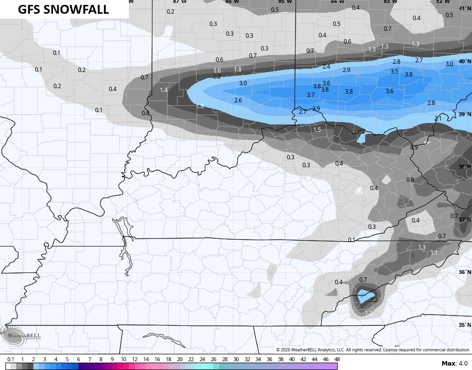
The GFS is in its own little world…
I’ll also have updates on my Meteorologist Chris Bailey Facebook Page
Until then, here are your tracking tools for the day…


Make it a great Sunday evening and take care.
