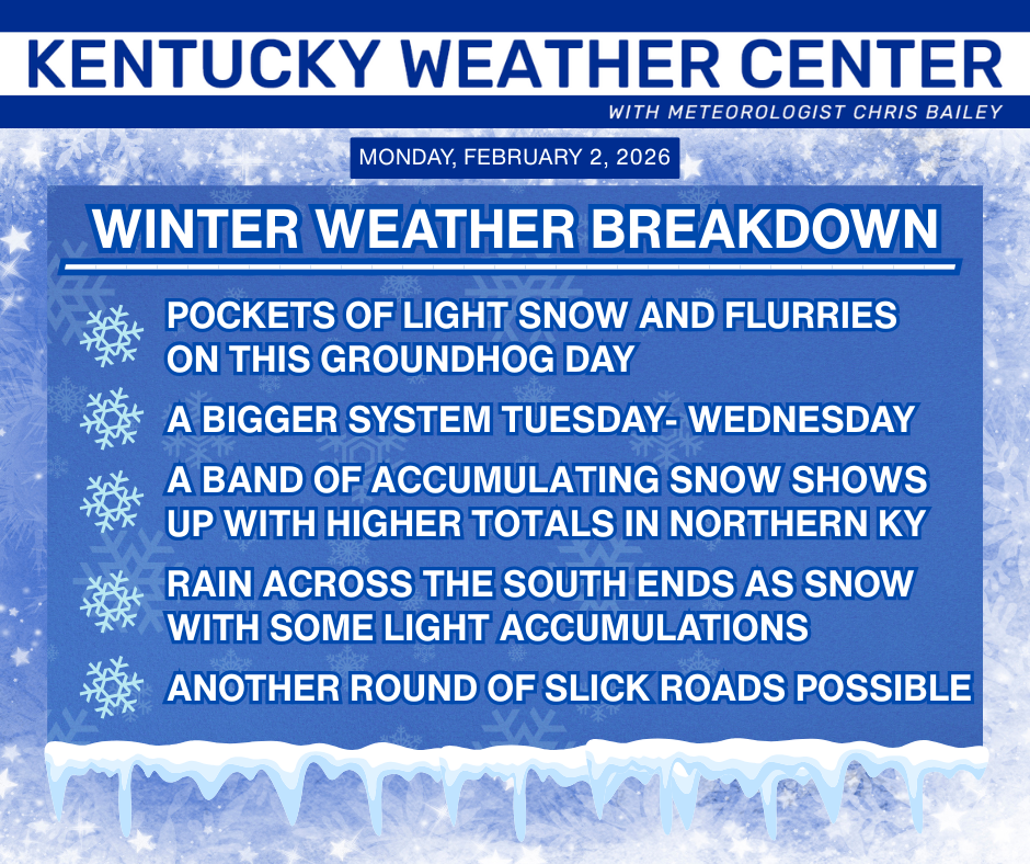
Good afternoon, everyone. While the Groundhog only does his or her thing once a year, Kentucky Weather Center is here each and every day for you weather weenies. Take that, ya furry forecasting animal! 🙂
Areas of light snow and flurries are out there today, mainly impacting the north and northeast. That kicks off our Winter Weather Breakdown…
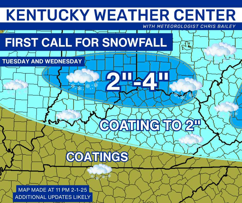
I’ll be updating the Call For Snowfall later today on WKYT-TV and WKYT+ starting at 4pm. Here’s what the First Call looks like…
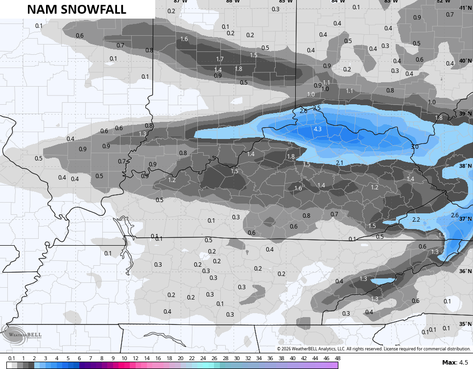
The morning model runs are a touch farther south and southeast with the NAM bringing the heaviest snows mainly south of the Ohio River…
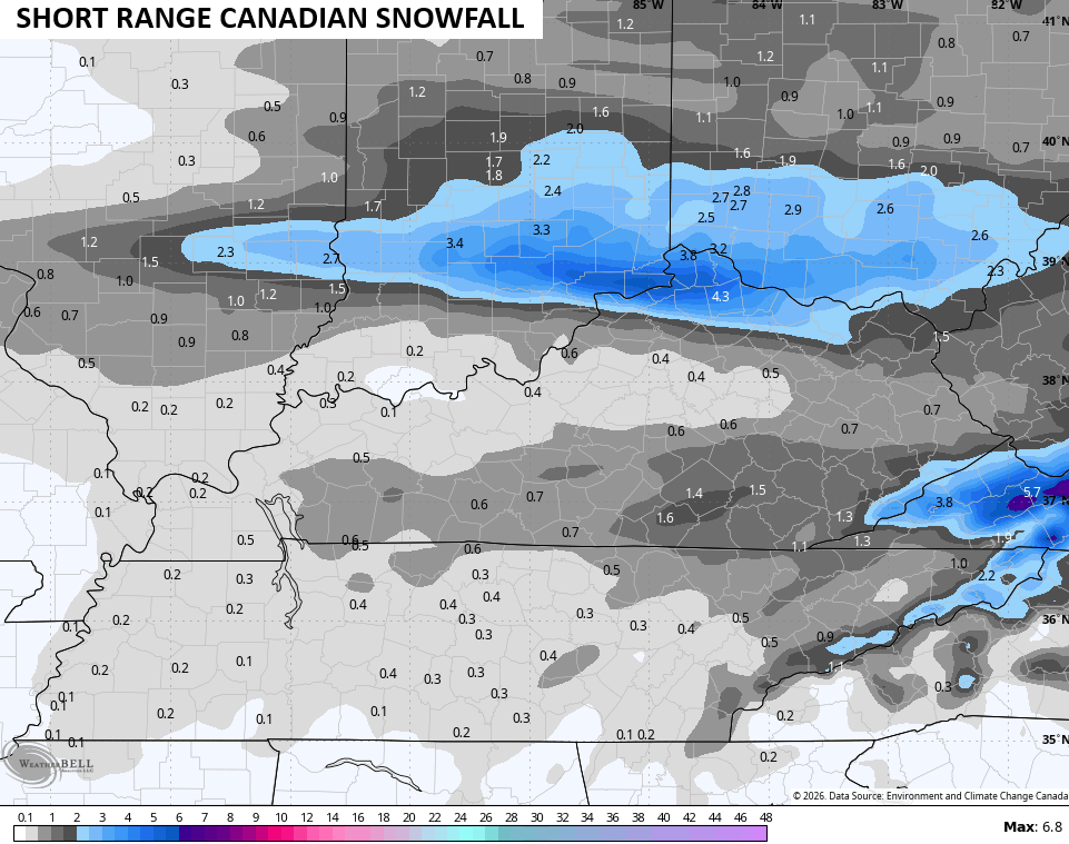
The Canadian is as well, but it’s showing two different stripes of decent snow. The model has almost a secondary low that develops and puts down snow early Wednesday in the southeast…
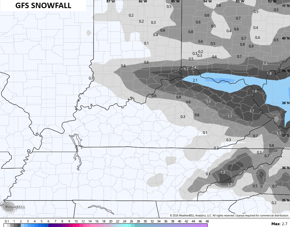
The GFS started with the best snows way up in Ohio and Indiana, but it’s sinking south and southeast…
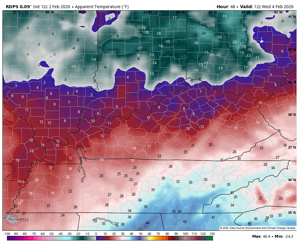
Cold air continues behind this system with wind chills threatening to hit zero again Wednesday night and early Thursday…
Updates come your way later today. I’ll also have updates on my Meteorologist Chris Bailey Facebook Page
Until then, here are your tracking tools for the day…


Make it a great Monday and take care.
