Good evening, everyone. A Winter Weather Advisory is now out across parts of Kentucky Tuesday into early Wednesday. This comes from a system bringing light snow and some light rain to Kentucky during this time.
The Winter Weather Advisory is out for the real estate painted in blue…

I think that gets pushed farther south later tonight or early Tuesday, especially in the east.
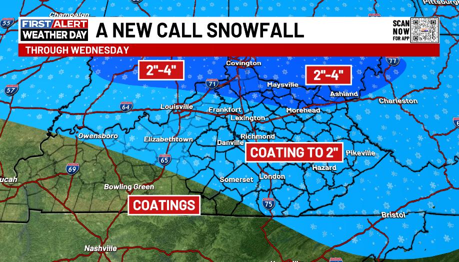
Here’s my New Call for Snowfall…
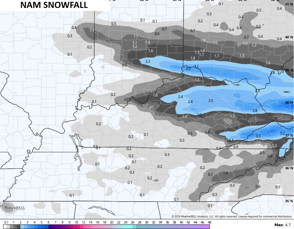
The NAM is showing 3 areas of decent accumulations…
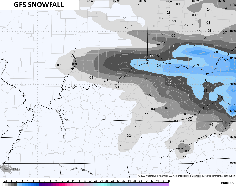
The GFS comes a little farther south with each run…
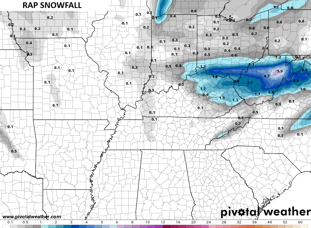
The RAP looks like this…
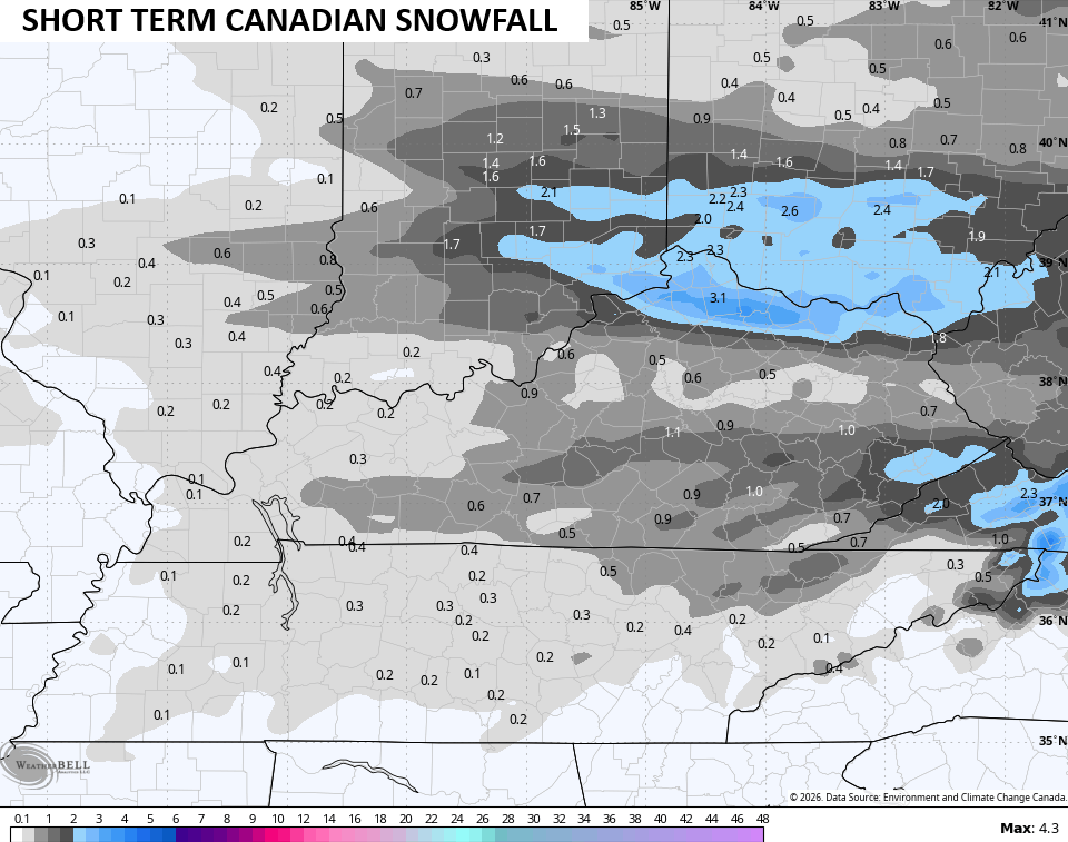
The Short Range Canadian sees two main areas of accumulating snow, with the one in the south coming from that second wave of snow Tuesday night and Wednesday morning…
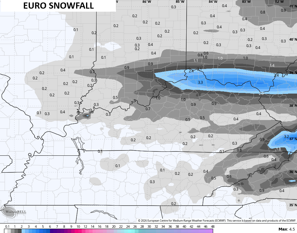
The EURO mainly sees the main snow band in the north but it’s showing more in the south than earlier runs…
This isn’t a major system, but it’ an impactful one that will create additional travel issues late Tuesday into Wednesday.
Updates come your way later today. I’ll also have updates on my Meteorologist Chris Bailey Facebook Page
Until then, here are your tracking tools for the day…


Make it a great Monday and take care.

None for WKY….back to normal.
Just be glad you’re not in Omaha. Last year at this time they had only received one inch of snow. This season, 6.1 inches. Again, OMAHA!
WEATHER ITEM OBSERVED TIME RECORD YEAR NORMAL DEPARTURE LAST
VALUE (LST) VALUE VALUE FROM YEAR
NORMAL
………………………………………………………….
TEMPERATURE (F)
TODAY
MAXIMUM 44 357 PM 66 1992 35 9 58
MINIMUM 25 745 AM -25 1905 16 9 24
AVERAGE 35 26 9 41
PRECIPITATION (IN)
TODAY 0.00 0.44 1943 0.03 -0.03 0.00
MONTH TO DATE 0.00 0.06 -0.06 0.00
SINCE DEC 1 1.25 2.03 -0.78 0.85
SINCE JAN 1 0.92 0.81 0.11 0.05
SNOWFALL (IN)
TODAY 0.0 6.7 2004 0.3 -0.3 0.0
MONTH TO DATE T 0.6 -0.6 0.0
SINCE DEC 1 2.2 13.6 -11.4 1.0
SINCE JUL 1 6.5 15.8 -9.3 1.0
SNOW DEPTH 0