Good Tuesday, everyone. Another snow and rain maker is rolling into Kentucky today and will cause more winter weather woes for much of Kentucky. This system will then be followed by a Friday clipper with a thaw lurking into next week.
Here we go with how this system looks to play out:
- One band of light snow impacts far northern Kentucky early today
- Rain and snow will then quickly increase from west to east this afternoon.
- The rain/snow line is likely to set up south of Interstate 64 with the precipitation shield increasing the farther east you go.
- A pretty healthy band of snow is likely with this from the Bluegrass region into eastern and northeastern Kentucky.
- The snow line then pushes farther south through the evening as the storm system pulls away.
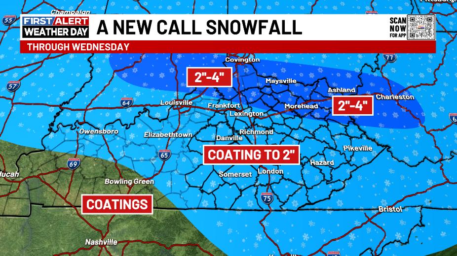
- Another wave of low pressure is likely to throw light snow into southern and southeastern Kentucky late tonight into Wednesday.
- That band may be a bit of an overachiever in these areas.
- The rest of the state will see some snow showers and flurries on Wednesday.
- Slick travel is a good bet across many areas of central and eastern Kentucky late today into Wednesday.
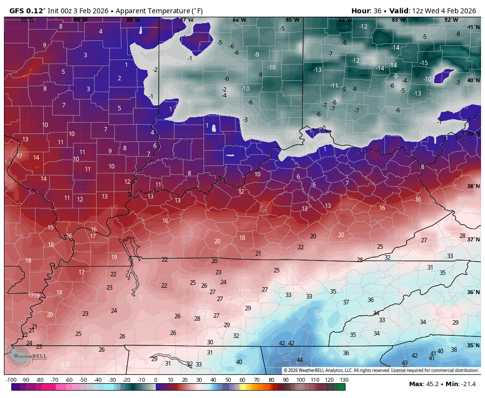
- Another round of bitterly cold temps move in later Wednesday into Thursday.
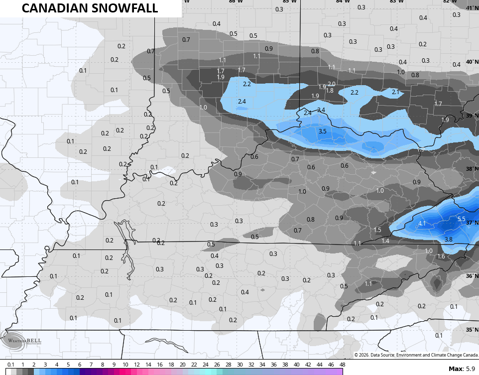
With all that in mind, here’s my New Call for Snowfall…
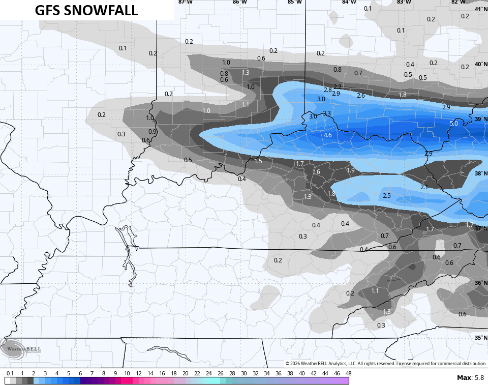
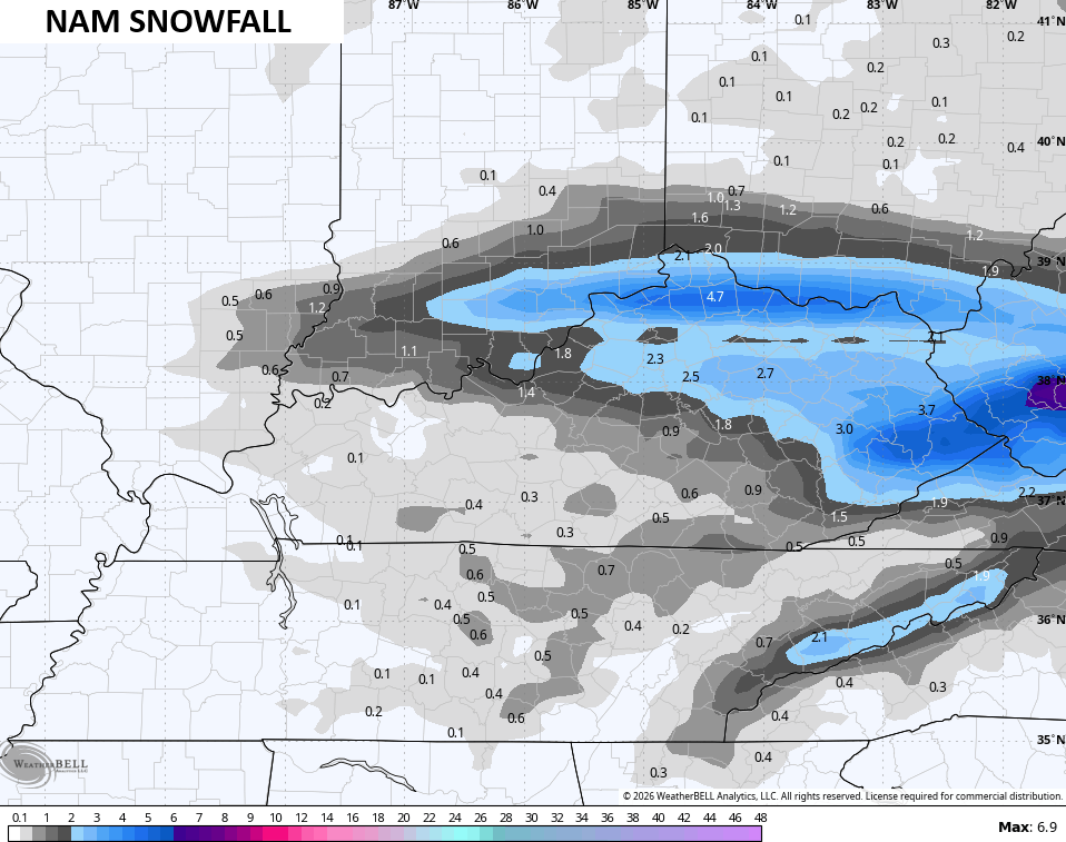
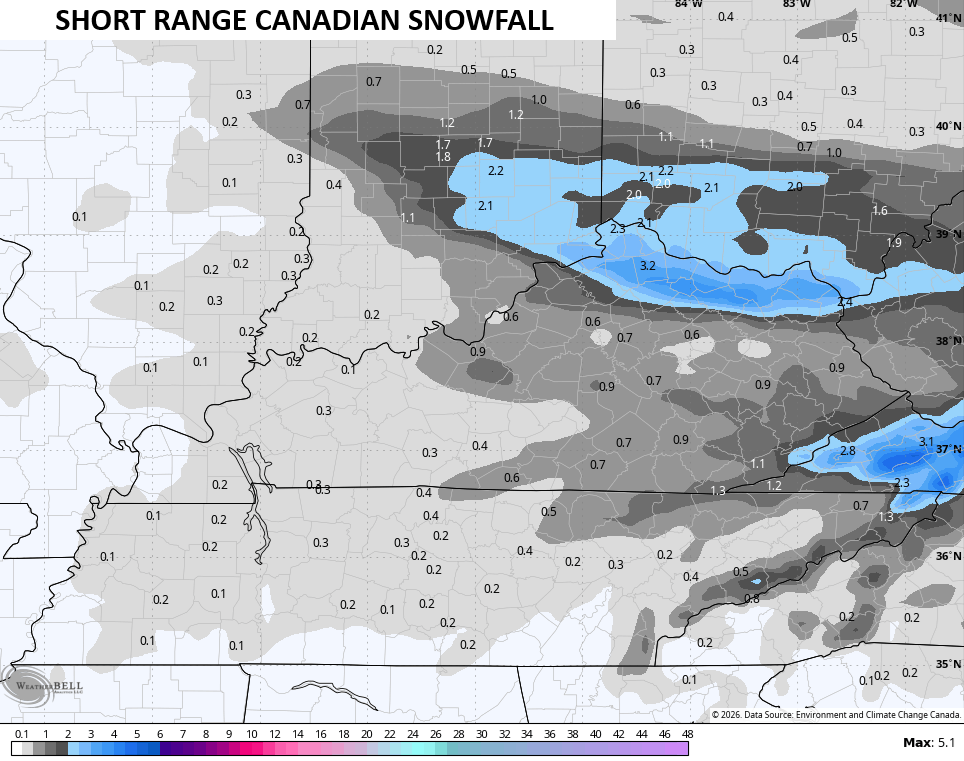
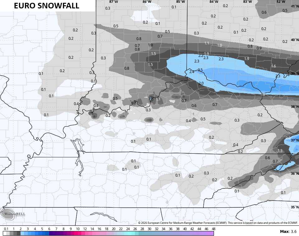
In terms of what the models are seeing, here’s a look…
A Winter Weather Advisory is out for many areas of central and eastern Kentucky…

This comes with another blast of frigid temps with wind chills making a run at zero or below. This animation starts at 7am Wednesday and goes through 7am Thursday…
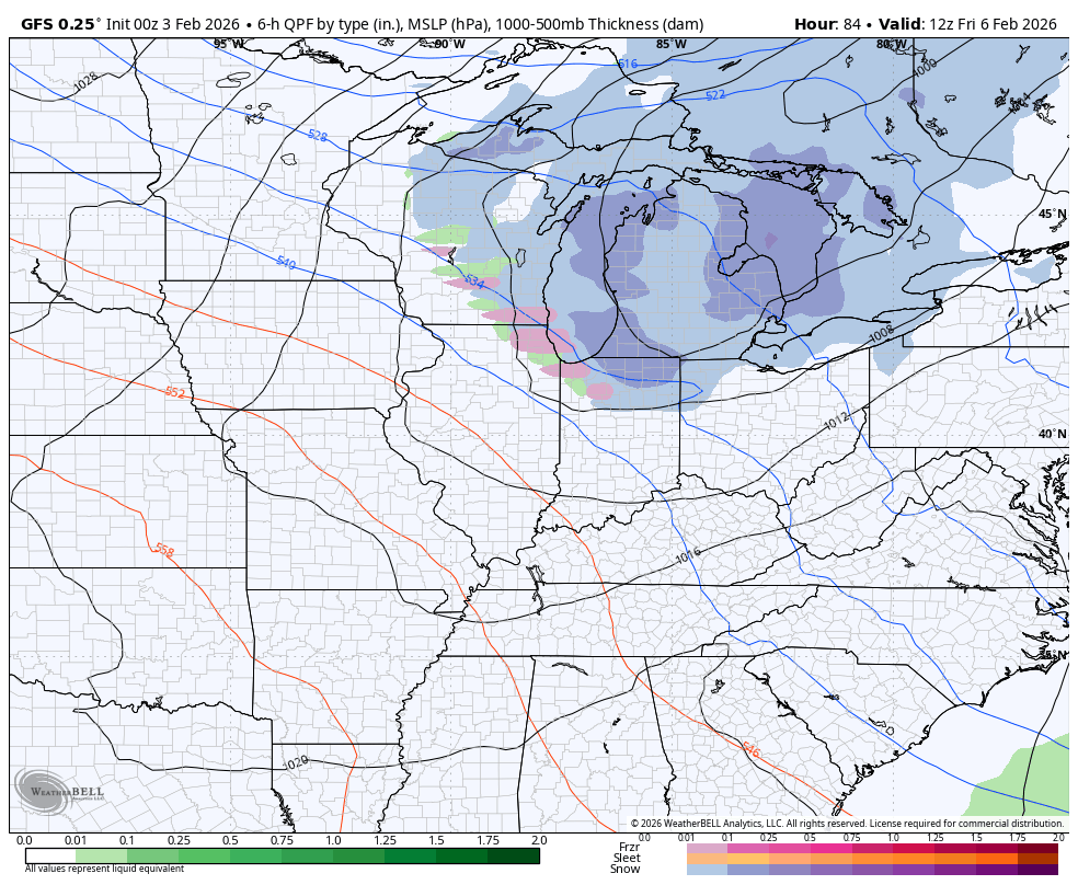
From there, we watch two clippers dropping in from the northwest Friday into the weekend. Each of these can put down light accumulations, especially across central and eastern parts of the state.
The EURO and GFS see them but handle them differently…
EURO
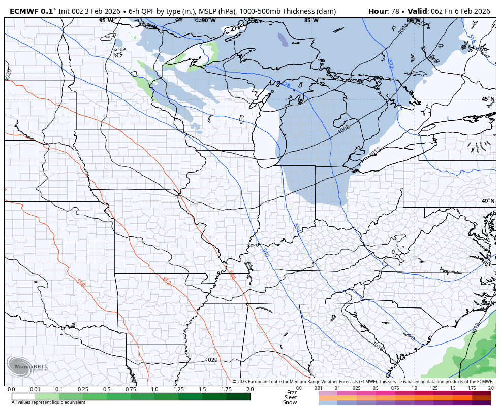
GFS
Temps are frigid once again, but a big thaw looks to take hold next week. Bring. It. On.
Updates come your way later today. I’ll also have updates on my Meteorologist Chris Bailey Facebook Page
Until then, here are your tracking tools for the day…


Make it a terrific Tuesday and take care.

Thanks Chris. Sea Surface Temperatures Changes Are Occurring In The Tropical Pacific. ENSO / La Nina Is Beginning To Phase To ENSO / Neutral. This Phase Often Leads To A More Typical, Less Predictable Weather Pattern. ENSO / El Nino May Follow Later This Year, But There Is Still A Question On This Occurrence Happening.
In The Meantime, I’m Ready For The Thaw, And More Sunshine Please !
WKY back in the snow free zone…..
I Don’t Think We Are Through With The Snow Yet Russell. Some Of Biggest Snow Events, Were Late Snows.