Good afternoon, everyone. Snow and rain continue to develop and push across Kentucky as Old Man Winter keeps kicking us when we’re down. This light snowmaker is likely to cause slick roads to develop again later today into Wednesday.
These slick roads will likely cause additional snow days into areas of central and eastern Kentucky, so get ready for that.
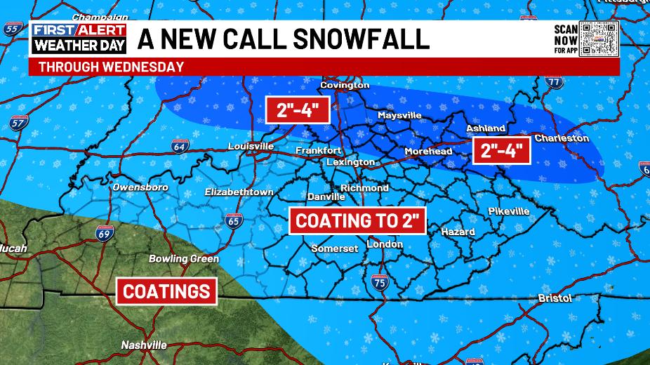
A Winter Weather Advisory continues across parts of these areas, but I don’t think they’re expansive enough in the east as of this writing. Here’s a look…

I’ll roll with this snow map…
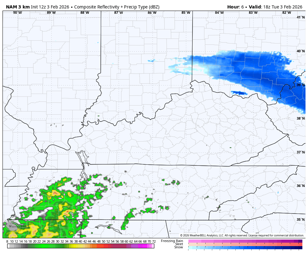
The Future Radar from the HI Res NAM shows the rain and snow this afternoon through tonight with that second wave of light snow impacting the south and southeast Wednesday. This animation starts this afternoon and goes through Wednesday night…
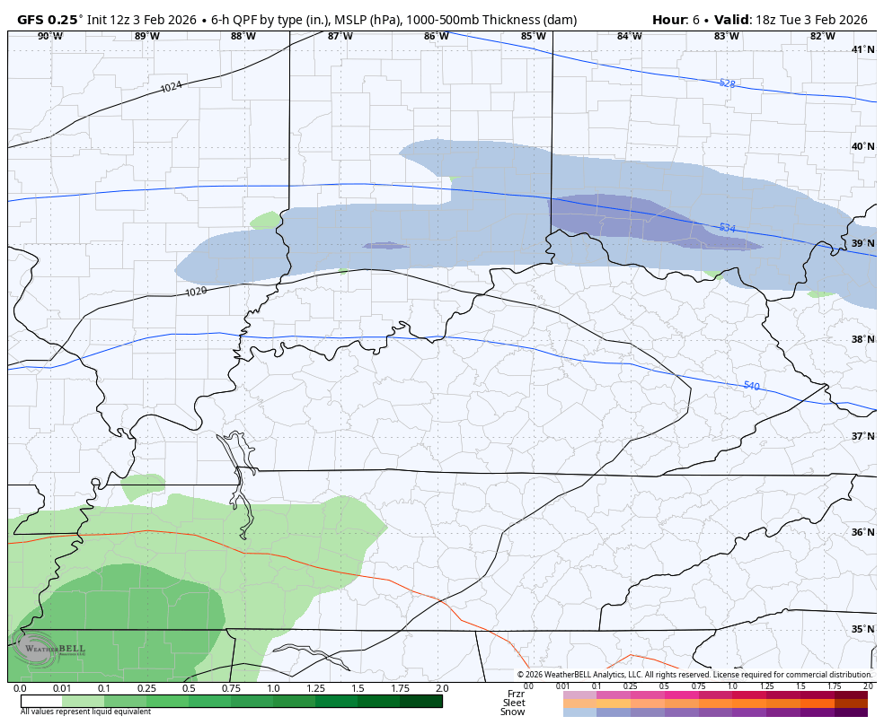
The GFS is actually pretty similar as it’s also seeing that second wave of light snow in the south and southeast…
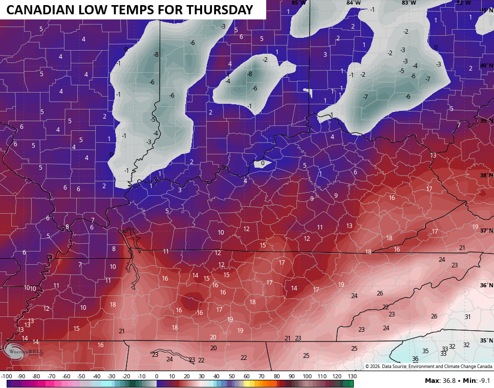
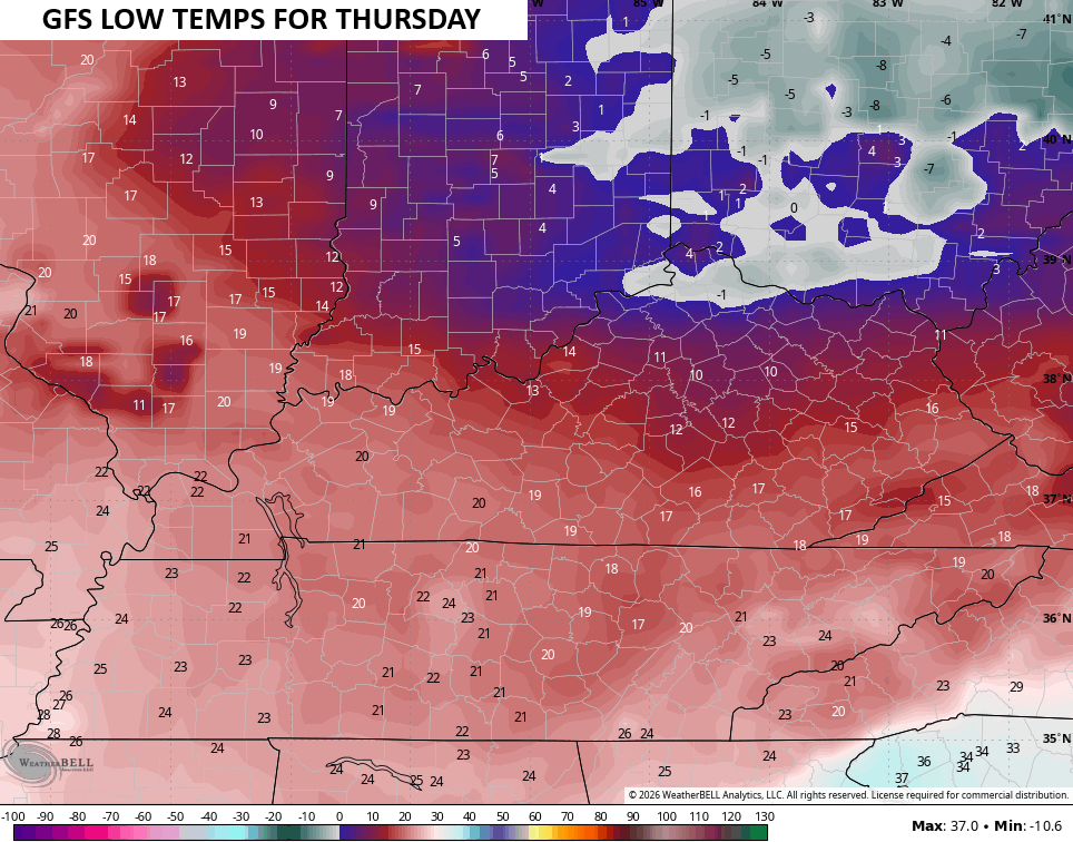
Temps tank behind this system with Wednesday night lows making a run at 0 or below in the north, especially…
Updates come your way later today. I’ll also have updates on my Meteorologist Chris Bailey Facebook Page
Until then, here are your tracking tools for the day…


Make it a terrific Tuesday and take care.
