Good Wednesday to one and all. Old Man Winter continues to have a stranglehold on Kentucky and surrounding areas and this looks to continue for a few more days. Once into next week, we find a true thaw looking to take over for a bit.
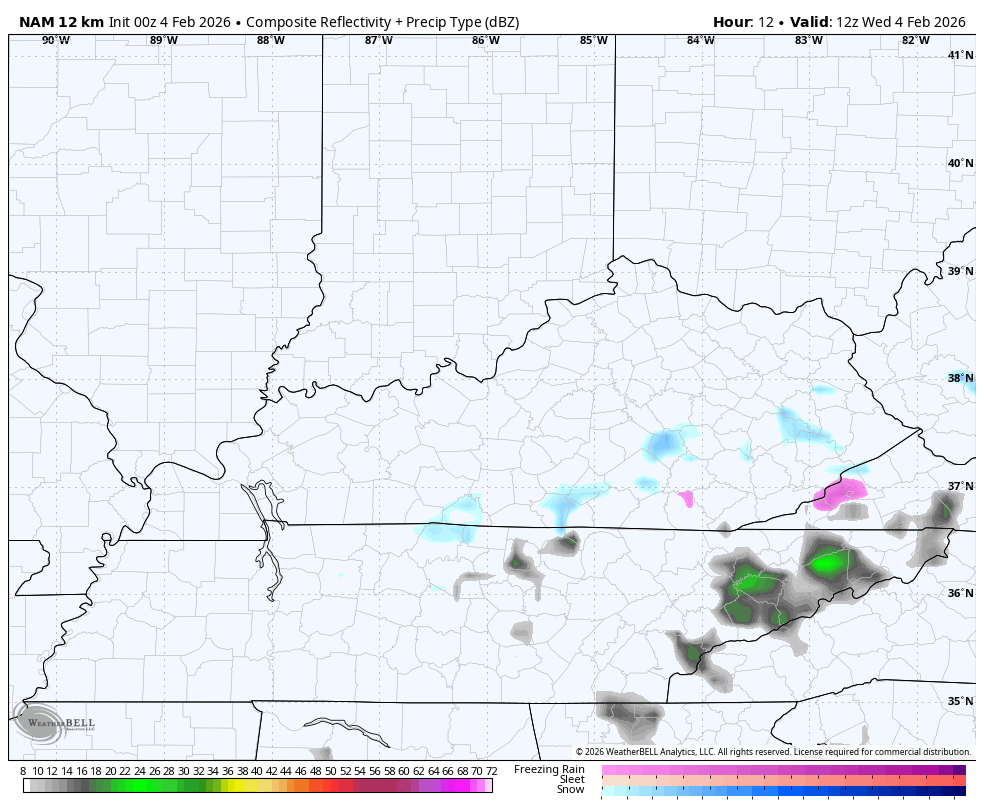
Light snow is out there this morning with a greater concentration in the south and southeast as a wave of low pressure zips into the southern Appalachian Mountains. There’s also some light freezing drizzle to boot. Low-level moisture is in place across most of the state, leading to some additional pockets of light snows through tonight.
The NAM future radar shows all this…
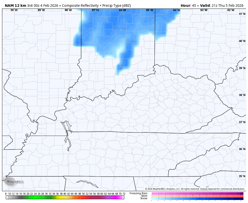
A light snow shower maker may return by Thursday night with a better chance for a swath of light snow and snow showers for central and eastern Kentucky. Here’s the future radar from the NAM from Thursday night through Friday night…
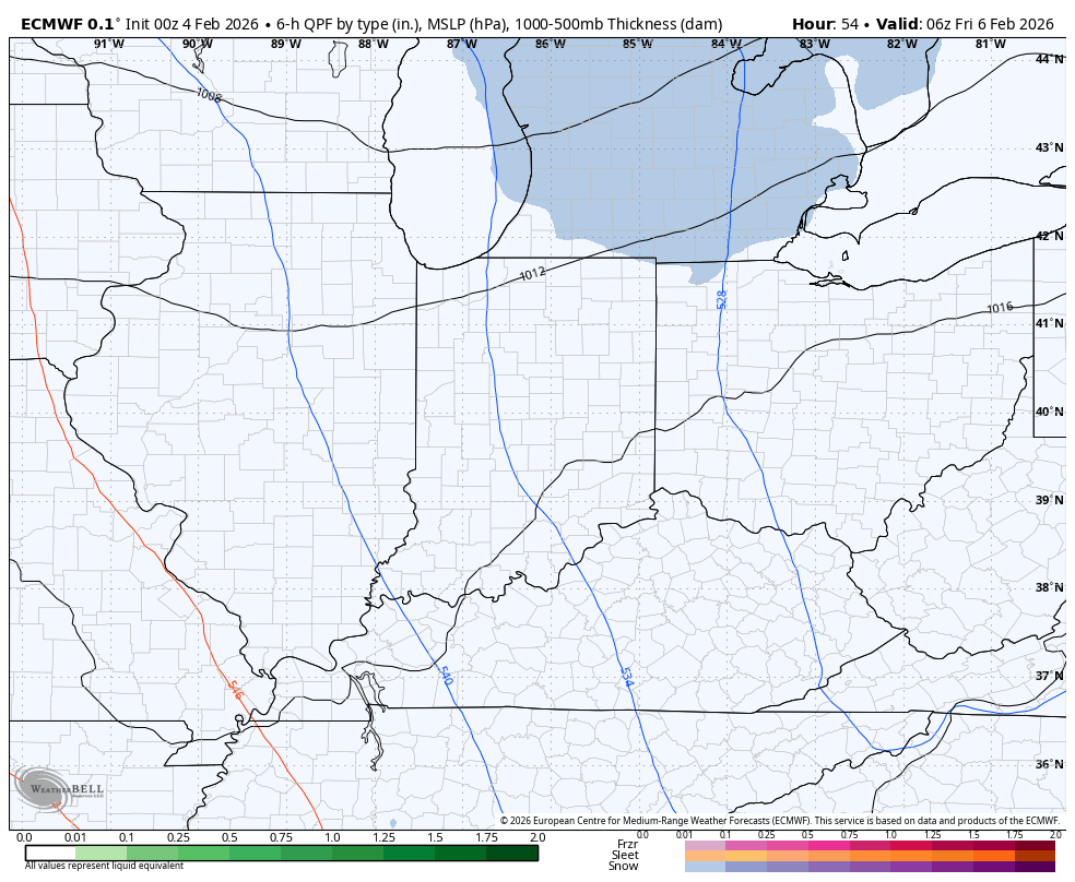
The Euro gives us a good look at another light accumulating snowfall for the central and east and even shows a plume of snow off Lake Michigan trying to reach us on Saturday…
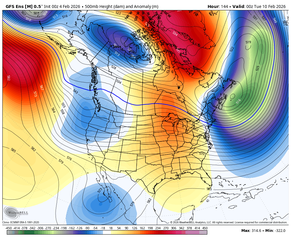
Temps are frigid again behind this but that turns around in a hurry by early next week. We finally get a chance to thaw out into next week before we start to see the pattern trying to revert back to deep troughs sweeping into the east…
Updates come your way later today. I’ll also have updates on my Meteorologist Chris Bailey Facebook Page
Until then, here are your tracking tools for the day…


Make it a wonderful Wednesday and take care.

This cold was crazy. Our power bills are going to be ridiculous. I don’t even wanna know. I mean, they’re already higher than they’ve ever been during normal conditions, much less this. I wanna say that once we thaw since we’re in Feb and we’ve had so much long sustained cold I want to say that maybe winter mostly is over after this… but honestly, I don’t know anymore. Every year is so different. It could warm up, then go right back to cold/snowy.. I mean, it’s not unheard of. Remember 2015? I think it was, 17 inches in late feb from a storm (and I think this was LATE feb, then three weeks later basically the same thing happened. The weather is so crazy. I don’t ever EVER remember the ENTIRE state of NC being covered in snow at the same time..
also … upon login to this site to comment. That verification thing is whacked! It wants you to verify, but I found out that if I try again, then again, it finally logs me in without me having to verify.
Since 1994, I can’t remember a longer stretch of days where ice and snow (mostly ice) continuously covered the ground in Warren County. Funny thing is, the insulating characteristics of that frozen precip on my roof may actually have briefly increased my R value!
Seriously, looking around the neighborhood I see quite a few roofs with an ice/snow layer, but for homes whose roofs are clear, the owners may have a serious heat loss issue.
Joe, We Had About 2 Inches Sleet, Plus 3 Inches Of Snow, And A Final Coat Of Freezing Rain. It’s Now A Big Block Of Ice. On The West Porch, The Ice Sleighed Off This Afternoon, With A Bang. I Too Notice That The Ground Has Been Covered With Ice And Snow, For As Long As I’ve Seen It Here.
Interesting Article On The Snow Cover So Far In The Northern Hemisphere : )
https://climateimpactcompany.com/2026/02/
Thanks Chris. The Pattern Is About To Flip. A Colder West, And A Warmer East. Stratospheric Warming Still Occurring In An Around The North Pole, So There Is Plenty Of Winter Left For The End Of The Month. Some Of Our Largest Snow Events Have Occurred In That Time Frame. We Shall See.