Good evening, everyone. Another frigid day is wrapping up with a little bit of light snow across the southeast. As we look ahead, there’s a clipper coming in with more snow Friday and Friday night with arctic air following for the weekend.
The light snow this evening will cause travel issues across far southeastern Kentucky so keep that in mind. Some pockets of light snow and flurries may show up elsewhere. Temps in northern Kentucky can hit the singles tonight with wind chills around 0 or a touch below.
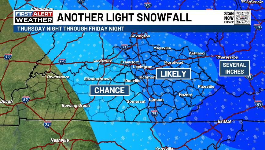
Some snow showers and flurries may be with us later Thursday and Thursday night with a full-blown clipper arriving Friday afternoon and evening. That brings a swath of light accumulating snow and snow showers to central and eastern Kentucky.
Here’s the area I’m thinking has the best chance to receive up to an inch or so of snow…
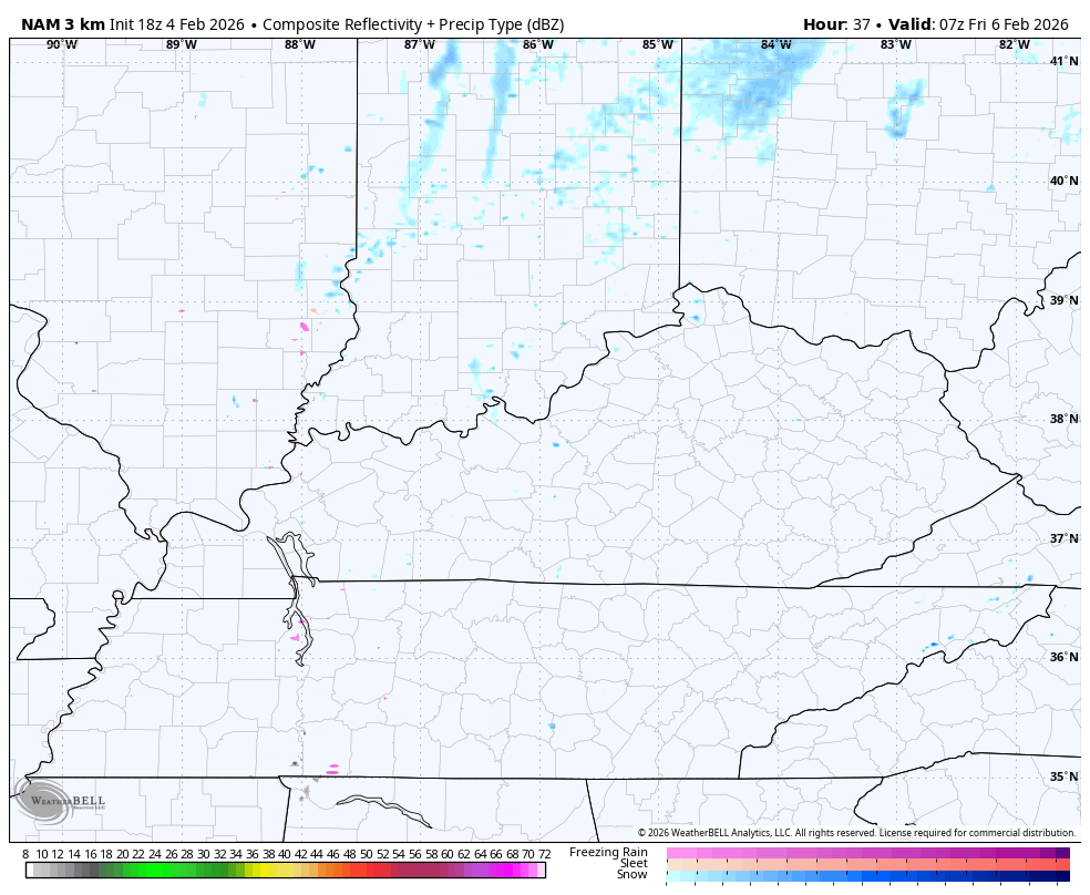
The Future Radar from the Hi Res NAM has some pretty good returns showing up with this on Friday. You can also see the lake effect snow showers and a few snow squalls behind this Friday night…
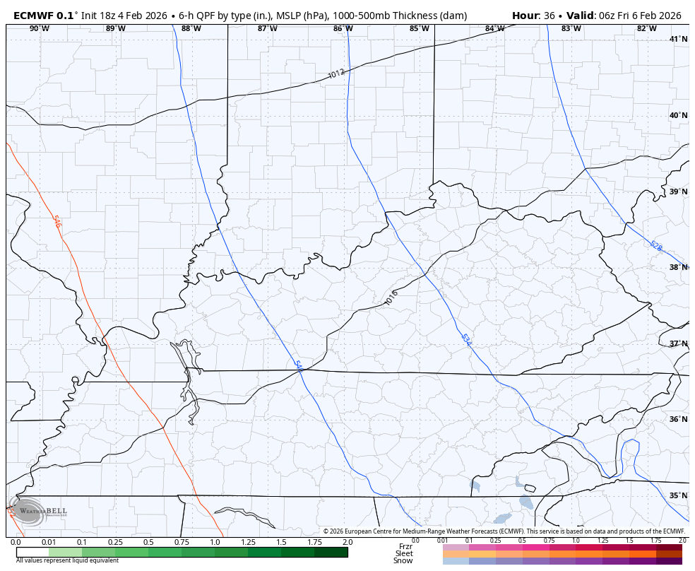
The EURO has been ahead of everything else on this and continues to show this action…
That would be a slushy snowfall to start before it ices up quickly as arctic air spreads in here Friday night and Saturday morning.
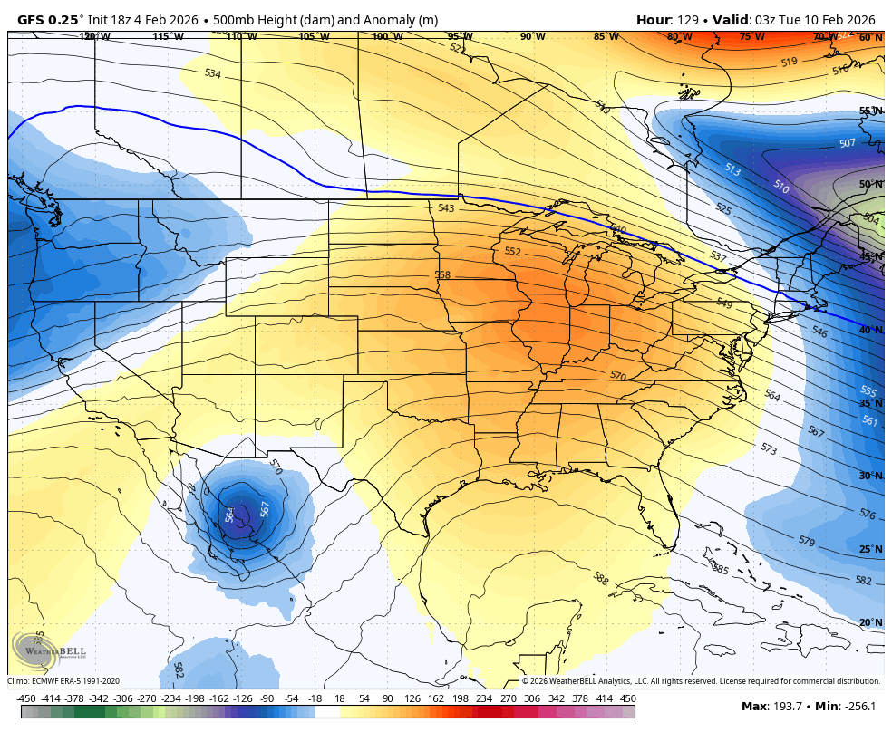
Temps finally recover early next week with 50s very possible for a few days. The pattern may try to turn back toward winter by the end of next week into next weekend as we see a big storm system rumble in.
Watch this transient ridge give way to a trough next week…
The full update comes your way tonight. I’ll also have updates on my Meteorologist Chris Bailey Facebook Page
Until then, here are your tracking tools for the day…


Make it a wonderful evening and take care.
