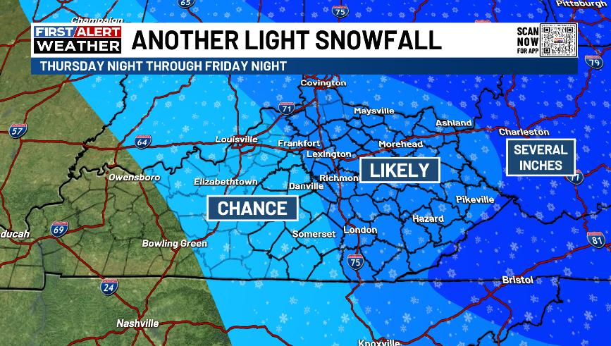
Good Thursday, everyone. Another light snowmaker is on the way to the region as a clipper drops in Friday. This brings another snowfall and unleashes arctic air for the weekend before things look to thaw out a bit early next week.
Temps this morning are frigid with single digits in the north and teens for the rest of the state. Highs this afternoon stay in the 20s for many with more clouds than anything else and there’s even the chance for a flurry or two.
A snow shower is possible tonight with a much greater swath of light snow and snow showers dropping in on Friday. This will mainly impact central and eastern Kentucky with some snow showers and a few squalls behind it Friday night and early Saturday.
I’ve made no changes to the areas likely to see a light snowfall…
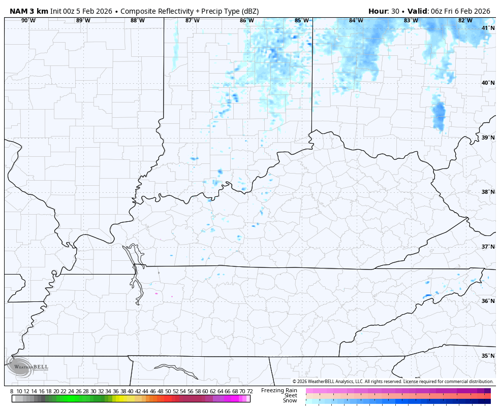
The future radar from the Hi Res NAM gives us a good look at some pretty intense wet snows. This animation goes from early Friday through 7am Saturday…
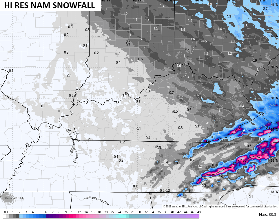
The Hi Res NAM is spitting out some snowfall totals of better than 1″ with some healthy totals in the high mountains along the Virginia border counties..
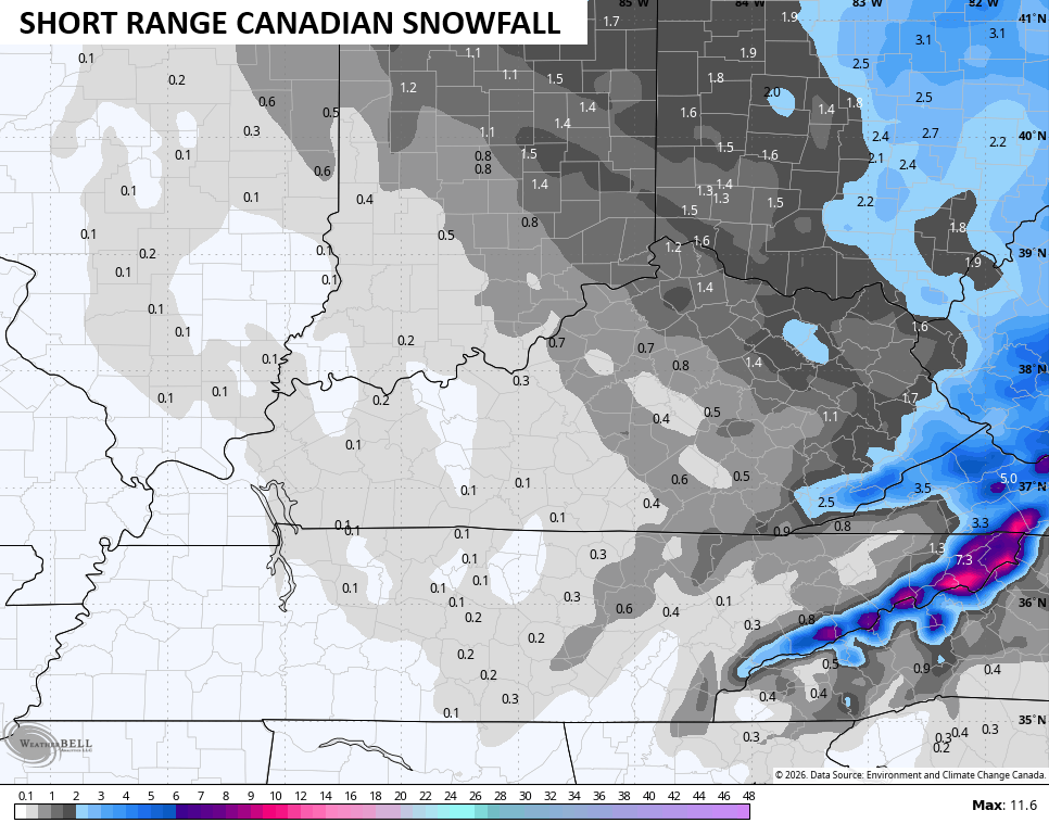
The Canadian family…
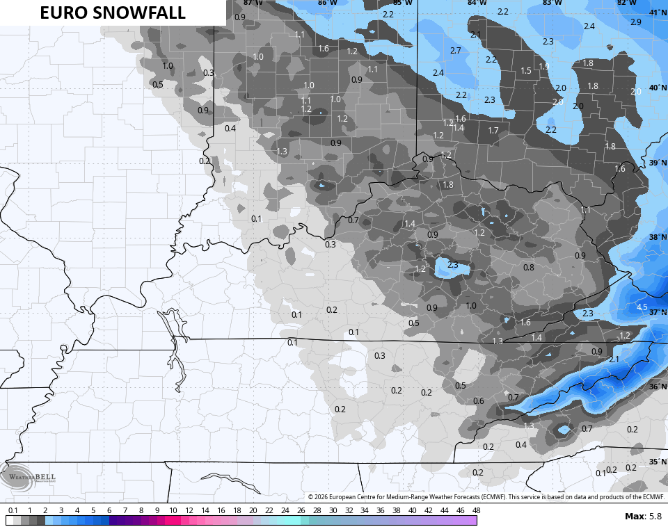
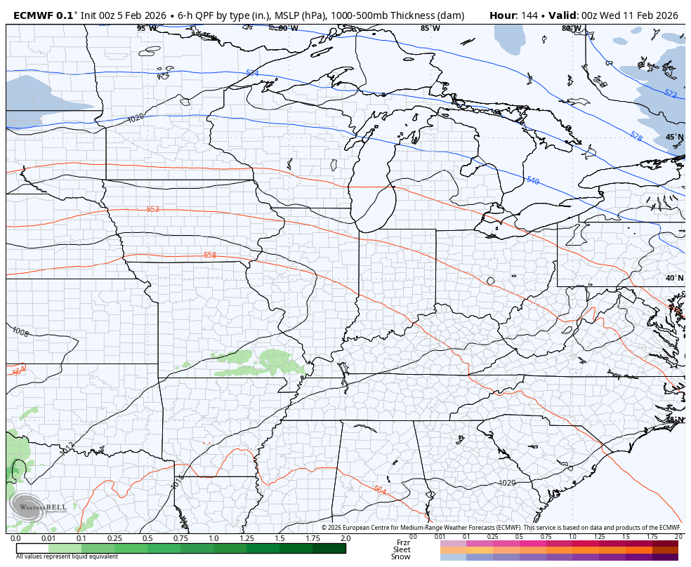
The EURO is farthest west with the accumulating snows…
I’ll get a First Call for Snowfall map out with the next update.
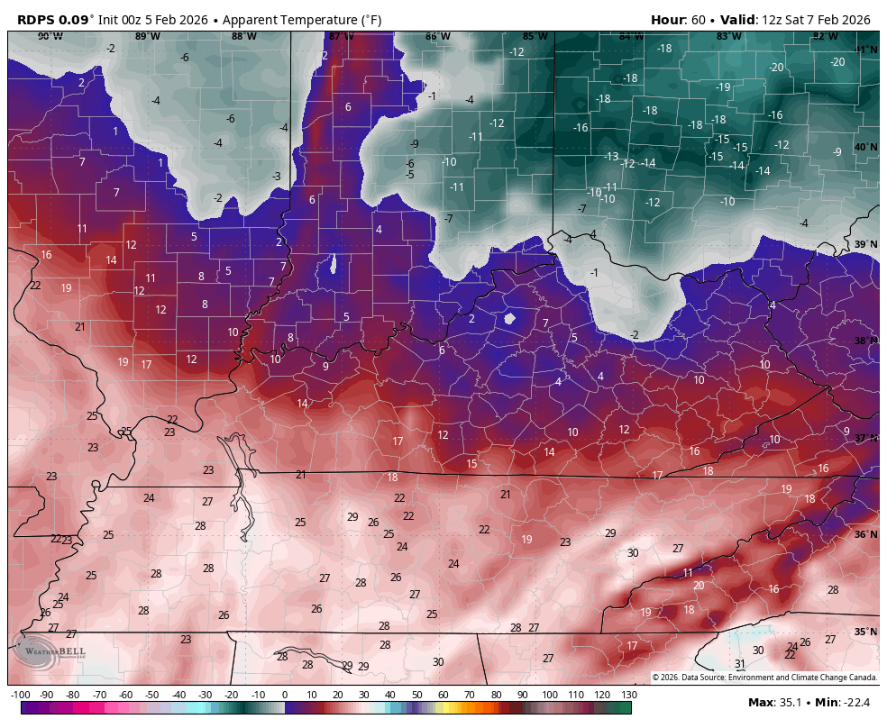
Temps this weekend are back to brutal, especially with the wind chills that can reach zero or a bit below for some Saturday and Sunday mornings. Here’s a look at the wind chill animation from 7am Saturday to 7am Sunday…
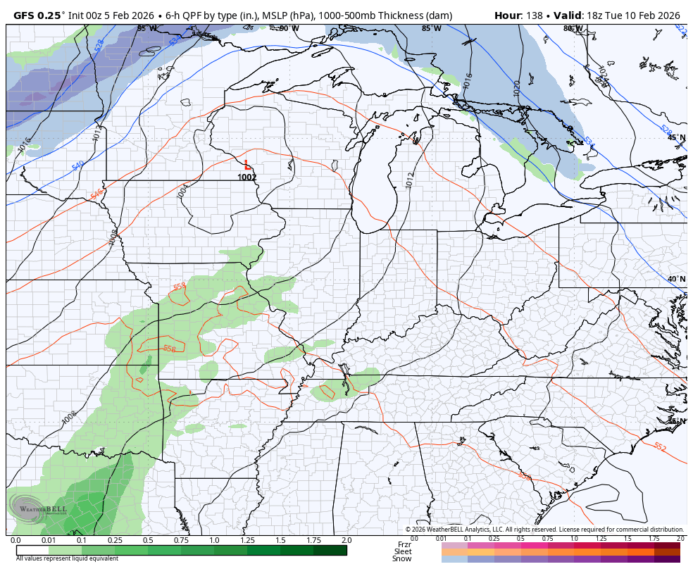
Milder winds finally kick in by Monday and Tuesday of next week with temps hitting 50 or better. How long that lasts remains to be seen. The GFS brings a cold front and rain in here by Wednesday with a drop in temps. It then follows it up with a rain to snow system late next week and weekend…
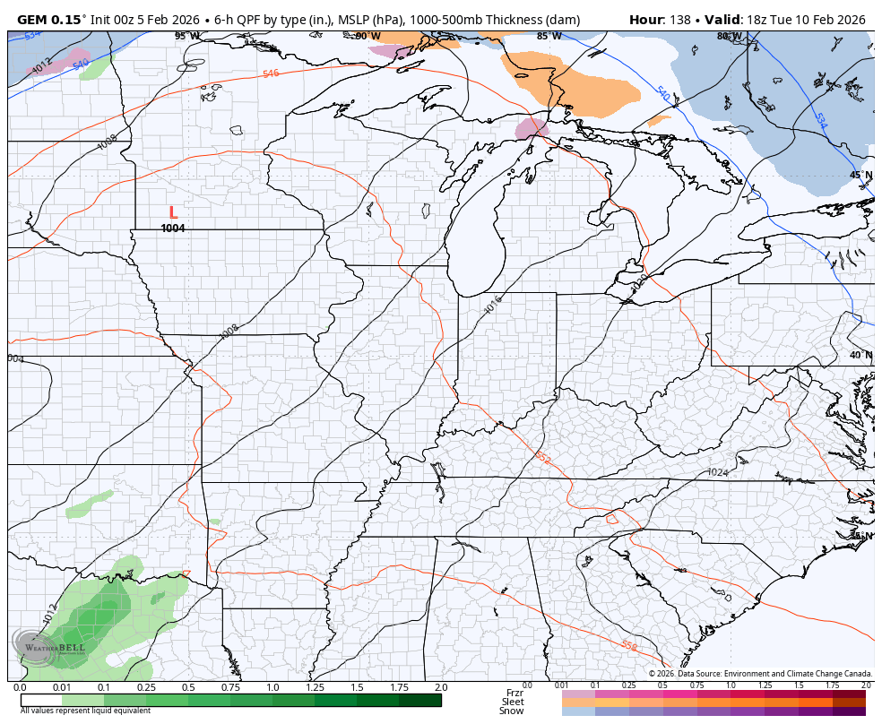
The Canadian is similar but has a colder and snowier scenario for the second system…
The EURO is even stronger with the second system…
Updates come your way later today, as usual. I’ll also have updates on my Meteorologist Chris Bailey Facebook Page
Until then, here are your tracking tools for the day…


Make it a wonderful Thursday and take care.

Thanks Chris. Bring On The Thaw, To Rid Us Of This Mostly Ice, That’s Still Covering The Ground. Hoping That Our Next Winter Weather Event Will Be All Snow.
Take Care Everyone !
Not buying it on the second system.
Outlook for ( March April May ) From The Climate Impact Company : ) Could Be A Very Early Spring, With The Southeast High Pressure Ridge Dominating In March. It Would Certainly Be Less Stormy. We Shall See. Here’s The Link : )
https://climateimpactcompany.com/daily-feature-high-impact-climate-for-mar-apr-may-2026-according-to-ecmwf-2/