Good afternoon, everyone. Some light snow continues to fly across parts of the state right now, putting down some coatings. This is happening ahead of a clipper moving in on Friday and that one will put down enough snow to cause travel issues.
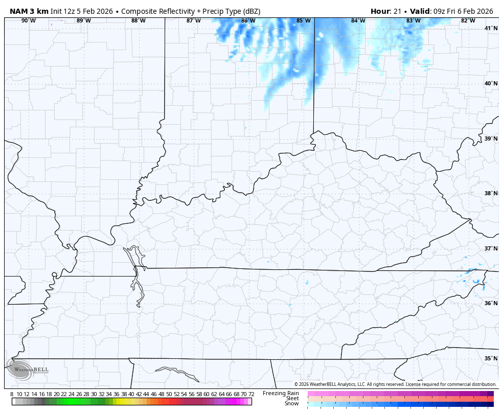
The light snow out there today is more into central and western parts of the state than anywhere else.
Our clipper brings a healthy swath of light to moderate snows from northwest to southeast across central and eastern Kentucky Friday. This be a wet snow that will be followed by arctic air with a few snow showers and squalls into Saturday morning.
The future radar from the Hi Res NAM shows this well…
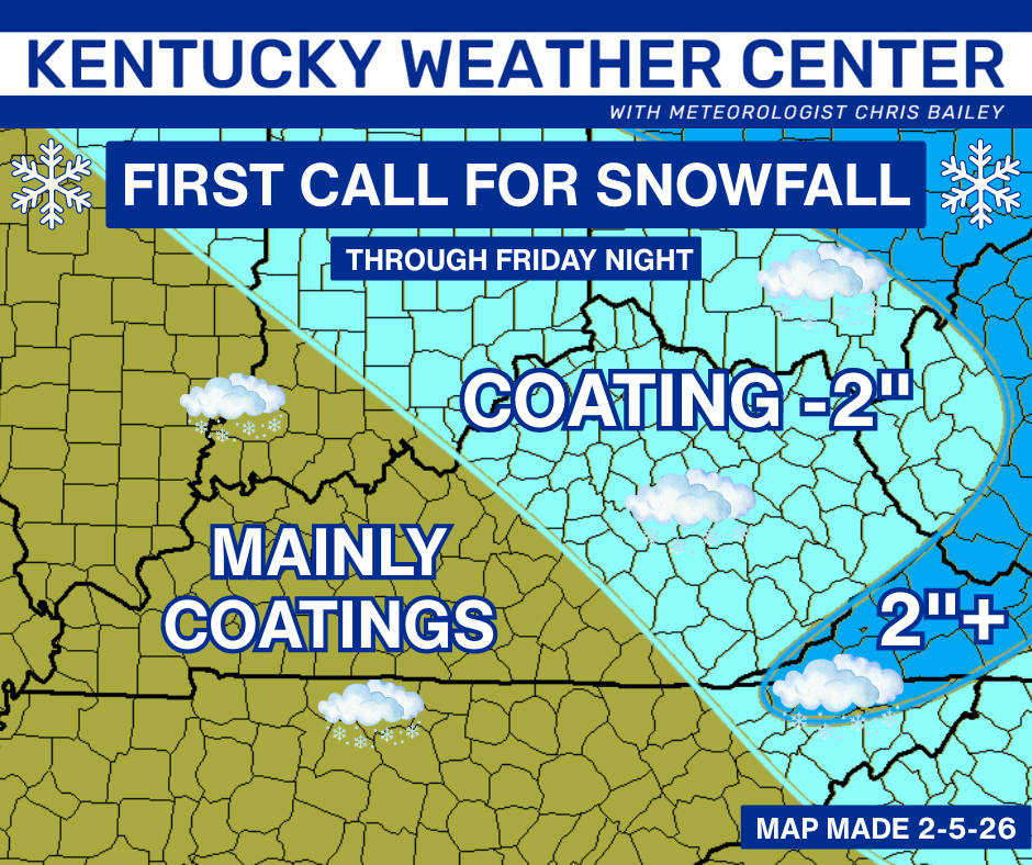
Many areas of central and eastern Kentucky have a chance to pick up a couple more inches of snow. Here’s the First Call for Snowfall…
Some of the forecast models are trying to show some enhanced bands setting up and, if that’s the case, a corridor of overachieving snows that can top 2″ will show up. The best chance for this is across the northeast into the far southeastern mountains.
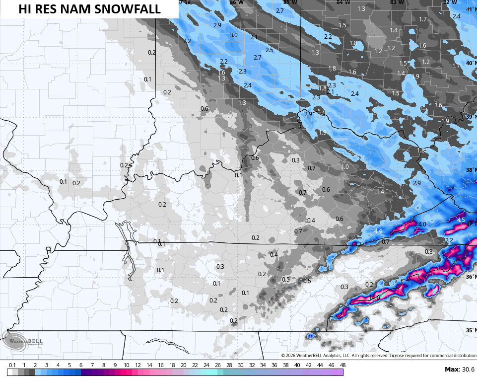
The Hi Res NAM is pretty beefy…
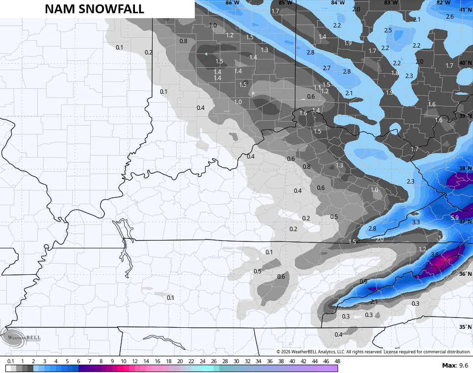
The NAM has this, too…
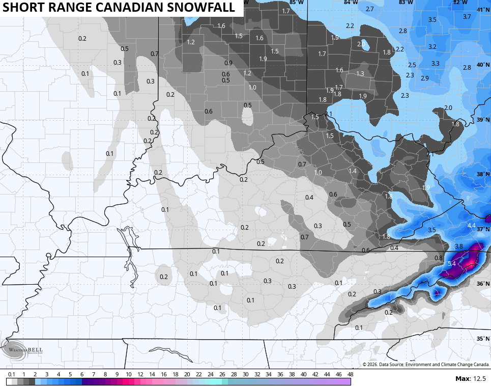
Notice a similar area on the Short Range Canadian…
I will be updating the Call for Snowfall on WKYT-TV starting at 4pm today and may very well account for this possibility.
Updates come your way later today, as usual. I’ll also have updates on my Meteorologist Chris Bailey Facebook Page
Until then, here are your tracking tools for the day…


Make it a wonderful Thursday and take care.
