Good evening, everyone. A Winter Weather Advisory is out for much of central and eastern Kentucky Friday into Friday evening. This is for the light snow system dropping in from the northwest that will also unleash more bitterly cold temps.
Here’s a look at the Winter Weather Advisory that could probably be expanded a county or two farther south…

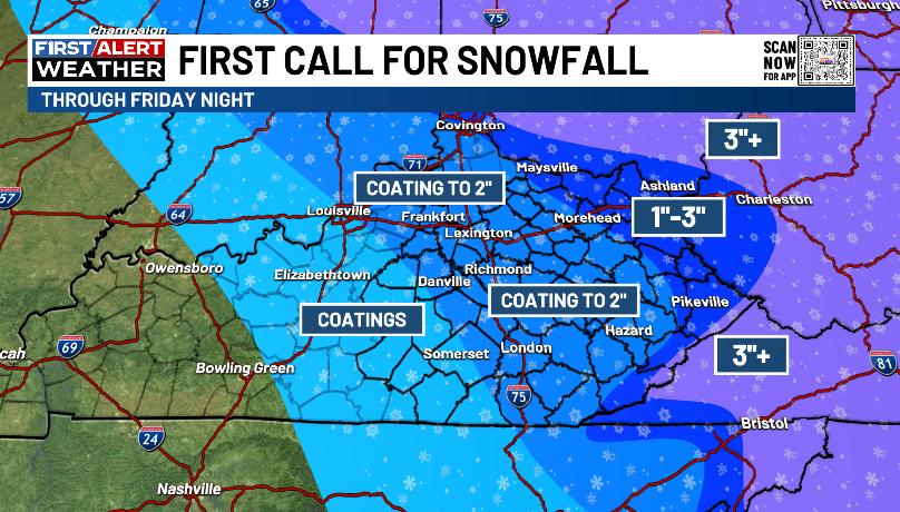
My updated Call for Snowfall was the First Call for WKYT, but I updated it to up the totals in the northeastern part of the state, especially…
I’ll be updating that again later tonight.
The Future Radar from the Hi Res NAM continues to show a hefty round of light to moderate snow with the snow showers and squalls kicking in behind that…
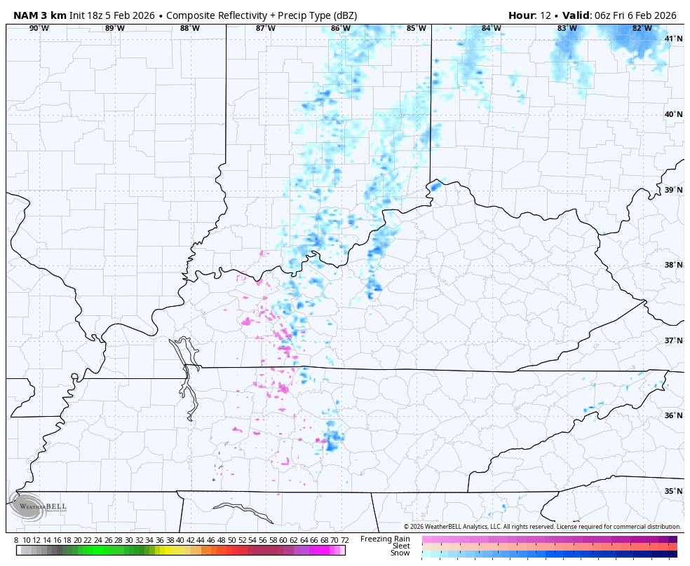
Don’t sleep on those snow showers and squalls Friday evening into Friday night.
Low temps this weekend can drop below zero in some areas with wind chills even colder.
The temps climb early next week but that window of warm continues to shorten as the models are rushing a cold front in here by late Tuesday and Wednesday. That would have a return of colder air following that quickly for the rest of the week.
The GFS has the cold and makes it so cold it deflects the late week storm to our south…
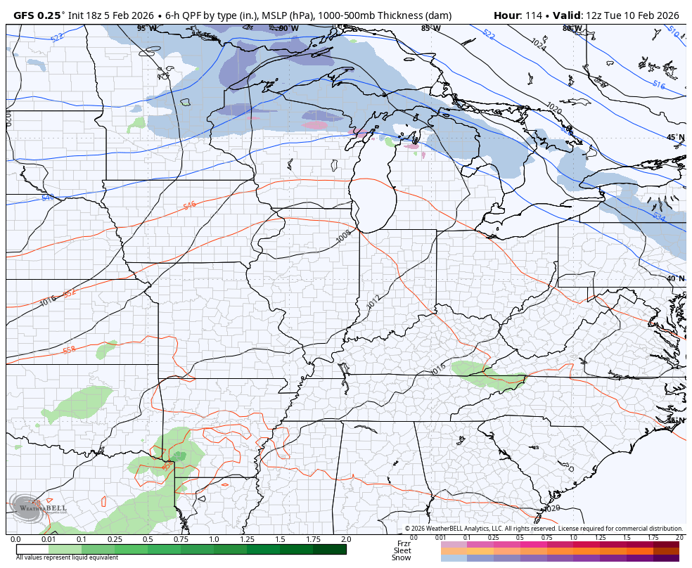
That’s probably not going to happen as I do expect a healthy storm into the eastern half of the country.
The full update comes your way tonight. I’ll also have updates on my Meteorologist Chris Bailey Facebook Page
Until then, here are your tracking tools for the day…


Make it a great evening and take care.
