Good afternoon, everyone. Our quick-hitting snow system continues to zip across central and eastern Kentucky as we get set for the snow showers and squalls to kick in later this evening into Saturday morning.
Our Winter Weather Advisory continues for many…

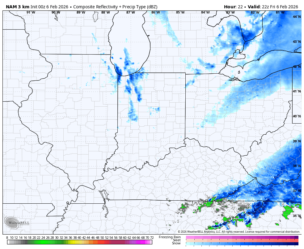
The snow showers and squalls will get a boost from Lake Michigan and this means we see a few bands of hefty squalls out there. Those start this evening and continue into early Saturday. The future radar from the Hi Res NAM shows this well…
Wind chills and temps will be bitterly cold tonight and Saturday with this lasting into the start of Sunday morning. A few more flakes will be possible during the afternoon as milder winds kick in behind this early next week. A cold front then sweeps in by Wednesday with gusty showers and colder air surging in behind it. From there, we watch for the potential for a bigger storm system next weekend.
The models change a lot from run to run on all this and that’s to be expected.
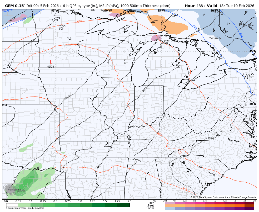
Here’s how the Canadian sees it all playing out…
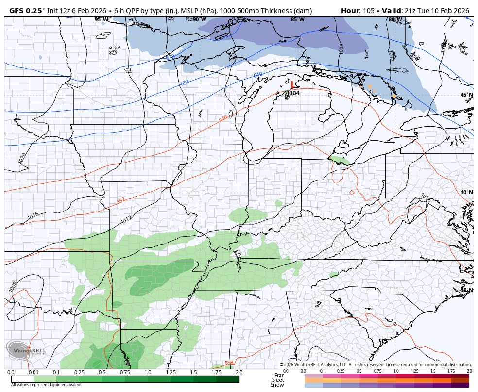
And the GFS…
Another update comes your way later today. I’ll also have updates on my Meteorologist Chris Bailey Facebook Page
Until then, here are your tracking tools for the day…


Make it a fantastic Friday and take care.
