Good Monday, everyone. Our week is starting off with milder air surging into Kentucky, bringing a much-needed thaw following what has been one of the harshest winter patterns on record. While the thaw is nice, don’t let it fool you into a false sense of security as I expect winter to return later this month.
A major north to south temperature spread shows up out there today with the snowpack playing a big role. Areas with a bare ground in the south and west will see temps reaching 60 today while areas with snow and ice on the ground rebound only into the 30s and a few 40s.
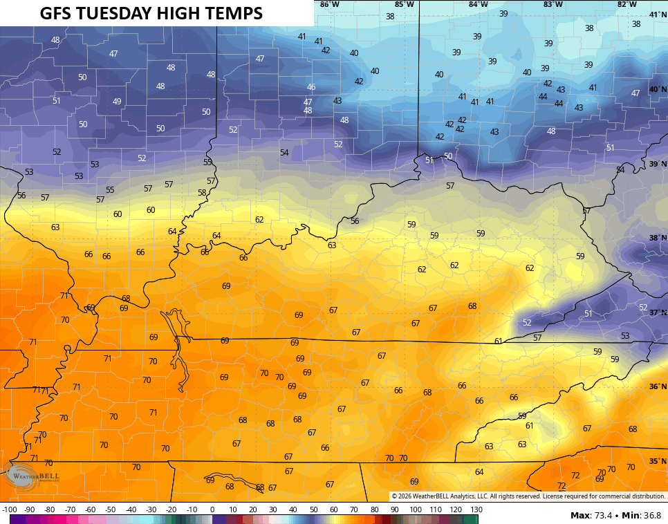
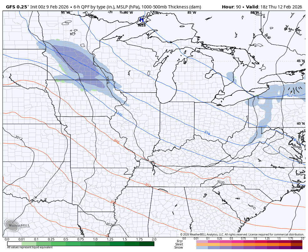
The spread becomes even more pronounced on Tuesday ahead of a cold front dropping in from the northwest. Those 60s head much farther north with the chance for 70 in south central and western Kentucky…
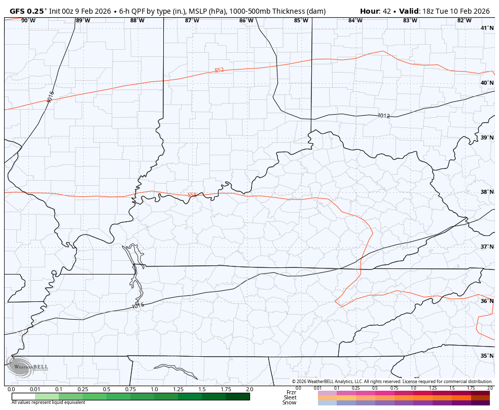
The cold front then brings a few showers as it moves through Tuesday night and early Wednesday…
Temps come back down to normal levels behind that for Wednesday and Thursday.
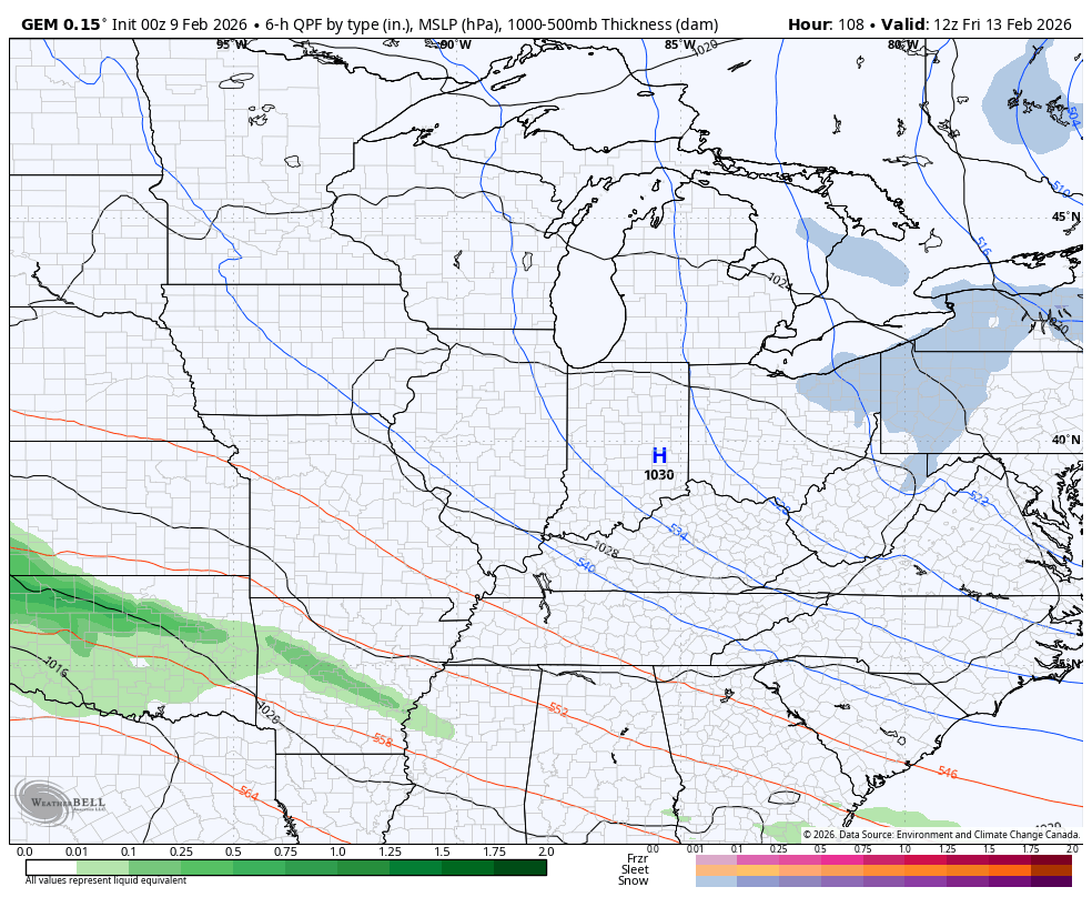
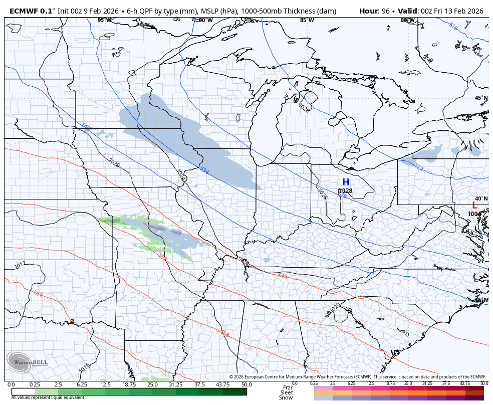
This sets the stage for the next two systems to show up, potentially impacting our late week and weekend weather. The extent of the impact remains to be seen as we continue to see a lot of model to model differences showing up.
The Canadian doesn’t see much for Friday but has a much stronger and farther northwest tracking system for the weekend…
The EURO is similar…
The GFS is farther south and weaker…
Watch for another big system to follow that up by the middle of next week. That one has a chance to produce strong storms in front of it with some snow behind it.
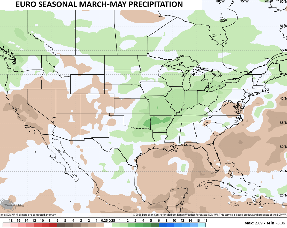
The latest EURO Seasonal is out and it now goes all the way through summer and it’s fairly tame for temps but keeps our active pattern rolling on.
For the springtime months of March through May, the EURO seasonal has our temps averaging a hair above normal…
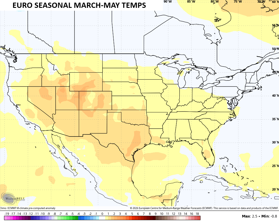
You can clearly see how the real deal above normal numbers are out in the west.
In terms of precipitation, one can deduce a very busy spring severe weather season from the southern Mississippi River Valley to the Great Lakes by the above normal rainfall..
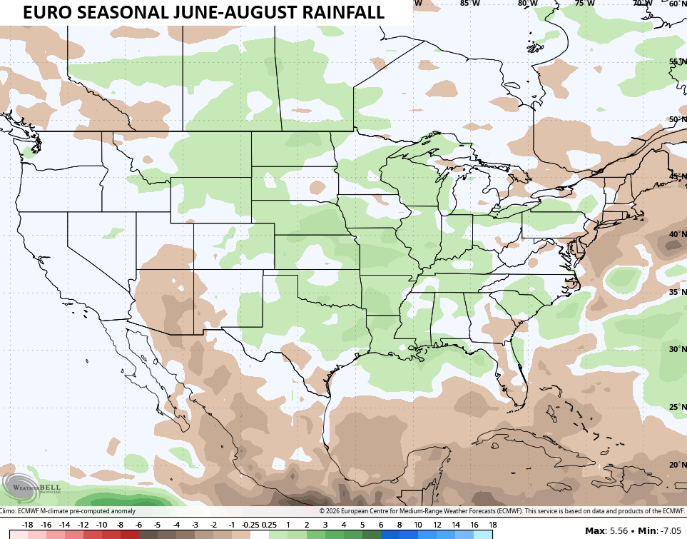
The latest outlook for the summer months of June through August is pretty tame with temps for much of the country…
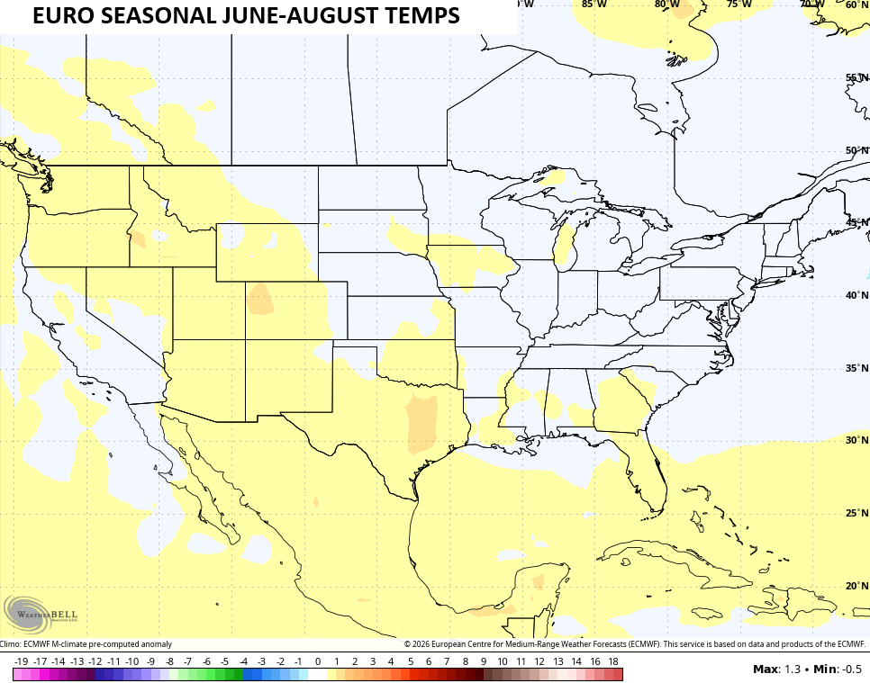
With a blossoming El Nino, that’s not a bad outlook. Neither is the opportunity of above normal rains…

Summer won’t be tame.
Jeff, Just So It Doesn’t Get Over 100 Degrees In The Coming Summer And No Drought, I’ll Be Good With That. I Can’t Remember Any Cool Summers Since I’ve Lived Here.
Thanks Chris. Very Well Detailed Blog This Morning. With Warmer Waters Beginning To Move Towards The West Coast Of The US, ENSO / El Nino’s Impact Will Become More Prevalent For The Fall And Winter 2026 – 27. Could Be Interesting To See What The Impacts will Be ?
Most Models Are Predicting A Very Wet And Stormy Spring. I Always Take Alert When The Models Agree.
As Far As This Summer’s Climate, Some Models Are Predicting A Mild Summer And Others A Very Warm Summer. I Would Predict Something In between. Again, We Shall See.
The Following Article Explains Why Our Winter Weather Is The Way It Is This Year. Notice On The First Map That One / Third Of Kentucky Is In The Very Cold And Snowy While The Other Two / Thirds Not So Cold And Snowy. Never Seen A Climate Set up Like This. A Very Strong ( MJO ) May Be The Cause : )
https://climateimpactcompany.com/ag-market-hot-spot-origin-and-continuation-of-the-dangerous-southwest-south-europe-storm-track-2/
06Z GFS Develops Arctic Air : )
https://climateimpactcompany.com/daily-feature-a-much-colder-06z-gfs-days-11-15-2/