Good evening, everyone. A quick-hitting round of showers and storms is rolling across parts of the region as a cold front drops through. This knocks our temps back to normal for the next few days before another system rolls in.
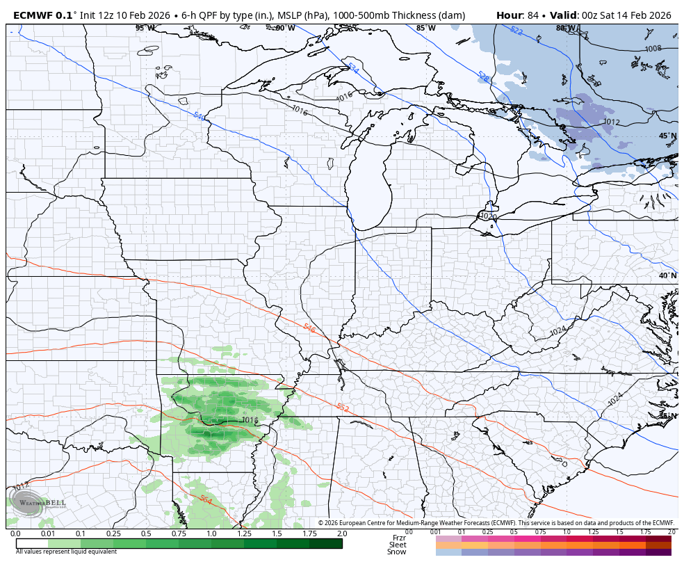
Let’s go ahead and jump to this next system. This impacts us later Saturday and Sunday with rain increase as low pressure rolls through across the Tennessee Valley. Here’s a look at the GFS with this…
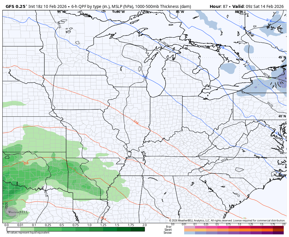
I actually think it has a better handle on it than the EURO does. The EURO continues to take this too far to the south…
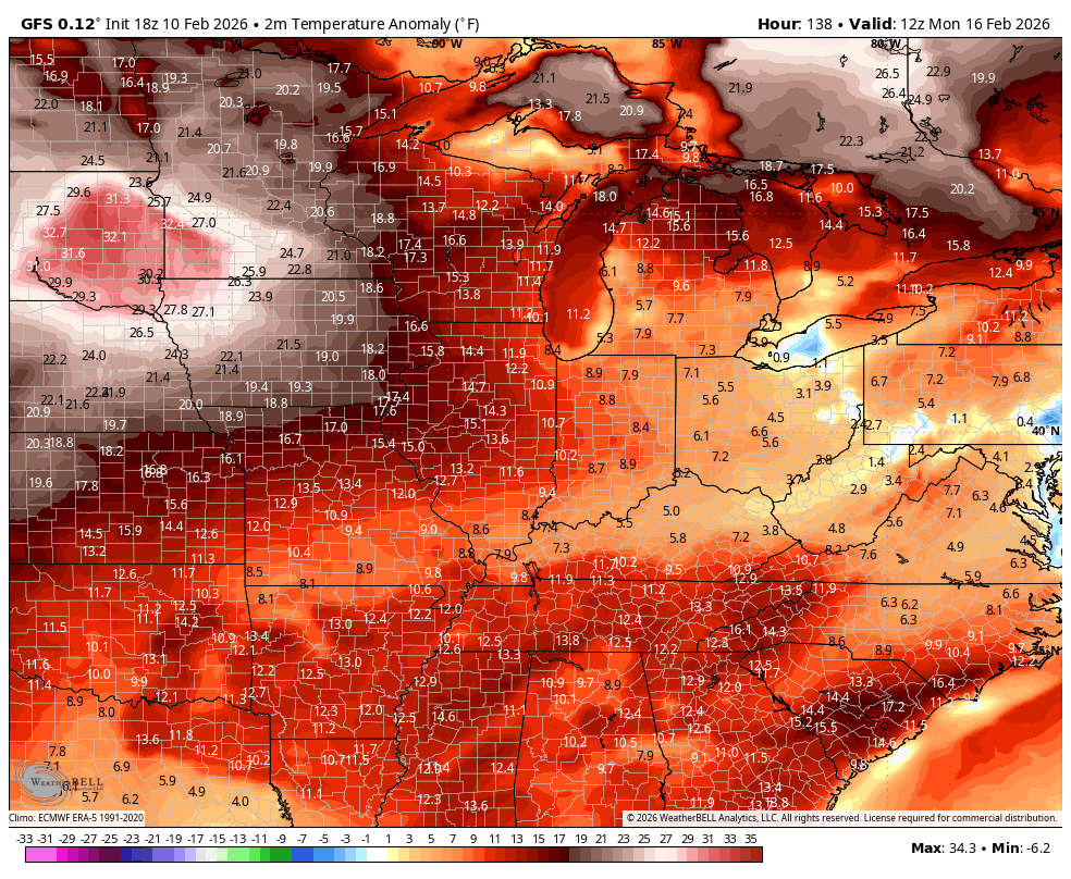
No matter the track of that system, we still appear to be heading into a major surge of Spring Fever for next week as temps jump back above normal. Temps may go WAY above normal as this Monday through Friday animation shows…
I will have the full update later tonight. I’ll also have updates on my Meteorologist Chris Bailey Facebook Page
Until then, here are your tracking tools for the day…


Make it a terrific Tuesday and take care.
