Good Wednesday to one and all. It’s a rare normal temperature pattern settling into the region over the next few days. This is calm weather ahead of a rainmaker rolling in here for the holiday weekend. Behind that comes a serious case of Spring Fever next week.
Showers exit southeastern Kentucky early today as clouds slowly break across the rest of the state. Watch for a little black ice early today for areas of central and northern Kentucky as temps drop below freezing. Temps this afternoon range from the low 40s to the low 50s for most of the Commonwealth.
The black ice potential is with us again each morning from Thursday through Saturday. Overnight lows reach the 20s with afternoon highs in the 40s and low 50s for many.
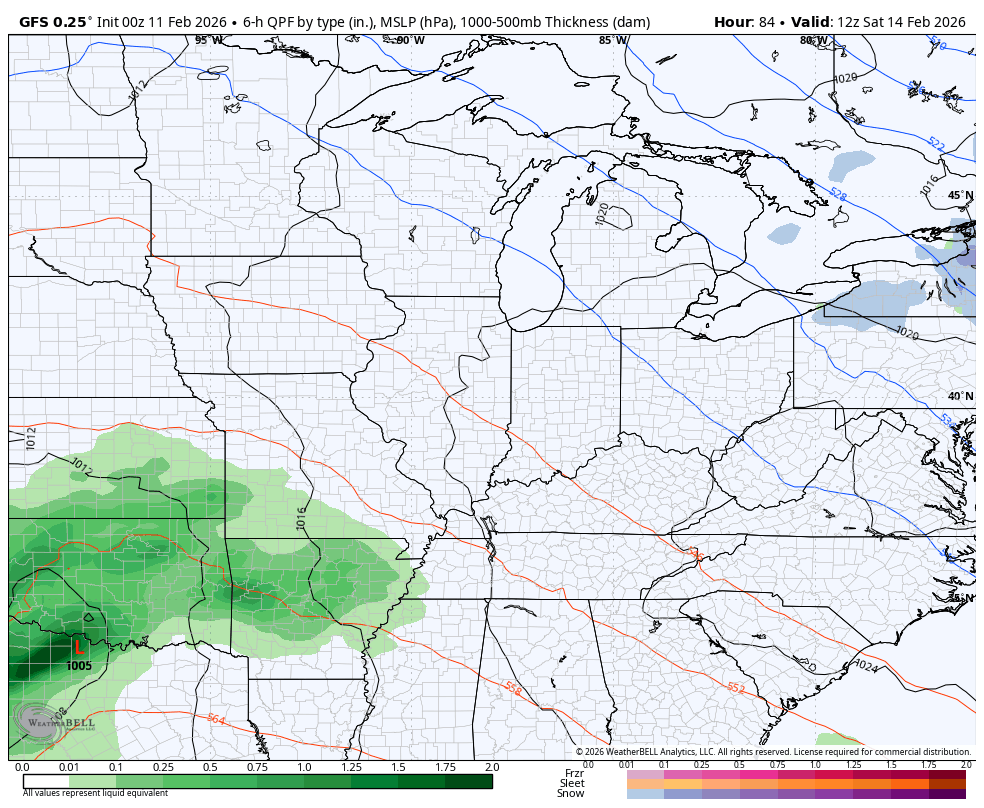
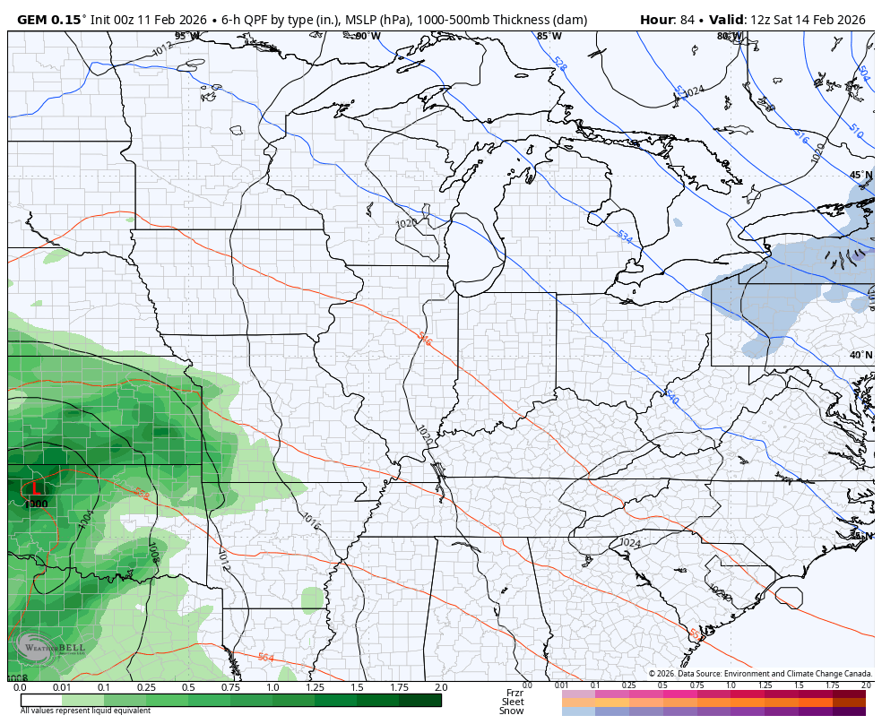
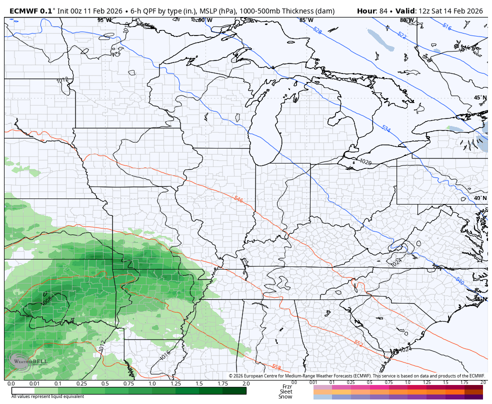
A big storm system then rolls our way from the southwest on Saturday and likely rolls through the Tennessee Valley Valentine’s Day into Sunday. With the absence of any true cold air to the north, this is a rainmaker for our region.
A general 1″-2″ rainfall continues to show up on the models…
GFS
CANADIAN
The EURO is finally coming around to this not being so far south…
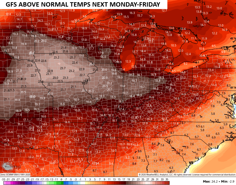
This system is followed by a MAJOR jump in temps as we head back into the 60s with another shot at 70 next week. Temps average MUCH above normal for the week…
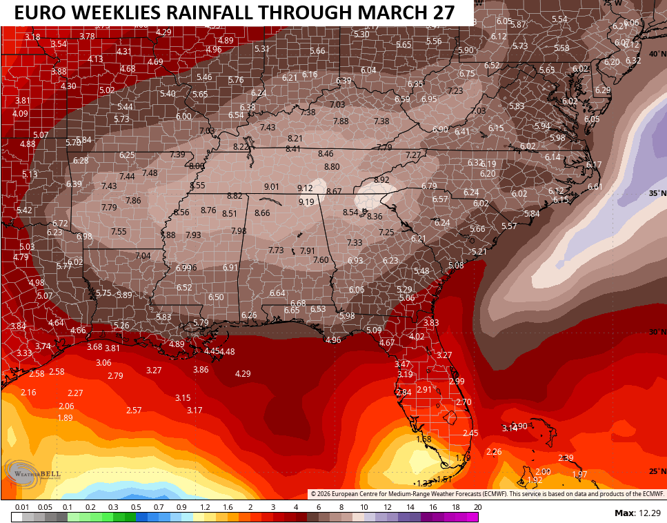
We can’t get to true spring before we get in on another spell of winter weather and, unfortunately, that’s getting pushed deeper into the start of spring. The latest EURO Weeklies go through March 27th, and they show a colder than normal setup for much of the country from the end of the month into March…
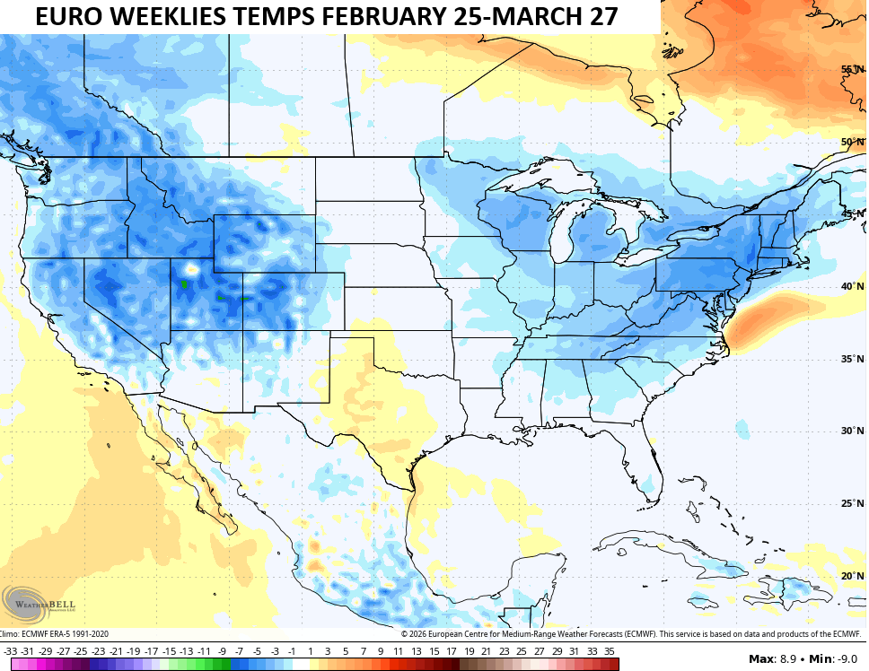
This likely comes with an active storm track across our region into the Tennessee Valley, delivering above normal rainfall through this time…
I do expect some of that to be in snow form with the increased potential for another winter storm threat. No, that doesn’t make me happy as I’m fully on board with #TeamSpring.
Another update or two comes your way later today. I’ll also have updates on my Meteorologist Chris Bailey Facebook Page
Until then, here are your tracking tools for the day…


Make it a wonderful Wednesday and take care.

As usual, the EURO weeklies will fail.
Jeff, The EURO Weeklies Is Just A Guild, That Could Result. Not A Direct Forecast.
Thanks Chris. Since We Don’t Have Any Storms To Track, Here’s A Very Interesting Article, That May Change This Long – On Going, Boring Weather Pattern We Have Been In Since 2015 : )
https://climateimpactcompany.com/february-2026-enso-outlook-first-summertime-el-nino-since-2015-in-2026-maybe-2-2/
Adding To The Above : ) If The PDO ( Pacific Decadal Oscillation ) Doesn’t Phase To The Positive, The Next El Nino Event Will be Very Weak, And Will Not Totally React With The Atmosphere. In The 2015 El Nino Event, The PDO Was Positive, Which Resulted In A Colder, Snowier Winter.
Chris, I’m Not Ready For TEAM / SPRING Just Yet. I’ll Wait Till The Last Day In March.