Good evening, everyone. We continue to work with near normal temperatures over the next few days before a big weekend storm system brings some rain in here. That’s followed by a full-blown spring fever alert.
With temps hitting the 20s tonight and early Thursday, watch for black ice for the trip into work and school.
The system rumbling in this weekend comes from a low tracking to our south. Normally, one would expect some winter weather with this, but we don’t have a cold high to the north, so it’s all rain.
The best chance for rain shows up late Saturday into Sunday…
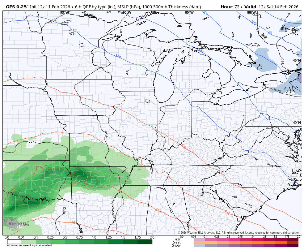
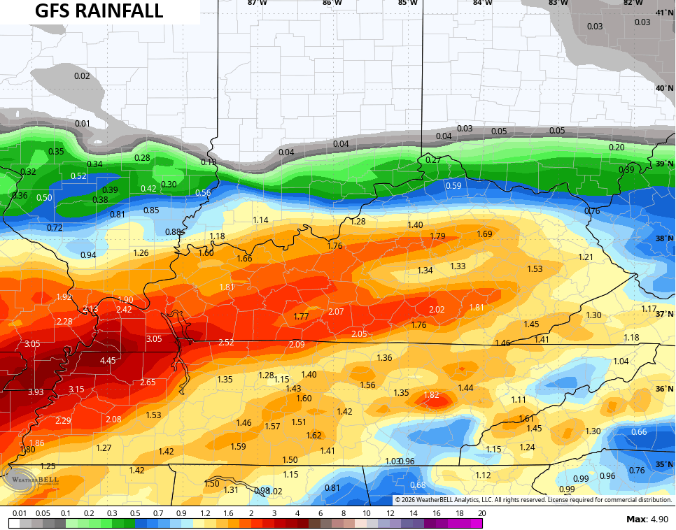
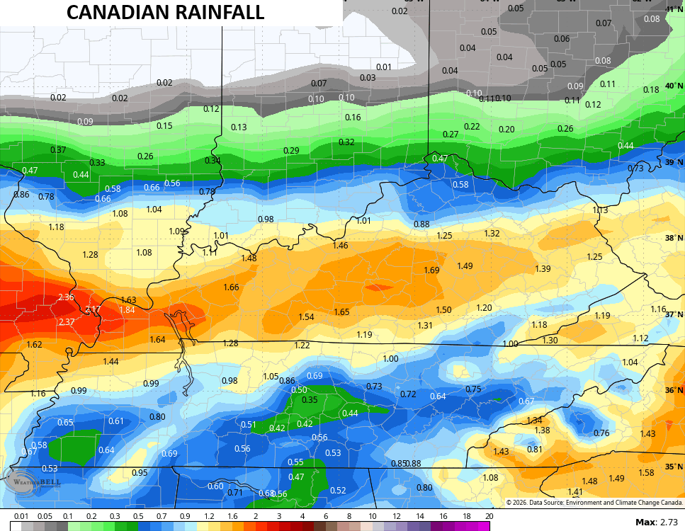
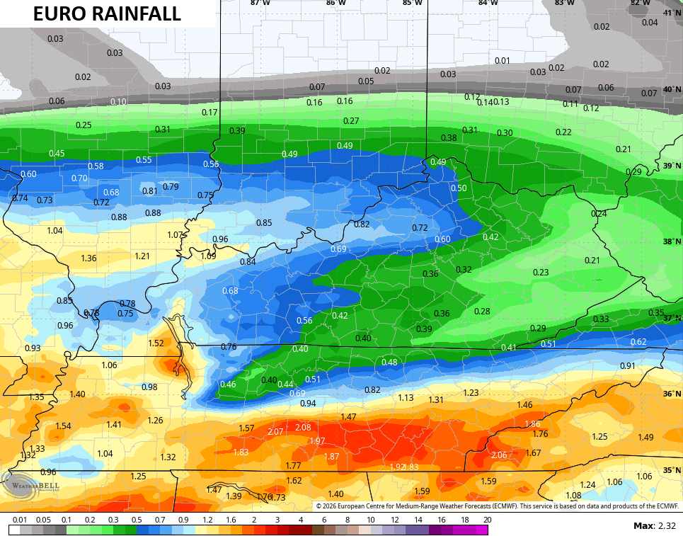
Locally heavy rains are a good bet with the greatest chance across the southern half of the state. The models are seeing the potential for a swath of 1″+ rains during this time…
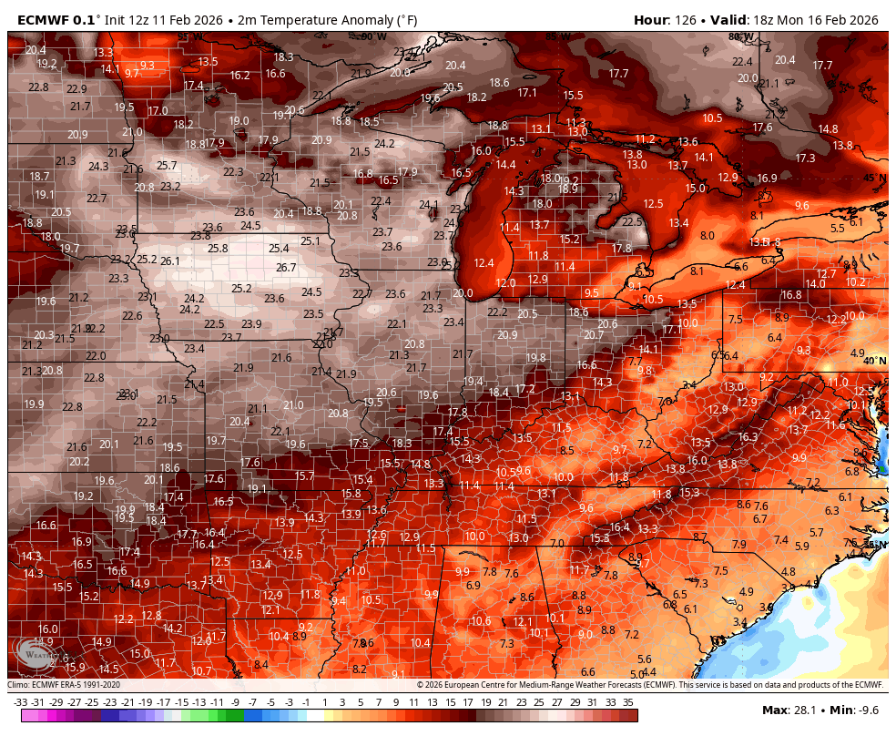
This is followed up by a prolonged surge of above normal temps. This animation goes all the way into the closing days of February…
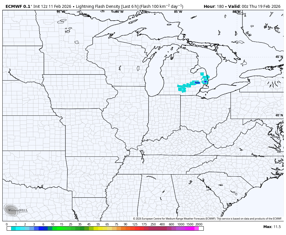
That setup may also bring some pretty good thunderstorm chances in here. Check out the lightning forecast from the EURO during this time…
Have a great evening and take care.
