Good Thursday, everyone. Our pattern remains fairly calm for the next few days but it turns wet this weekend as a storm system rolls in. This is part of a rather March-like setup that is settling in for the remainder of February.
Watch for black ice out there this morning as temps are in the 20s for many areas. Highs this afternoon hit the 40s for most of the state with some clouds and sun. There’s the slightest chance for a light shower in the west and south central part of the state.
Friday looks good with temps hitting 50 or better for most of Kentucky. Clouds will increase later in the day ahead of that weekend storm system. Low pressure rolls from Texas to the Carolinas Valentine’s Day into Sunday. A track like that normally brings winter weather to Kentucky, but there’s no cold air to the north of it, so you get rain.
Here’s the setup from Saturday morning through Monday morning…
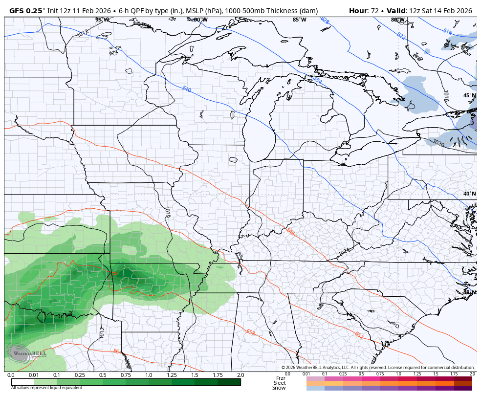
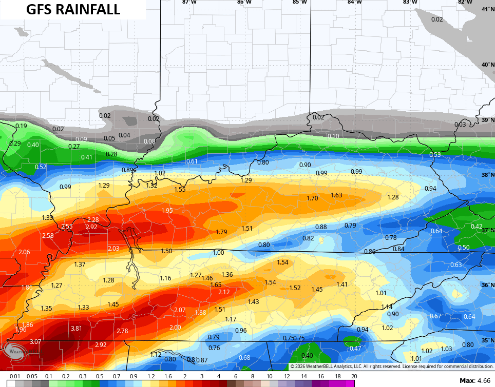
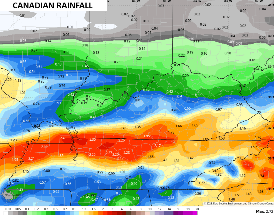
Locally heavy rains are a good bet, especially across the southern half of the state…
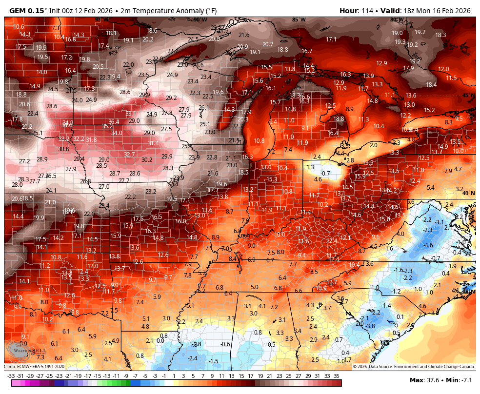
That big case of spring fever breaks out behind that for next week. It’s false spring, but I’ll take whatever spring I can get this time of year. Look at those above normal temps…
Old Man Winter puts up a bit of a fight starting next weekend and that takes us into March.
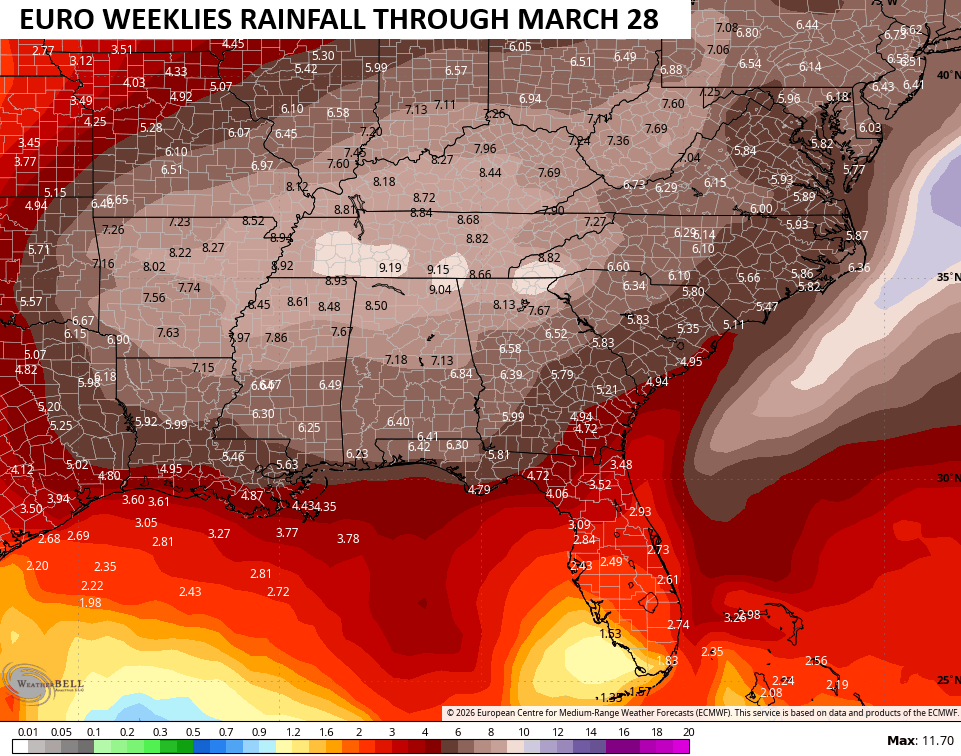
The pattern continues to look very active through March as the EURO Weeklies keep the bullseye
Another update comes your way later today. I’ll also have updates on my Meteorologist Chris Bailey Facebook Page
Until then, here are your tracking tools for the day…


Make it a terrific Tuesday and take care.

Rain > winter
Thanks Chris. Changes In The North Pacific Regions Would Explain The Long Term Of Mild Weather. A Change Back To What We Had Earlier ( Winter Weather ) Will Occur Before Spring Weather Is Here To Stay. On The Precipitation Side, We Are In A Very Dry Pattern, So I Hope The Predicted Rains Pan Out This Weekend.
Here comes the mud 🙁
Though the CPC now says there is a 60% chance for La Niña to ENSO-Neutral transition during Feb thru Apr, it appears that this transition has already begun. East to west trade wind velocities have weakened, and the sea surface temperature anomaly chart shows that warming in the eastern equatorial Pacific is well underway. Historically, when this transition occurs in the late winter to early spring timeframe, we see an uptick in severe weather, especially during the mid March to mid May timeframe.
https://www.ospo.noaa.gov/products/ocean/sst/anomaly/