Good evening, everyone. Another calm weather day is coming to an end as we gear up for a weekend rainmaker. That’s a system that would normally bring snow in here, but the pattern just does not have much cold air to work with.
Friday looks great with temps reaching the 50s with mostly sunny skies. Clouds will increase Friday night and Saturday as low pressure rolls from Texas to the Carolinas over the weekend. That means rains roll in from west to east late Saturday into Sunday…
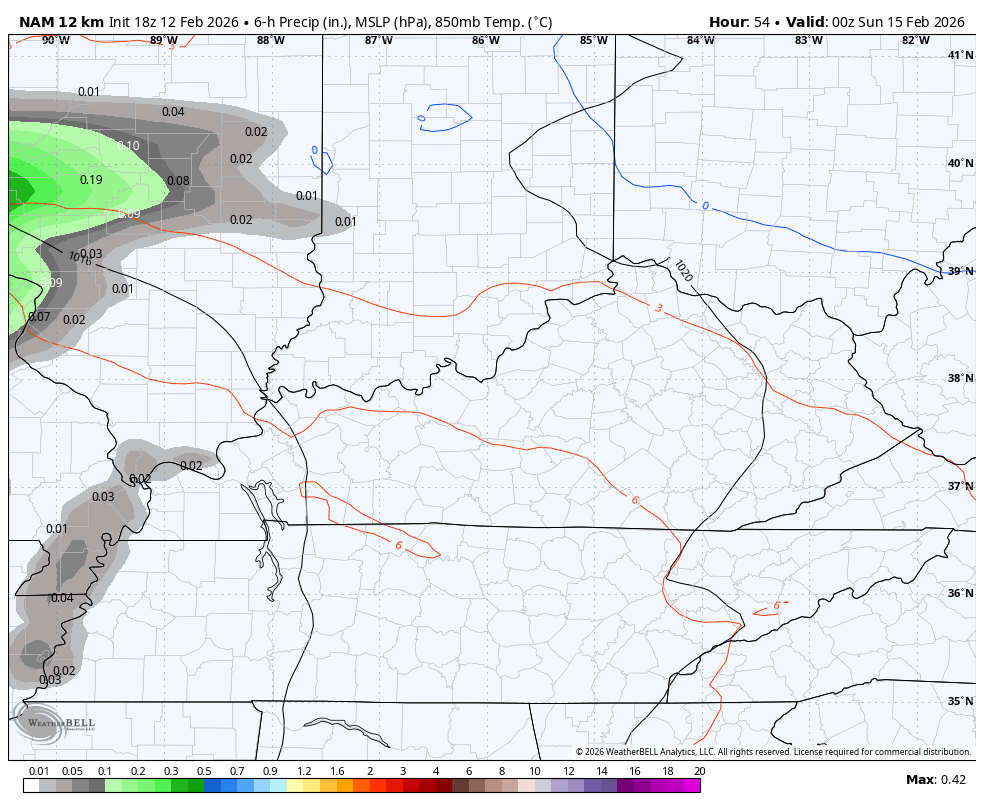
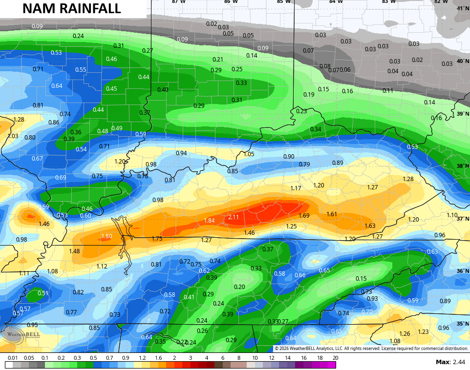
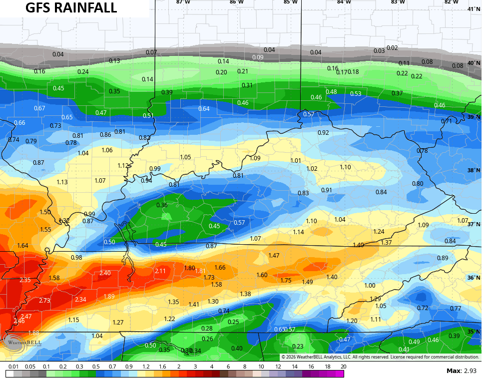
Some locally heavy rains are possible, especially across the south. The NAM is most amped up with 1″” totals…
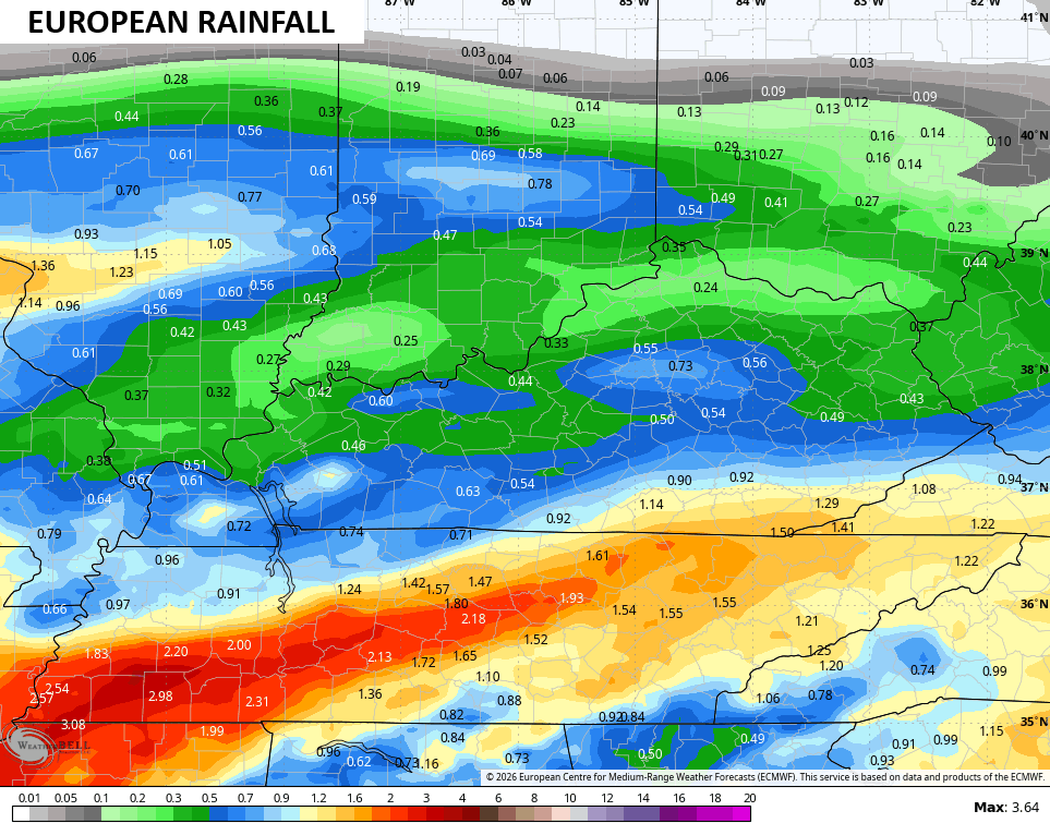
The Euro isn’t too far behind..
The Canadian is farther south…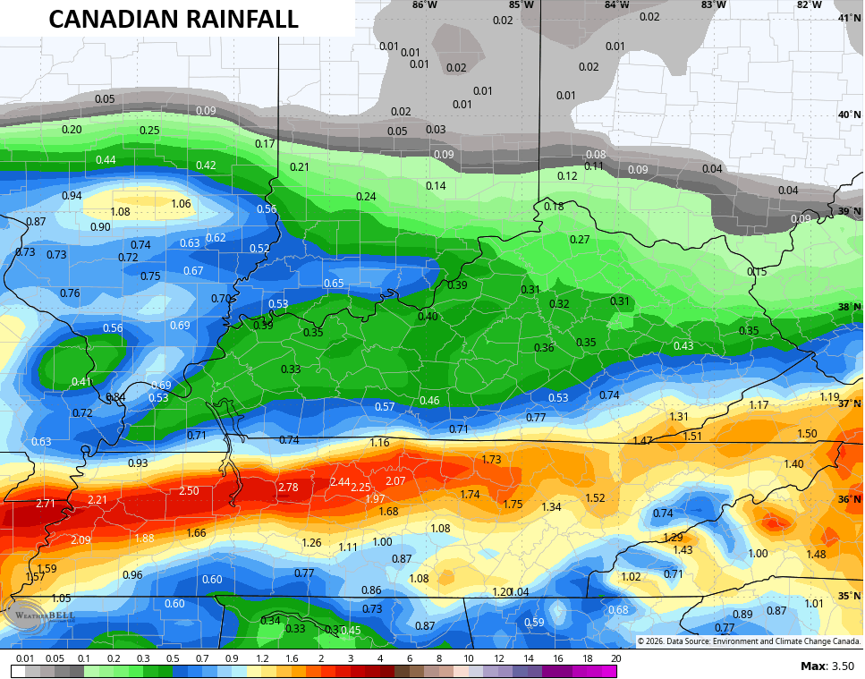
The GFS has a bit of a hole in the rains across the west…
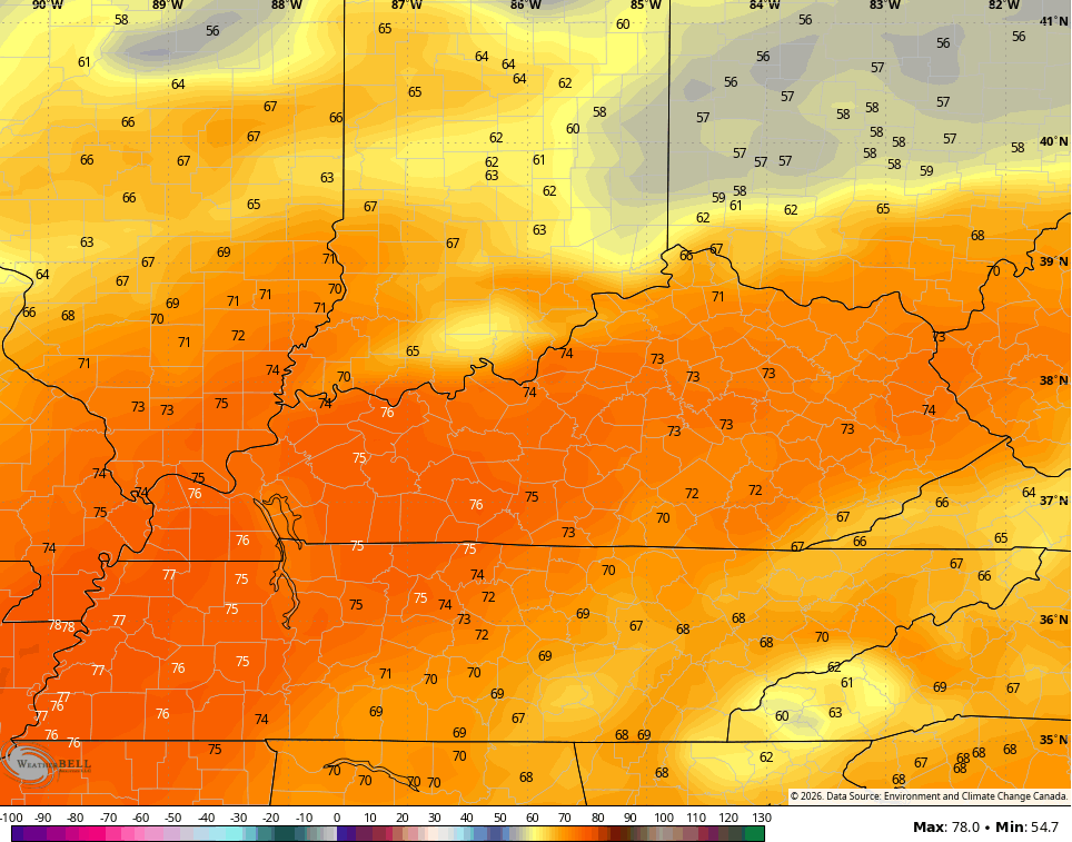
Once this moves out, get ready for a spring surge for most of next week. Temps can easily hit 70 on a day or two and the models are showing this potential…
Enjoy the evening and take care.
