Good Sunday, everyone. Your friendly weatherdude literally just landed back in Lexington around the midnight hour with just enough time to get this post together. I’ll give you guys a quick update then I’ll post a bigger one later today.
Rain. It’s wet out there today with locally heavy downpours showing up with temps generally in the 40s for highs. The rains taper off from west to east this afternoon and evening as our low pressure pulls away.
Behind this low comes a blast of March-like air for the week ahead. Highs routinely hit the 60s with a good shot at a 70 by Thursday or Friday as a strong southwest wind kicks in. This is ahead of a front moving in here late in the week into the start of the weekend.
This has the chance to touch off some strong thunderstorms along and ahead of it with colder air pressing in behind it. This takes on more of a typical look and feel for late February but how we get there exactly is a work in progress.
Here’s the GFS from Thursday through early the following week…
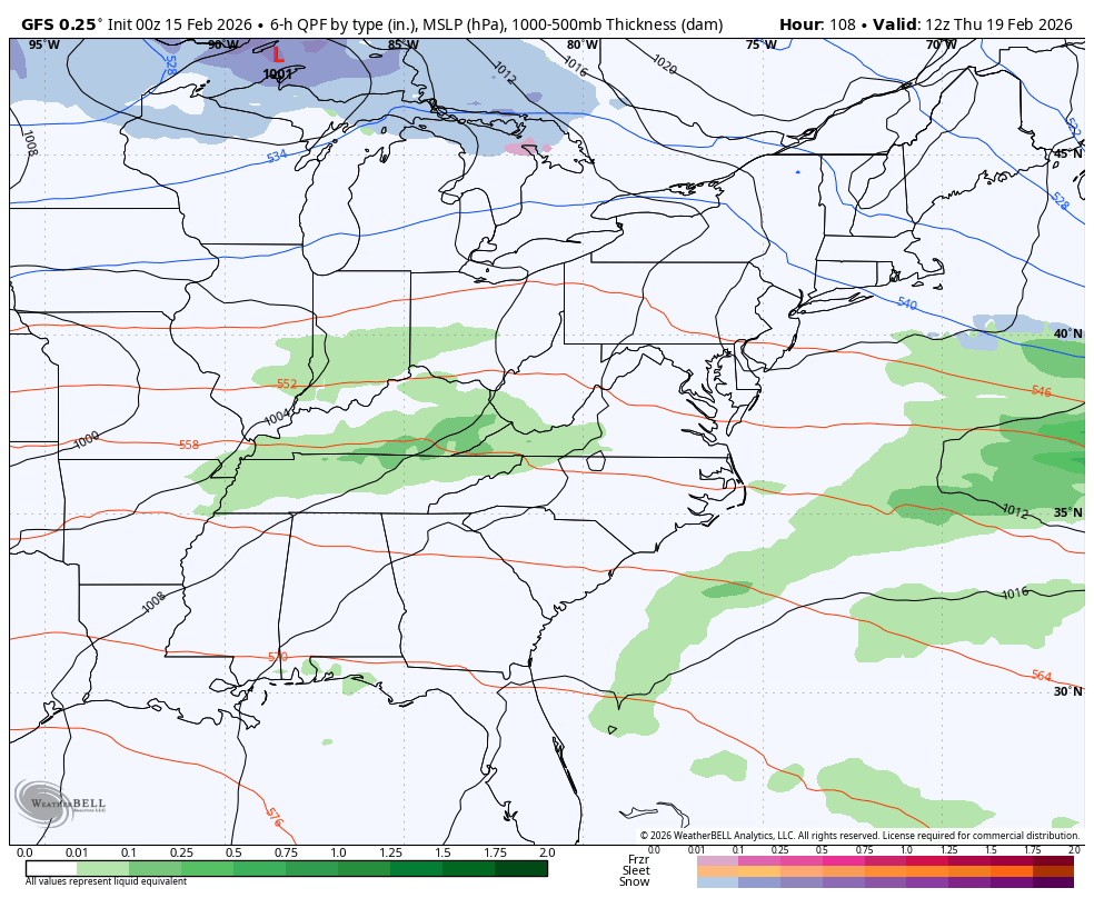
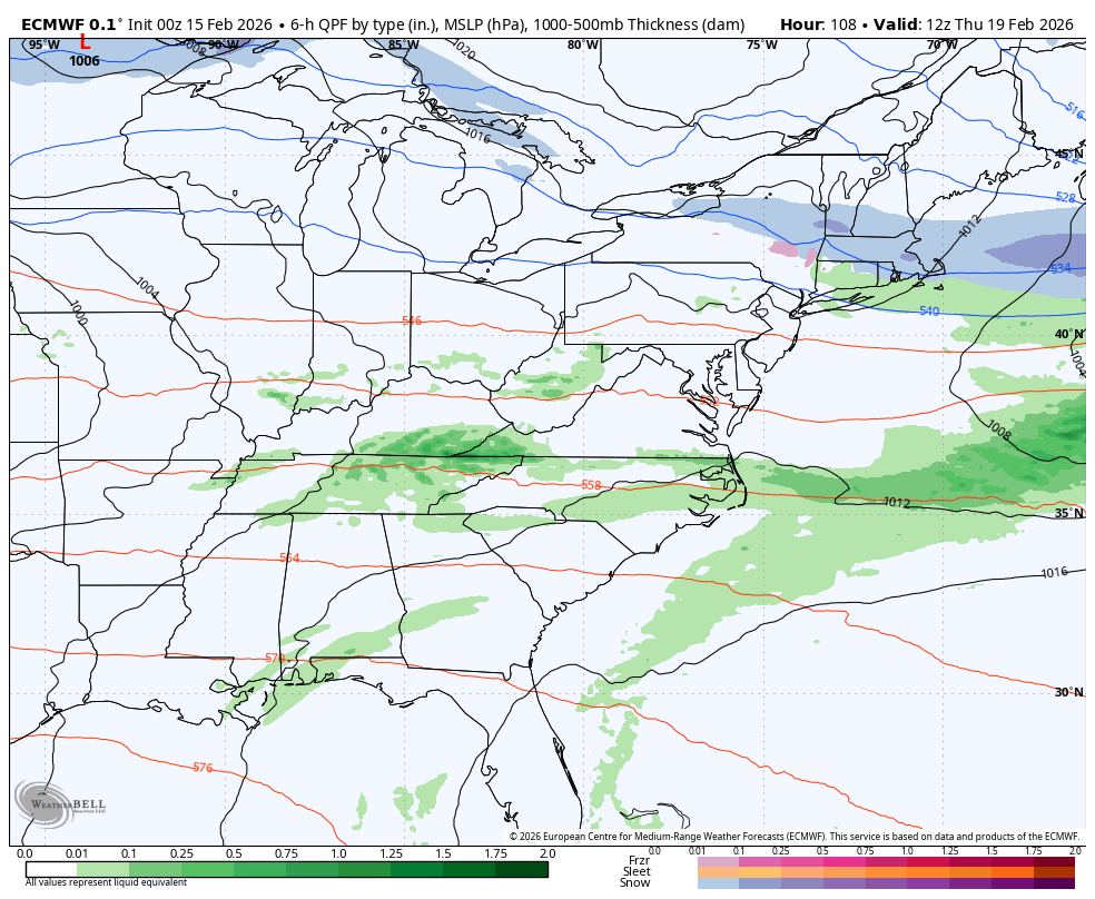
You can see the GFS is active with two more systems following the late week front. The EURO is hinting at this, too…
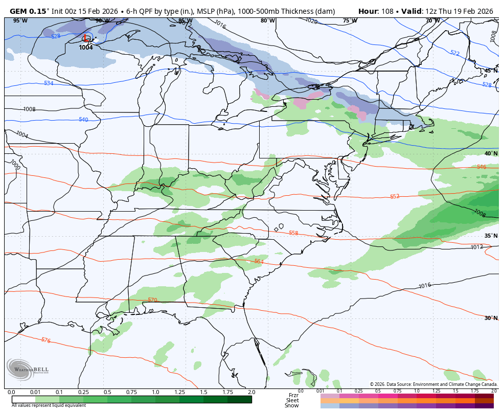
The Canadian Model says that first front brings full-blown arctic air back into the eastern half of the country…
Watch how the model takes us from frying pan colors back to Barney in just a few days…
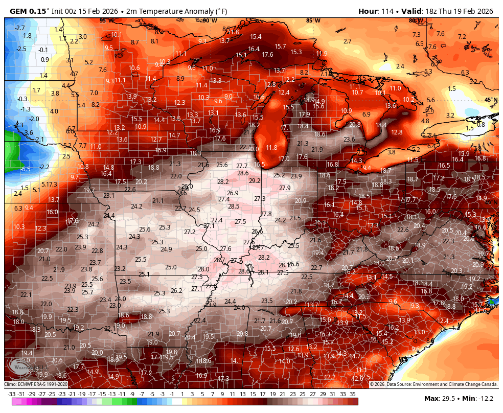
As I look at this pattern through the end of the month, I can easily see wild swings like that taking place. You may even get seasick from all the back and forth.
Another update or two comes later today. I will also have updates on my Meteorologist Chris Bailey Facebook Page
Until then, here are your tracking tools for the day…


Make it a great Sunday and take care.
