Good Monday, everyone. On this Presidents Day, we are looking ahead to a mild week of February weather that may end with some strong storms. That threat is ahead of a push of winter temps surging in later in the weekend and early next week.
Dense fog is out there to start the day and will be very slow to burn away for some. Areas with the lingering fog will only reach the low 50s while areas seeing more sun hit 60.
Temps for Tuesday and Wednesday will generally reach the 60s with a mix of sun and clouds.
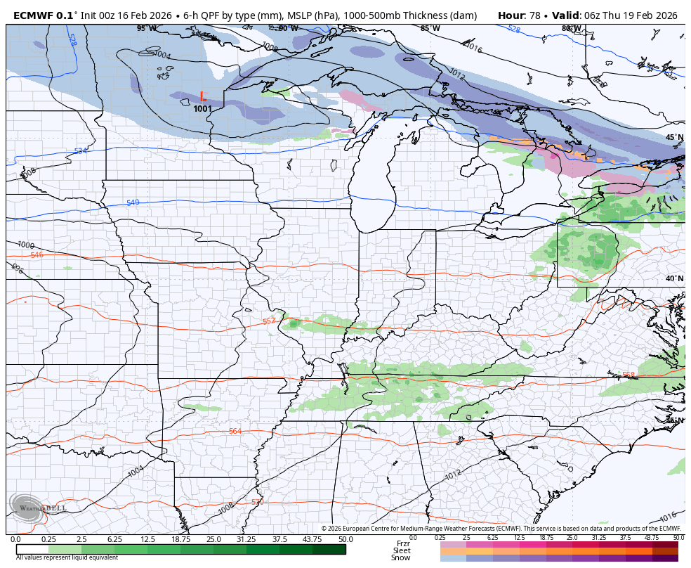
The chance is there for a shower or storm to go up at some point Wednesday with a much greater risk for showers and storms showing up later Thursday and Friday. The setup for this features low pressure developing in the Midwest and rolling toward the Great Lakes. The area south and southeast of the track of the low will be in a moderately unstable atmosphere.
The potential for a few rounds of strong to severe storms is there Thursday and Thursday night across Kentucky and parts of the Ohio Valley. You can see these storms firing up on the EURO…
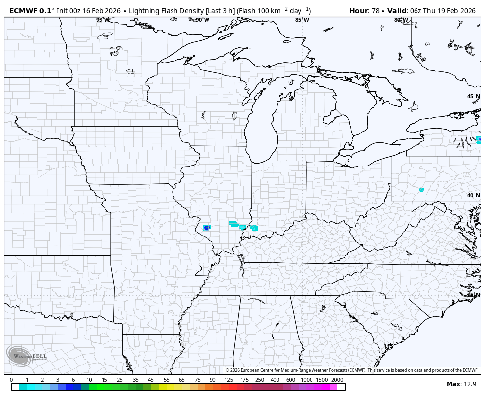
With a little bit of shear showing up, the chance is there for a tornado or two to spin up.
Here’s the lightning from the EURO during this same time…
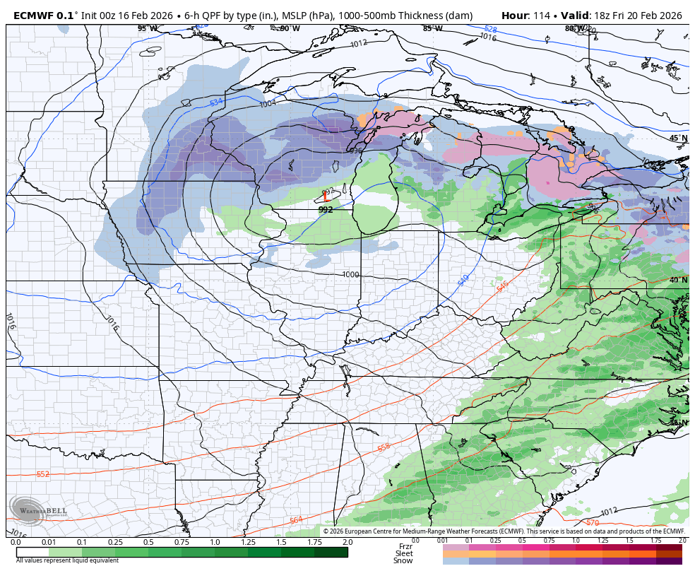
The front with this slows down on top of us Friday into Saturday, allowing for another low pressure to develop along it. This looks to roll through here with the potential for heavy rain. The opportunity for this to end as some snow is there as cold air crashes in behind it.
The GFS is the most bullish on the winter potential…

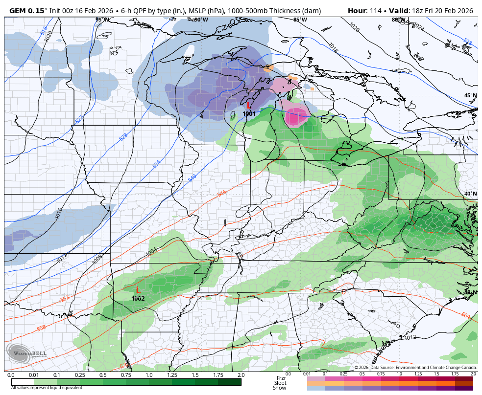
The Canadian sees the cold and some flakes…
The EURO doesn’t have the second system and is most progressive with the whole setup…
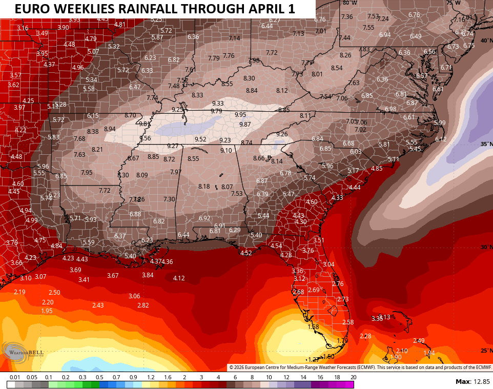
The EURO Weeklies now take us all the way to the first day of April and continue to look very active in our region. The bullseye of heaviest rainfall is right on top of our region…
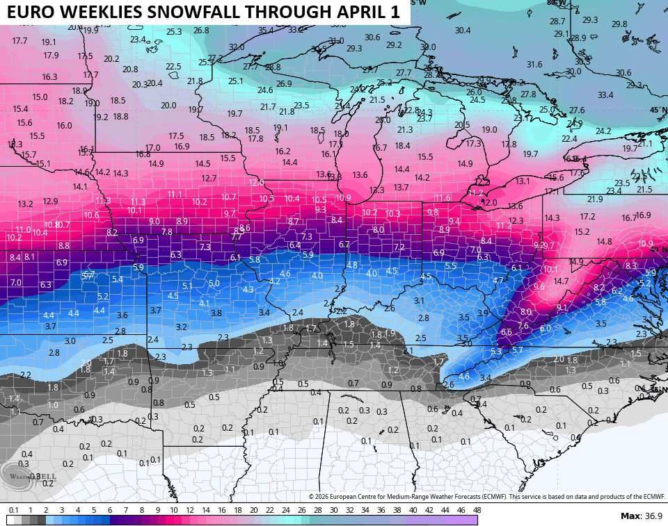
The weeklies are also showing a decrease in the winter weather potential, but still suggest we have to be on guard for a storm system that can put our region on the snow side of the track…
Another update or two comes later today. I will also have updates on my Meteorologist Chris Bailey Facebook Page
Have a magnificent Monday and take care.

I’m not convinced that we remain above normal for rainfall.
Thanks Chris. I Always Dread The Changing Weather Patterns. Already, Tornado Potential Is Mentioned In Your Discussion, And It’s Only The 16th Of February. I Was Hoping For More Winter Weather Through At Lease Mid – March. One More Major Snowstorm Before We Head Into What May Be A Very Stormy Spring. I Can Recall The Tornado Outbreak We Had In The Spring 1974.
https://en.wikipedia.org/wiki/1974_Super_Outbreak
April 3 1974 in west ky we fortunately missed the tornadoes. But in Princeton we had a devastating hail storm with the stones as big as grapefruit. Dad saved a few in the freezer to prove it happened. He said afterwards the ground was pitted….and several windows were busted out of our trailer. I barely remember it as I was only 3.
Brandenburg Ky wasn’t so fortunate. They were hit with an F5 tornado-the states only F5. They lost 31 people. They are about 45 minutes southwest of Louisville which was hit by an F4.
It Was Terrible Russell. I Was In College At That Time, Murray State University. The Skies Glowed An Erie Green, But the Town Of Murray, Ky. Was Not In The Impacts From Tornado Touch Downs, Which There Was Many. A Young Lady From Brandenburg, Ky. Who Was A Student At The Time, Lost Her Parents, And I Had To Hear That With Her. Very Very Sad.
Oh Wow Schroeder small world and so sad.