Good evening, everyone. We’re putting the wraps on a mild weather day across Kentucky as we turn our attention toward another wild weather ride later this week into the weekend. The throws strong storms and snowflakes at us during this time.
A quick-hitting band of showers and rumbles of thunder will be with us early Wednesday. Outside of this action, temps hit the 60s.
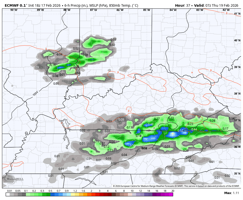
The threat for strong to severe storms continues Thursday and Thursday night with the greatest risk across the north and west. This is where the Storm Prediction Center has the Slight Risk for severe weather…

Large hail and pockets of wind damage may be the primary players around here. There’s still a low-end risk for a tornado or two to spin up, but the greatest risk looks to be to our northwest.
The EURO is increasing the chance for thunderstorms and locally heavy rains. Here’s the latest run from that model from Thursday morning through Friday morning…
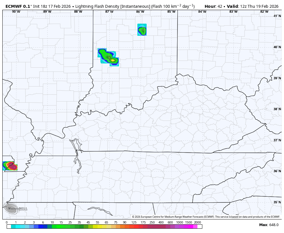
Here’s the lightning tracker from that same run…
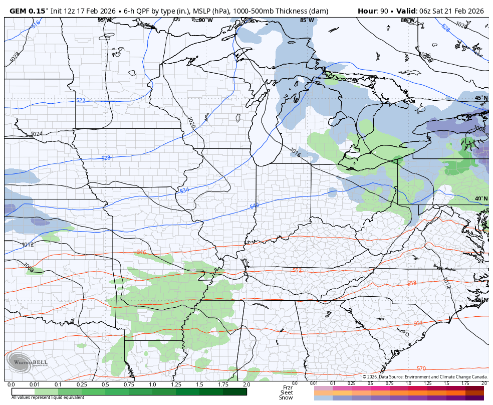
I still expect low pressure to develop and move across the southern Appalachian Mountains and into the Mid-Atlantic States this weekend. That brings some rain to snow with the potential for some pretty healthy snow showers behind it Sunday and Monday.
I like what the Canadian models are doing with this…
Canadian
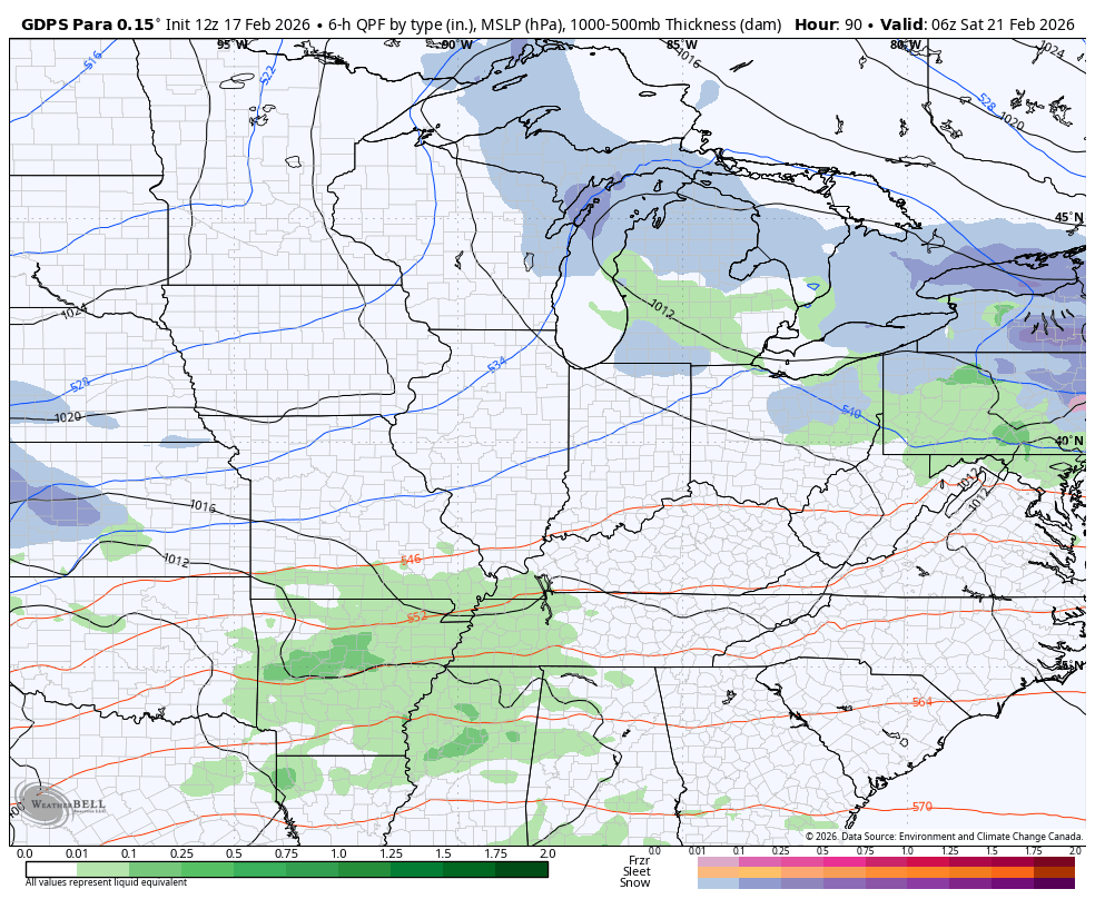
Parallel Canadian…
There’s a legit chance to put some snow on the ground Sunday and Monday.
The full update comes your way later tonight. I will have updates on my Meteorologist Chris Bailey Facebook Page
Until then, here are your tracking tools for the day…


Make it a great terrific Tuesday and take care.
