Good evening, everyone. The potential for severe weather is still there for Thursday and Thursday night with a change to winter later in the weekend. That’s with a pattern looking colder as we get closer to the arrival time.
A few showers and storms develop later tonight and early Thursday with a greater chance for scattered storms during the afternoon and evening. It’s once into the afternoon and evening when the best chance for a few strong to severe storms show up.
That’s ahead of low pressure rolling to our north, dragging a cold front into Kentucky Friday morning. That has a broken line of showers and storms along and ahead of it.
The latest future radar from the RRFS shows all this well…
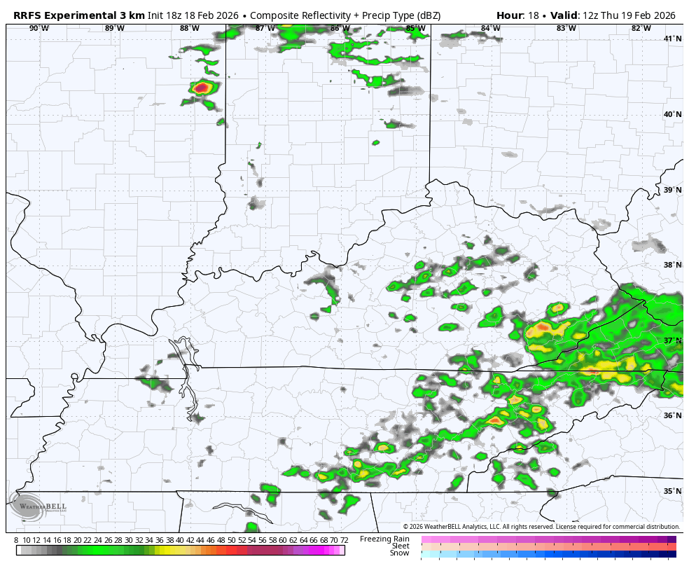
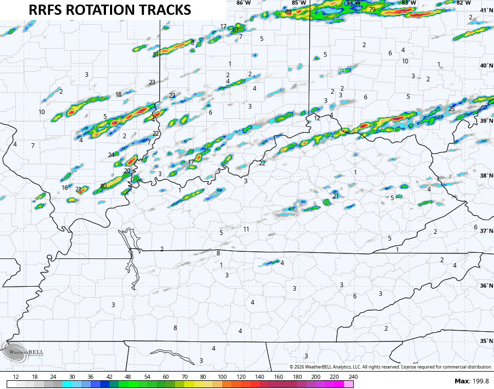
This particular model run is the farthest south with the severe threat, bringing a few rotating storms across Kentucky…
The Storm Prediction Center continues to have a Marginal Risk to Slight Risk out…

The tornado threat is greatest to our northwest…

Areas of damaging winds have a better chance to show up in Kentucky…

Some of these storms may end up producing large hail, especially across the north…

The full update comes your way tonight. I will have updates on my Meteorologist Chris Bailey Facebook Page
Until then, here are your tracking tools for the day…


Make it a wonderful Wednesday evening and take care.
