Good Thursday, everybody. A few strong to severe storms show up across the Commonwealth today as our spring preview of a pattern comes to a booming end. This will be followed up by a big change to winter over the weekend and it’s one that may put a little snow on the ground for some.
Here are a few things to know about today’s weather:
- Scattered showers and a few storms are with us this morning, especially across the southern half of the state.
- As these move on, partly sunny skies break out with temps heading toward 70 or better for many.
- Watch for a couple of storms to go up mid to late afternoon across the west and north.
- This is the area to watch for a few severe storms. The threat is lower in the south and east.
- Any storm that cranks can have damaging winds and large hail.
- There’s enough shear available to get a few storms to spin, giving us the low-end tornado risk.
- The tornado risk would increase for any supercell thunderstorm interacting with the warm front.
- The best chance for severe weather is across north central and northwestern parts of the state.
- The bullseye for the worst of the weather is likely to set up just north of the Ohio River into southwestern Ohio, Indiana and Illinois.
The latest Severe Weather Outlook from the Storm Prediction Center follows along with my overall thinking…

The individual severe weather threats from the SPC look like this…


The showers and storms end quickly late tonight and Friday morning as cooler and drier winds blow in for Friday.
A weak system can bring a rain or snow shower in here Friday night and early Saturday with a better chance for rain and some flake action Saturday night and early Sunday as low pressure wraps up to our southeast.
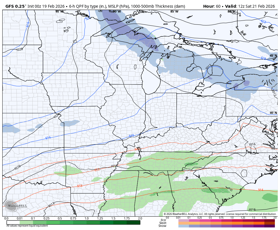
Strong northwest winds will then bring in some very cold air with snow showers and flurries Sunday and Monday. There’s even the chance for some light accumulations in the central and east. Here’s how the Canadian sees it all…
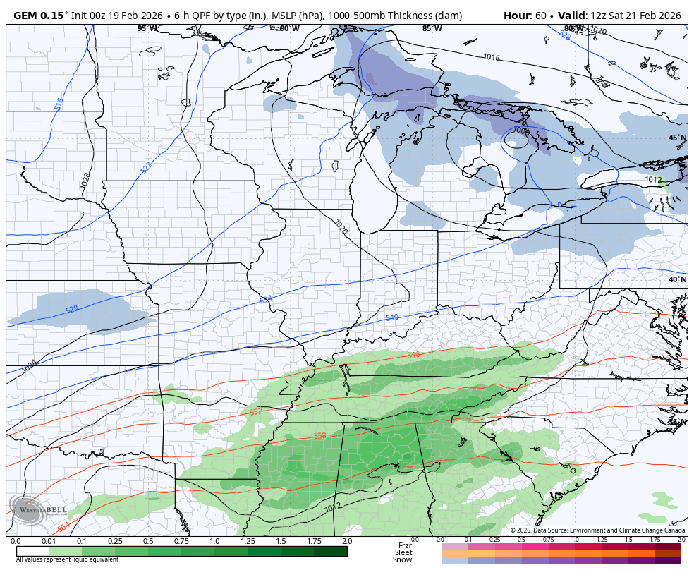
And the GFS…
I will have updates as needed throughout the day. Until then, here are all the storm tracking tools you need to start the week…


Current watches

Possible Watch Areas

Make it a great day and take care.

It will get cold again sure, but otherwise no big deal.
Also Jeff, A Snow Shower Would Be Welcome, With The Coming Cold. Reminds Everyone, That It’s Still Winter.
Thanks Chris. If The Cool To Cold Nights Just Last Till Mid – March, We May Not Have Any Plant Damage From Late Freezes. Hoping That No One Receives Any Tornadoes During Today’s Bout Of Severe Weather.
Tornado Watch Out For Many Kentucky Counties : )
https://forecast.weather.gov/showsigwx.php?warnzone=KYZ065&warncounty=KYC217&firewxzone=KYZ065&local_place1=Campbellsville%20KY&product1=Tornado+Watch&lat=37.3475&lon=-85.3491