Good Monday, everyone. It’s the last week of February and we are kicking things off with bitterly cold wind chills and some snow showers. This cold will ease in the coming days, but a very active setup looks to be unfolding to end the month and begin March.
Wind chills out there this morning are in the single digits in many areas as a strong northwest wind continues. Temps out there today stay in the 20s across much of central and eastern Kentucky with wind chills likely in the teens.
Snow showers and flurries will continue to fly, and these are creatin slick roads in some areas. This likely leads to a few cancellations and delays this morning, especially in te east and southeast.
That Winter Weather Advisory has a little more left in the tank in the southeast…

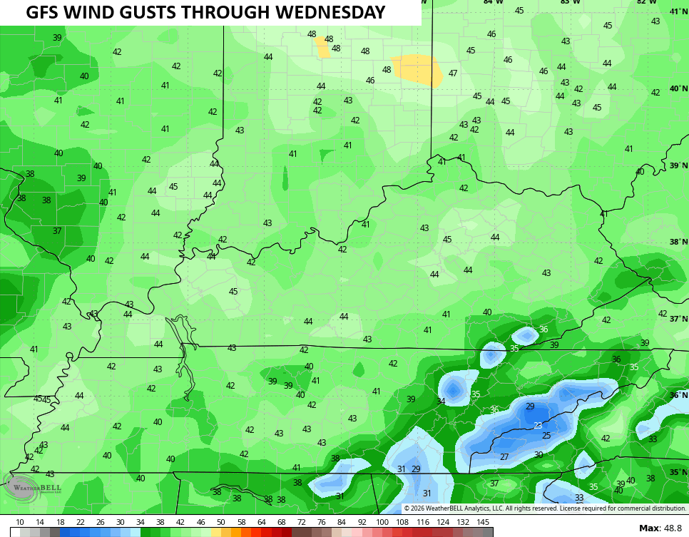
Temps rebound later Tuesday with another weak front possibly bringing a stray shower in here early Wednesday. This will have some very gusty winds with it and we may top 40mph at times…
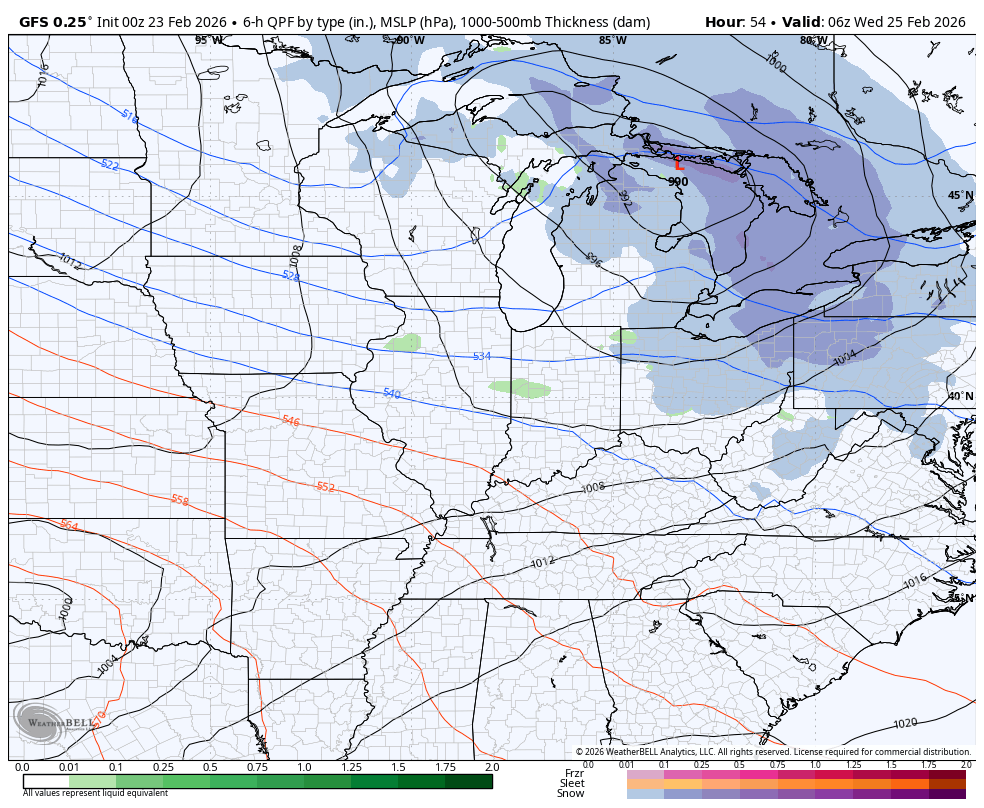
Milder winds develop later Wednesday ahead of another storm system moving in here on Thursday. This one takes a track right across Kentucky, meaning rain and some ugly…
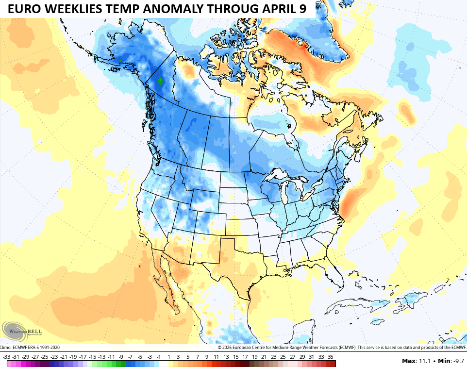
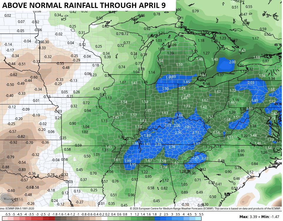
The latest EURO Weeklies continue to show a very active setup with an all too familiar temp pattern across North America. The Weeklies go through April 9 and show below normal temps from Alaska and the Yukon all the way into our region…
That sets our region up for the potential for early season spring floods as the Bullseye of the heaviest rains are on top of Kentucky and Tennessee…
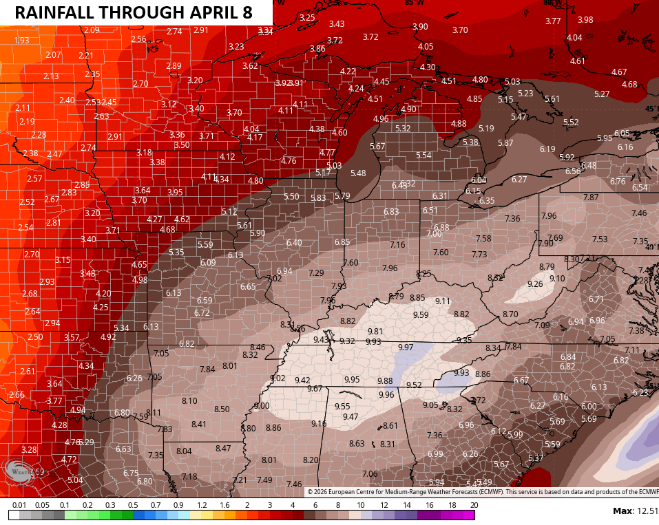
Those numbers are well above normal during this time period…
I still expect a storm system or two to threaten our region with a sizeable snow event in March.
Another update comes your way later today. I’ll also have updates on my Meteorologist Chris Bailey Facebook Page
Until then, here are your tracking tools for the day…


Make it a magnificent Monday and take care.

I think the models are deceiving you.
Wouldn’t surprise me if we have a snow event in March. Long over due and the way thin winter has been never know what mother nature will give us.
It’s too bad we (in Lexington) are right in between two weather radars so these light snows don’t show the snow in between, even tho it’s there. From my understanding, the further away you are from the radar, the lighter snows don’t show at all… Only heavy precip shows. it’s snowed more this morning than I thought and it’s still snowing… and nothing on radar.