Good evening, everyone. Snow showers and squalls continue to push across central and eastern Kentucky, causing slick roads into the overnight. As we look ahead, the pattern shows a lot of up and down pattern to end February and begin March.
Before we look ahead, let’s focus a bit on the snow showers and squalls out there this evening. It’s disappointing that the NWS in Jackson did not adjust the Winter Weather Advisory at all over the past few days. That Advisory needed to be for their entire forecast area, but they never changed it from the get-go and they continue with it into early this evening…

We had all kinds of road closures and school closings outside of the Advisory area. I expect more in the way of light accumulations and slick roads well outside of the Advisory again this evening into the wee hours of Tuesday.
Winds become a big player later Tuesday with gusts of 40mph or greater Tuesday night. That’s ahead of a weak front that can bring a shower in here by Wednesday morning. How much of a push this front gets will be the determining factor on the system coming in behind it Wednesday night and Thursday.
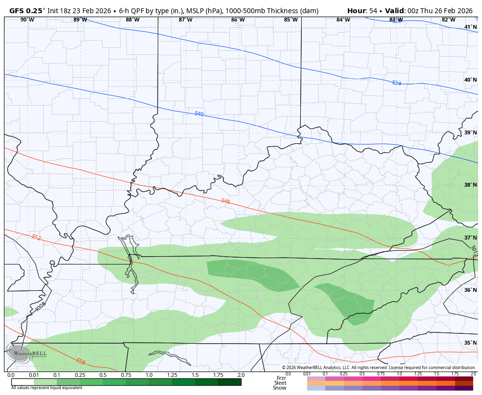
The GFS now brings this far enough south for rain and snow across Kentucky…
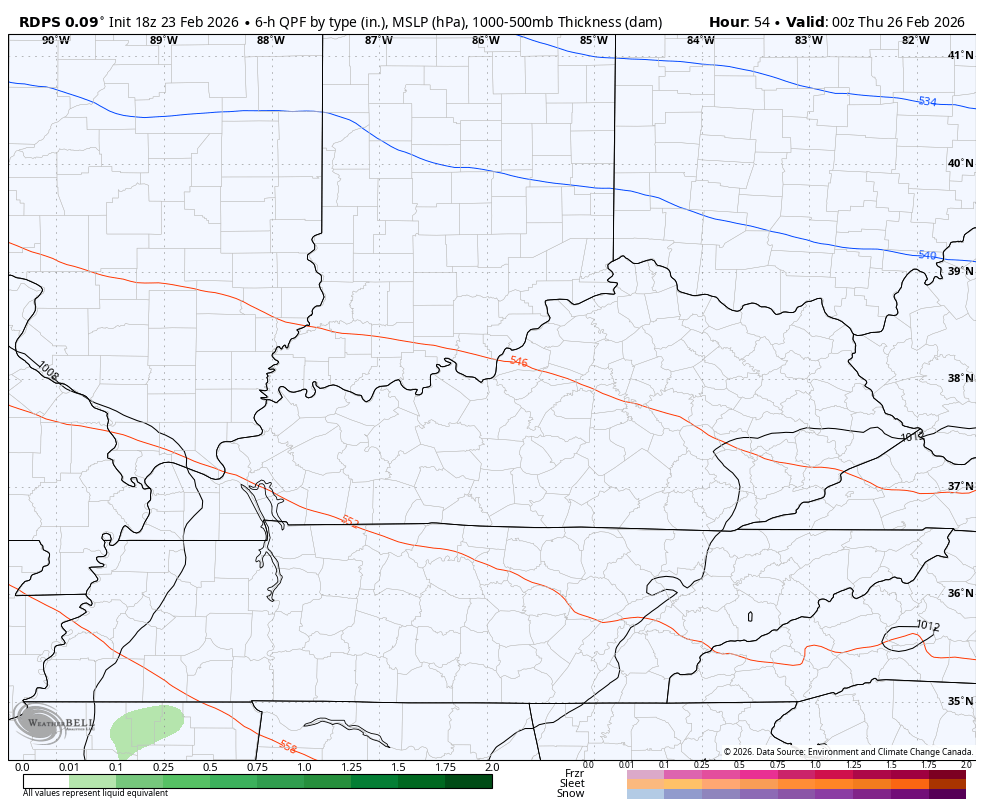
The Canadian family of models isn’t as far south…
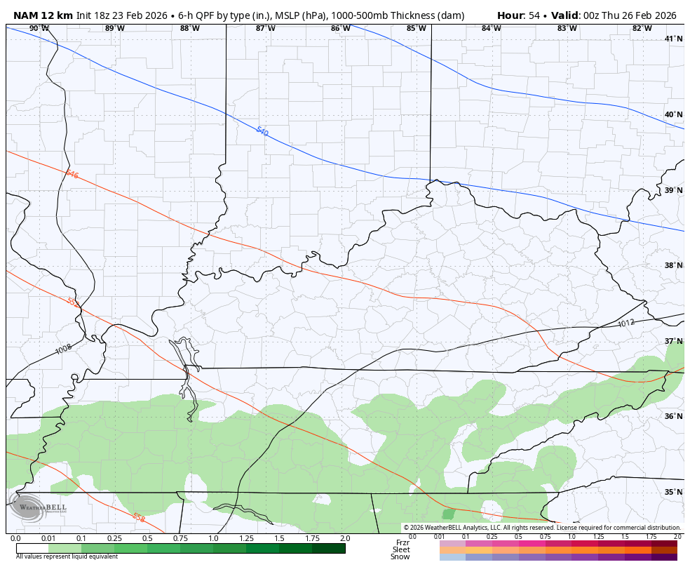
The NAM is north…
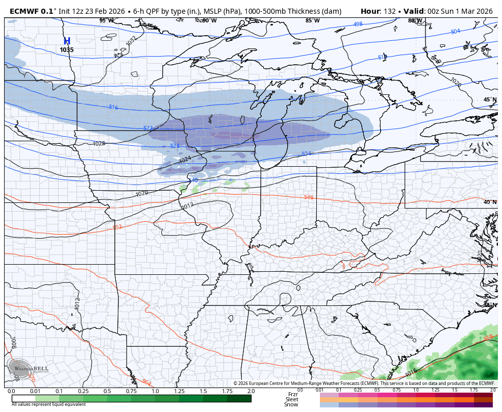
From there, we find our region in an active storm track with very cold air to the north and spring taking off to our south. Some big ups and downs are likely…
Another update comes your way later today. I’ll also have updates on my Meteorologist Chris Bailey Facebook Page
Until then, here are your tracking tools for the day…


Make it a great Monday evening and take care.
