Good Tuesday to one and all. We’re in the closing days of February, but the overall weather pattern is already in March mode. This back and forth setup looks to continue all the way into… March. The ups and downs come courtesy of a very active pattern.
Our day starts with bitterly cold wind chills and leftover snow showers across the east and southeast. Temps slowly recover to above freezing levels this afternoon with mid 30s in the north and mid 40s in the west and southwest.
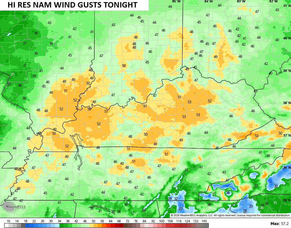
Winds are a major player this evening into tonight ahead of a weak cold front dropping in. 40mph wind gusts are a good bet in several areas with some of the models going above and beyond…
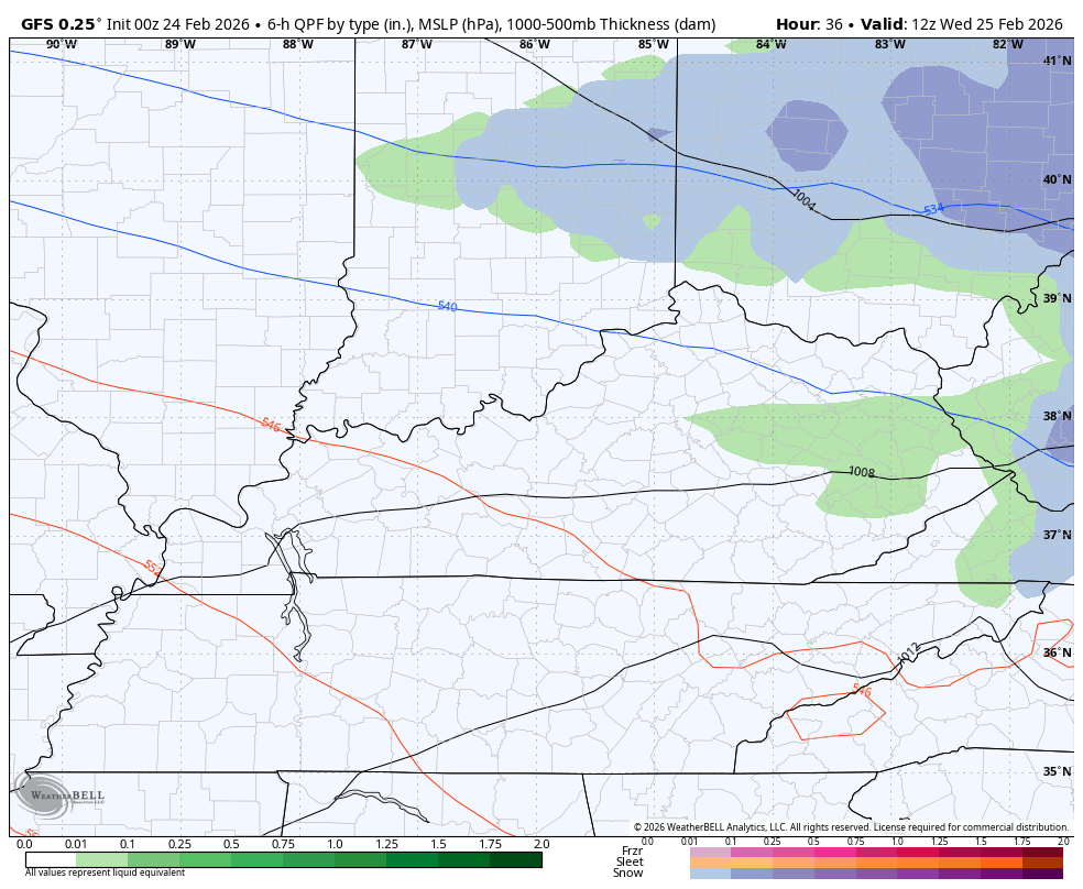
The front dropping in Tuesday night and Wednesday morning may have a band of showers along it. That front slows down with a wave of low pressure developing along it and rolling east, leading to a swath of rain with the chance for a little snow on the northern edge of this. The GFS has been leading the charge with this setup. This animation starts at 7am Wednesday and goes through 7am Friday…
Once that goes through, milder winds quickly kick in with highs in the 50s for Friday with the 60s surging in on a strong southwesterly wind for Saturday.
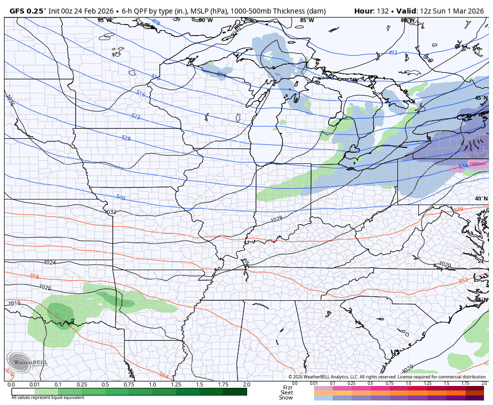
Another front drops in with falling temps on Sunday. That sets the stage for an active opening to March with several systems rolling through here next week…
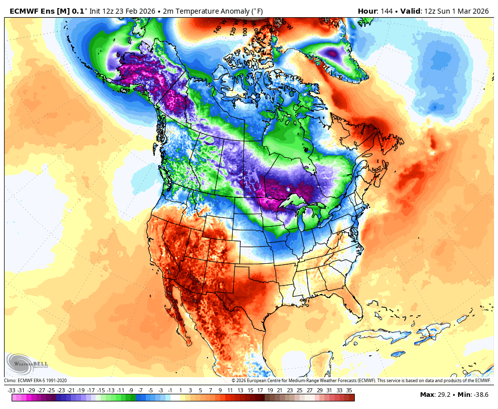
The EURO Ensembles show troughs moving through the east to start March with a big ridge following that…
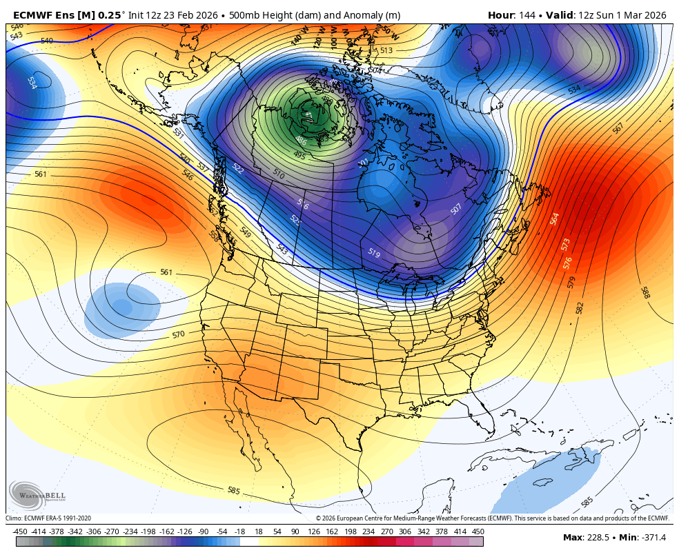
Watch those well below normal temps flip to much above normal…
This back and forth pattern should roll right through March, providing our region with a very active setup. This leads to the bullseye of heaviest rains right on top of our region…
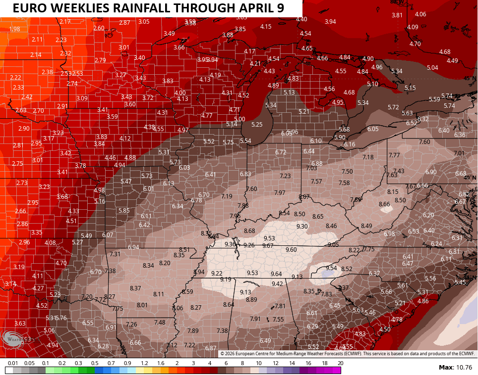
That’s the average rainfall from 101 members that make up the EURO Weeklies. If we just look at the single run of the weeklies, we find a much healthier rain signal…
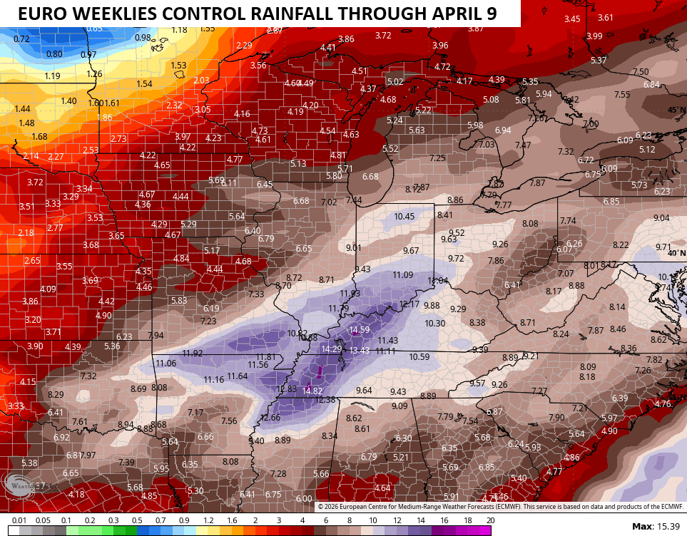
Ugh.
Another update comes your way later today. I’ll also have updates on my Meteorologist Chris Bailey Facebook Page
Until then, here are your tracking tools for the day…


Make it a terrific Tuesday and take care.

March coming in like a lion, huh? 😉
March Comes In Like A Lion, And Goes Out Like A Lamb. Never Seen This ” Old Saying ” Play Out.
https://climateimpactcompany.com/u-s-medium-range-forecast-overall-trend-is-warmer-u-s-2-2/
Just Found Out, That The PDO Will Continue It’s Negative Reign In March, Which Means That The Chances Of A Major Late Snowstorm State Wide Has Decrease, But Eastern And Southeastern Kentucky May Continue To Receive Those Accumulating Snow Squalls, Coming Off Lake Michigan. The Western And West / Central Areas Will Have To Wait Until We Phase Into ENSO / El Nino With A Positive PDO. Which May Never Happen For Next Fall And Winter. Bummer For Snow Lovers.