Good Wednesday to one and all. The closing days of February are upon us and we have the traditional back and forth temperatures you expect this time of year. As we enter March, the back and forth is likely to get us into some trouble with a very busy setup.
Let’s start with what’s going on out there today.
A front is sliding from north to south with a gusty band of showers. This settles into the south and slows down with some clearing across the northern half of the state. Temps areawide will jump into the 50-55 degree range during this time.
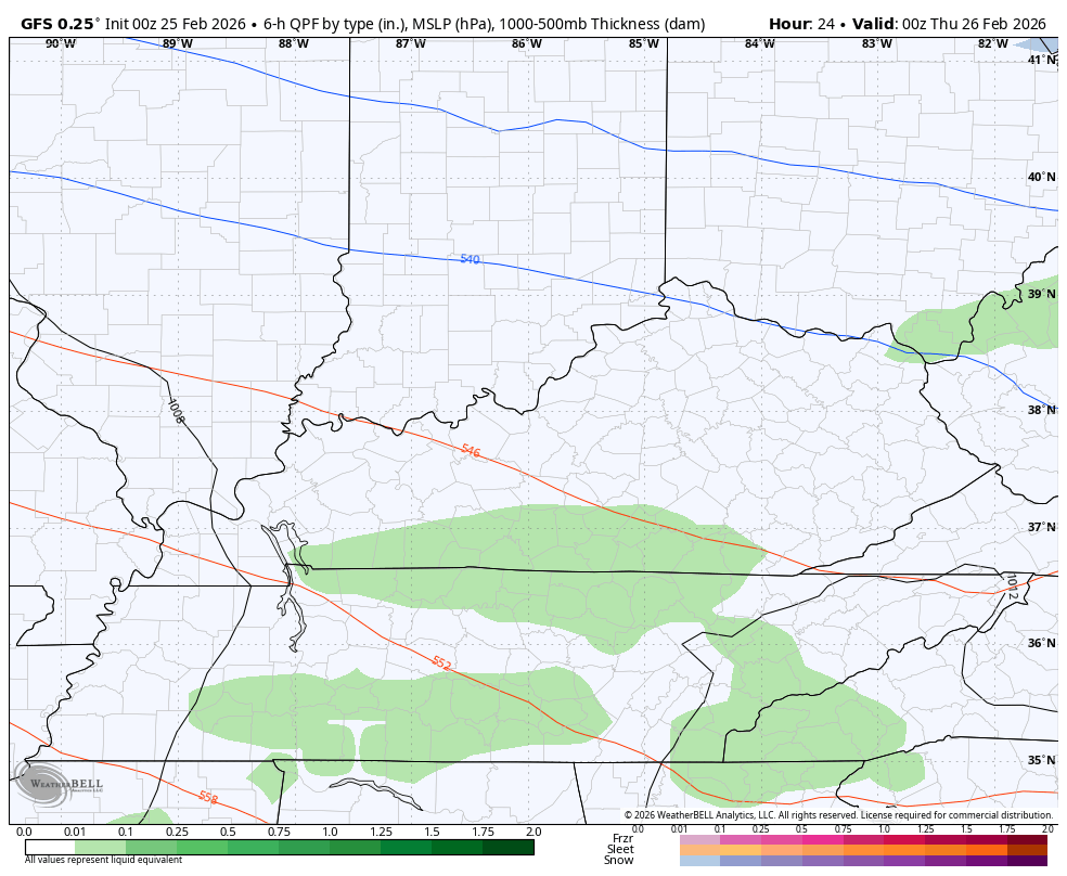
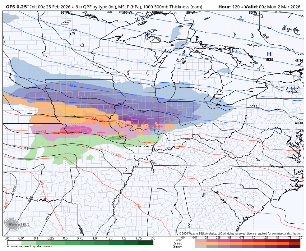
A wave of low pressure develops and zips eastward across this boundary tonight and Thursday morning. A band of rain and some rain/snow mix rolls eastward with it. Here’s the GFS…
The Short Range Canadian…
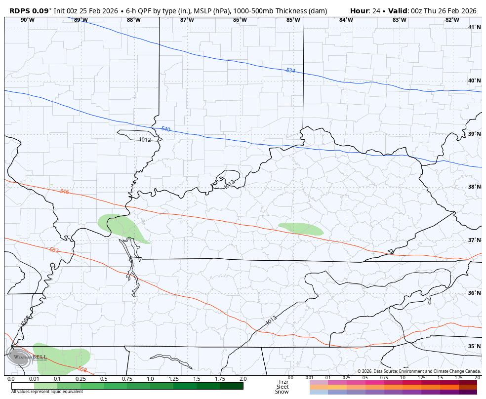
This has the chance to put down some slushy accumulations across the northern half of the state. For areas getting in on some accumulations, it goes away very quickly during the afternoon and evening as skies clear and temps jump.
This sets the stage for a mild wind kicking in for Sunday and Monday. Highs make a run at 60 degrees or better for Friday…
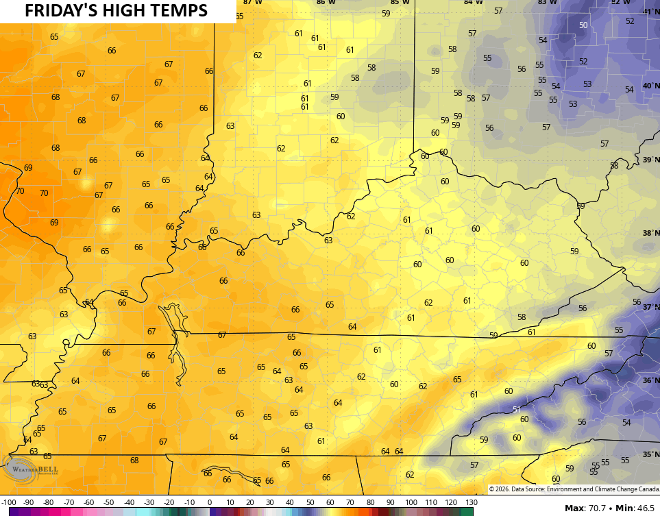
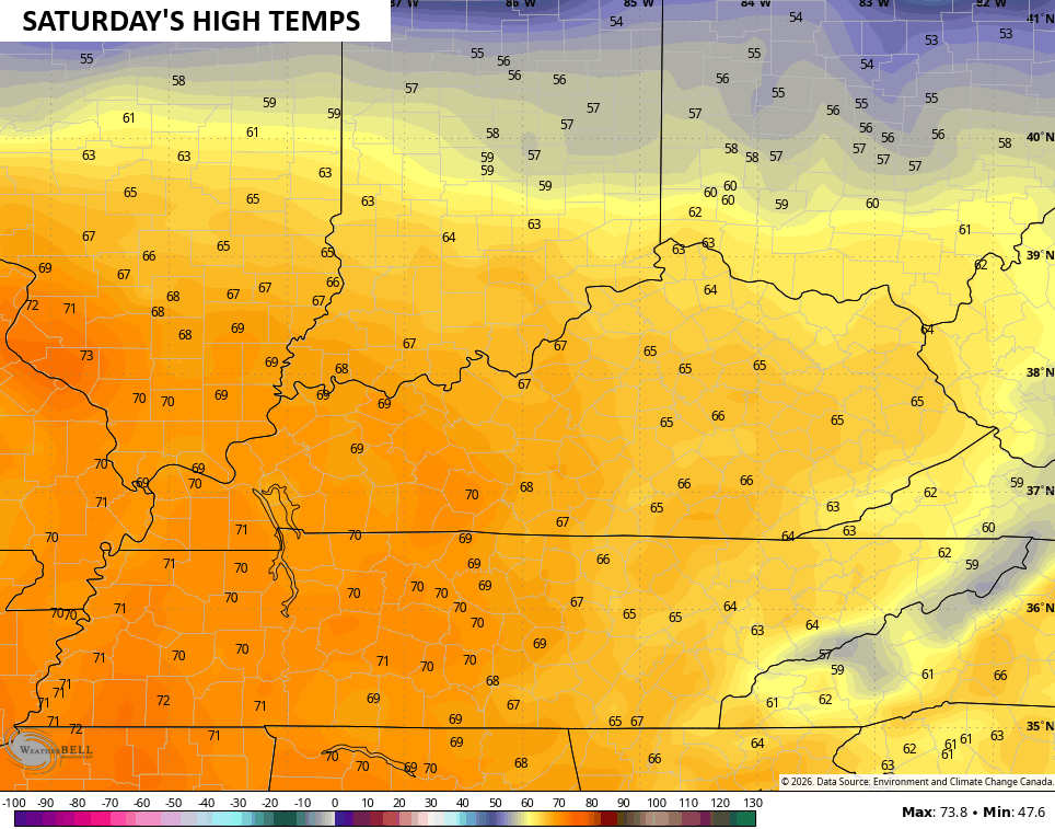
Low and middle 60s then show up for Saturday with locally higher numbers in the west…
A weak front then sags into the region on Sunday, dropping temps. This drops the numbers from north to south Sunday, likely setting us up with another stout north-south temperature gradient into Monday. That’s when another low pressure rolls eastward along it, bringing the potential for rain and, perhaps, some winter weather. That may have another system right on its heels for Tuesday as temps rebound. That sets us up for the potential for 70 degree temps later next week.
Here’s the GFS…
The setup just after that has the chance to be a severe weather producer.
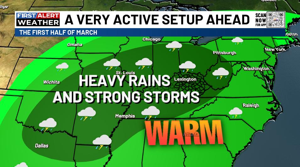
If you’re a regular reader, you know I’ve been really talking up the potential for a very active and wet setup to start spring. As I look deeper into this, the more amped up things are looking. If we just look at the first half of March, here’s what I’m expecting…
I’ll have the full update later tonight. I’ll also have updates on my Meteorologist Chris Bailey Facebook Page
Until then, here are your tracking tools for the day…


Make it a wonderful Wednesday and take care.

We are overdue for a dry, super hot summer.