Good evening, everyone. We have another system rolling into the region overnight and early Thursday, bringing rain and a swath of light accumulating snow for some. Beyond that, buckle up for a lot of action as we head into March.
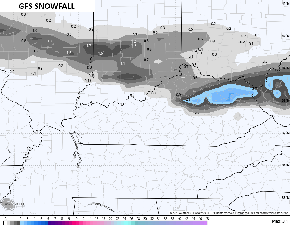
The light, slushy snowfall is possible early Thursday across the northern half of Kentucky. The GFS seems too aggressive with this…
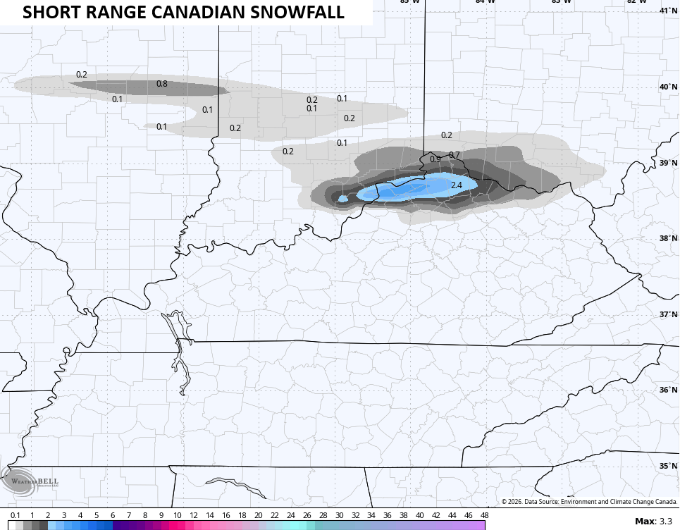
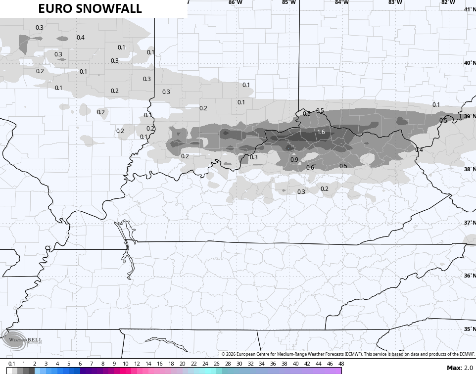
The Short Range Canadian and the Euro have a smaller band of slush…
Anything that sticks will melt away very quickly as afternoon temps hit the 40s with increasing amounts of sunshine across the entire state.
Friday and Saturday continue to look awesome with temps heading toward the 60s.
Another cold front drops in with a shower and colder temps Sunday. As that boundary hangs around, another wave of low pressure develops and rolls across our region Sunday night into Monday. Depending on the track of this low, some winter weather is possible.
The GFS seems way too amped up with the freezing rain signal…
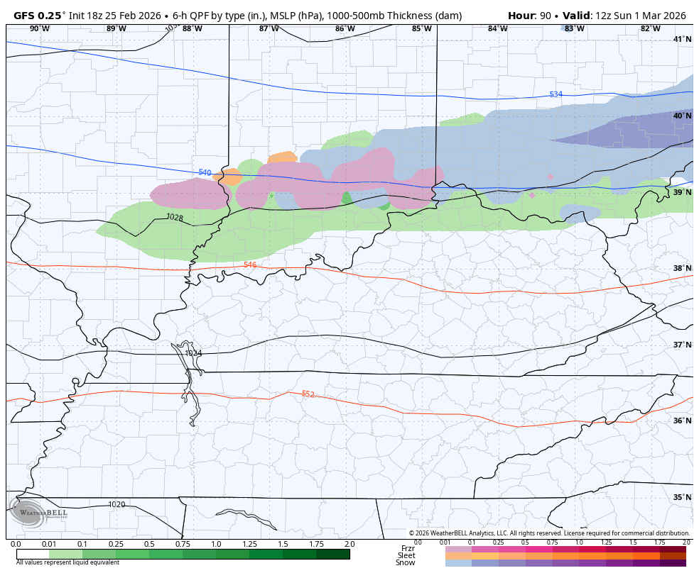
The EURO is lighter overall and has much less frozen stuff…
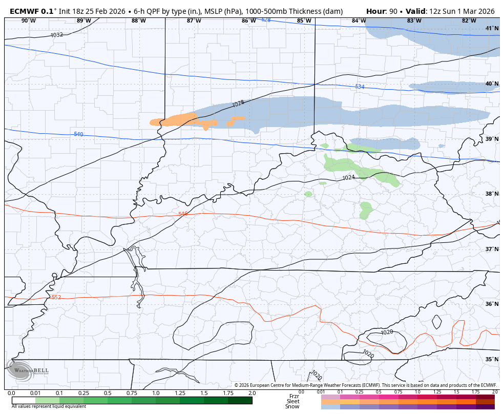
The potential is there for a swath of accumulating snow with this, but that won’t fully show itself for another day or two.
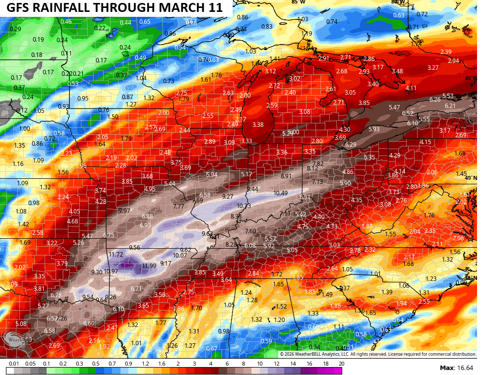
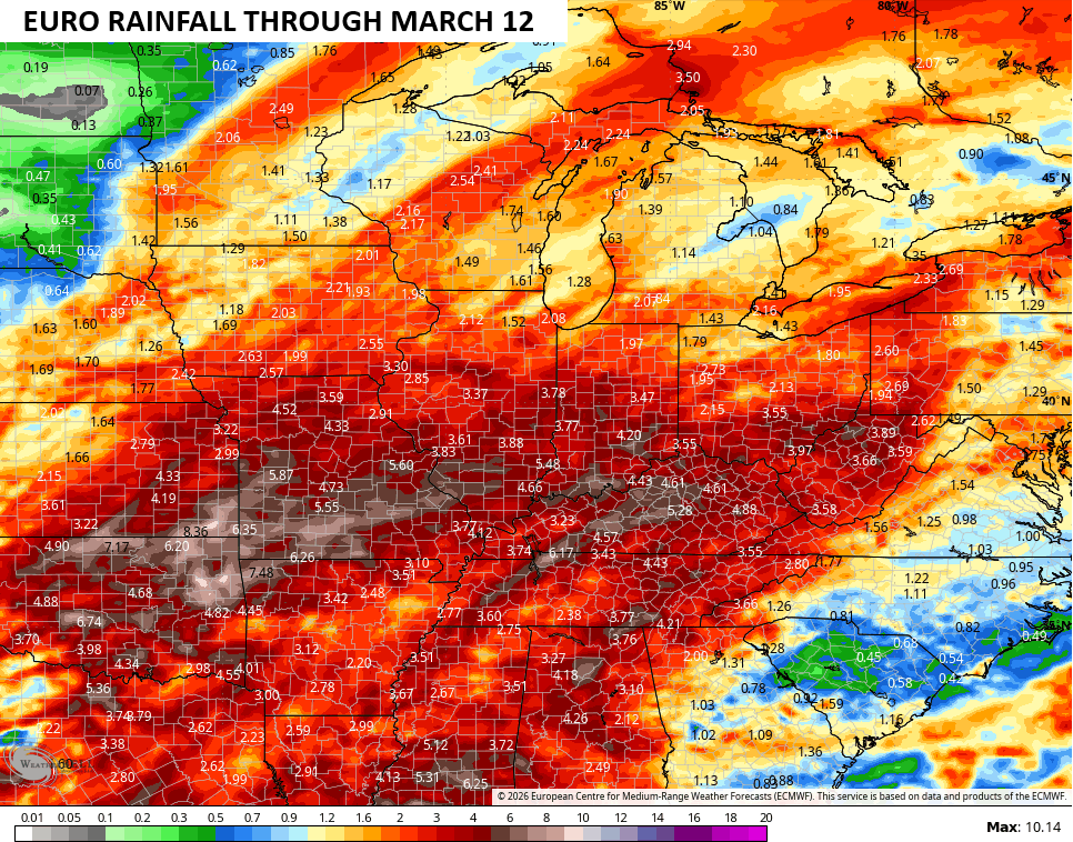
One that zips through, temps turn toward springtime as a very active weather pattern kicks in. The rainfall maps for the first part of March are looking a whole lot like the graphic I made for my last update…
I’ll have the full update later tonight. I’ll also have updates on my Meteorologist Chris Bailey Facebook Page
Until then, here are your tracking tools for the day…


Make it a wonderful Wednesday and take care.
