Good evening, everyone. I wanted to drop by for a quick update on the pattern ahead as we get set to close out February and roll into March. This pattern is likely to get us into trouble as we head into March.
Fog will be an issue tonight across areas of central and eastern Kentucky so keep that in mind for your Friday morning trip into work and school. By the afternoon, sunshine takes control with temps near 60 in the east and flirting with 70 in the west.
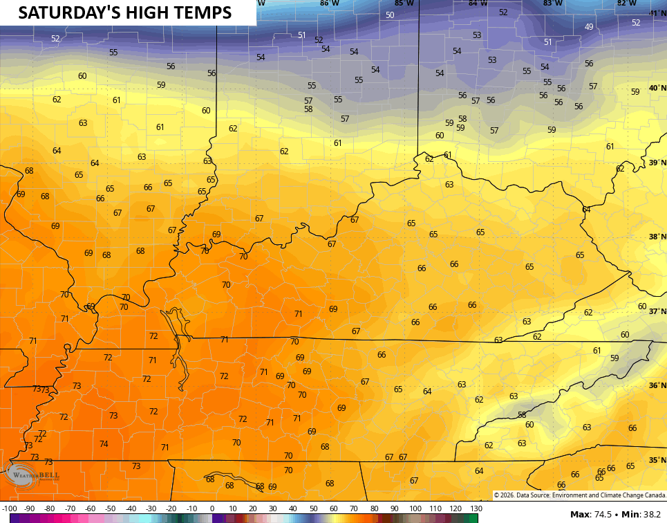
Those numbers jump even more for Saturday…
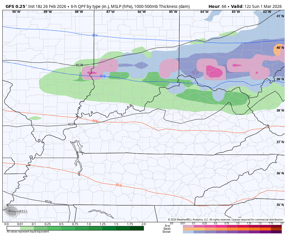
That’s ahead of a cold front dropping in Sunday morning that may have a rain or snow shower with it in the north. That boundary sags farther south late Sunday as a wave of low pressure rolls along it. That brings rain and some snow the region.
The GFS continues to have a thump and run snowfall for some…
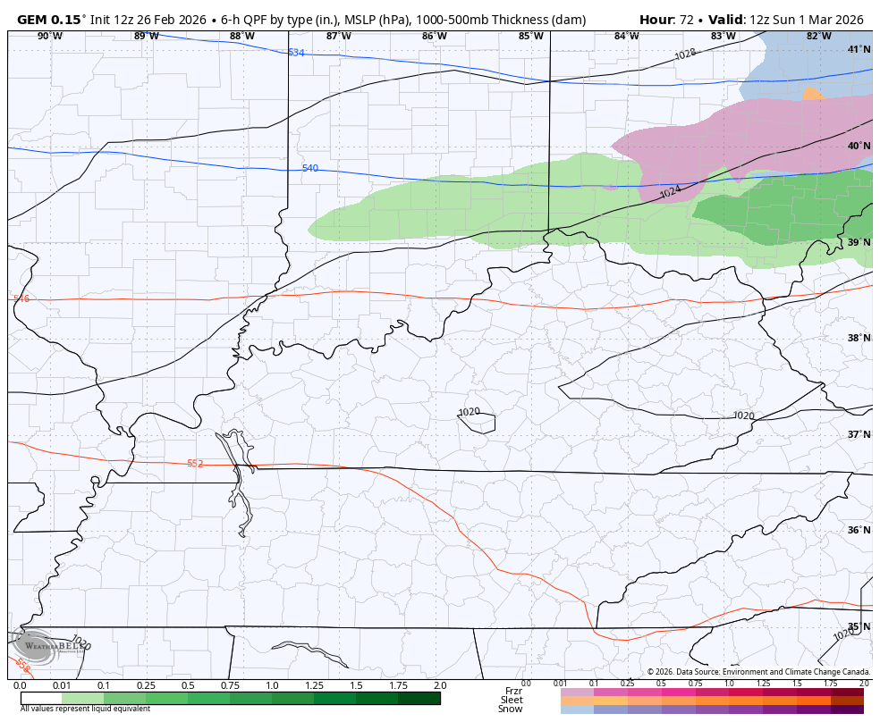
The Canadian has rain and a little mix…
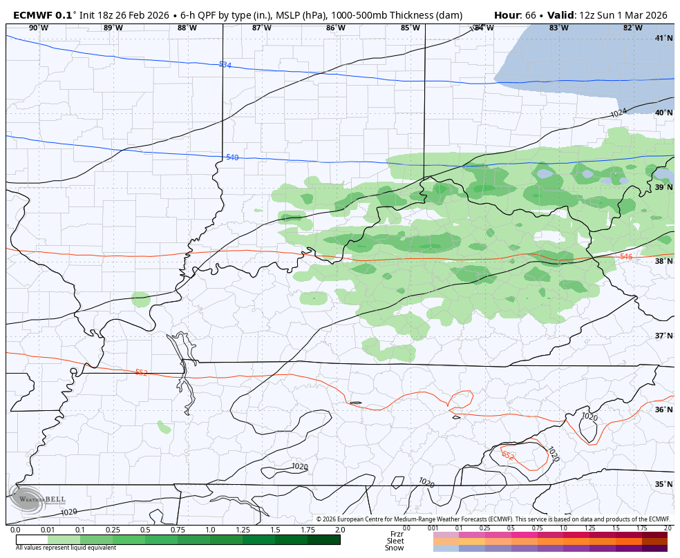
The EURO is similar…
The temps behind this will surge with later next week looking and feeling more like April. That can get us into trouble as this pattern will likely produce a lot of rain and storms for much of March.
I’ll have the full update later tonight. I’ll also have updates on my Meteorologist Chris Bailey Facebook Page
Until then, here are your tracking tools for the day…


Make it a great Thursday and take care.
