Good Friday, everyone. Much milder winds are kicking in for the final two days of February. Once into early March, a messy system brings rain and snow to the region Sunday night and Monday before an active spring pattern takes control.
Before we focus on all that, let’s start with the closing days of this month. Fog is an issue for some areas this morning, especially in the central and eastern parts of the state. Sunshine takes control this afternoon with upper 50s to middle 60s for the Commonwealth.
Saturday turns even milder on a strong southwest wind. Highs are low and middle 60s for many with a 70 in the south. Clouds will increase ahead of a cold front dropping in early Sunday and may have a band of showers along it.
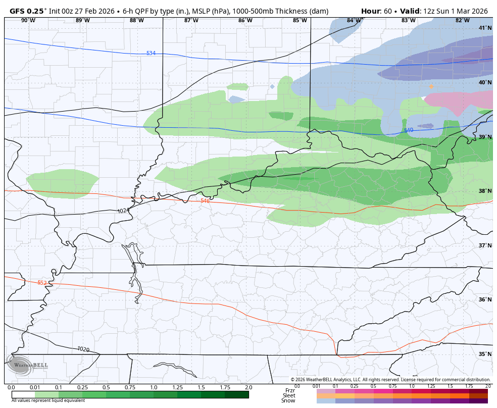
Temps come way down Sunday as we await a wave of low pressure working through the region. This brings a swath of rain and snow across the state Sunday night and Monday, potentially bringing some accumulations, especially in the north.
The GFS continues to be the most enthusiastic about this possibility…
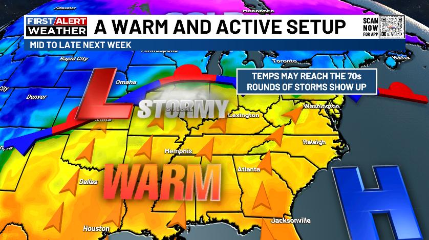
The pattern after this will feature a serious surge of spring with temps heading toward an extended run in the 70s. This may come along with rounds of storms…
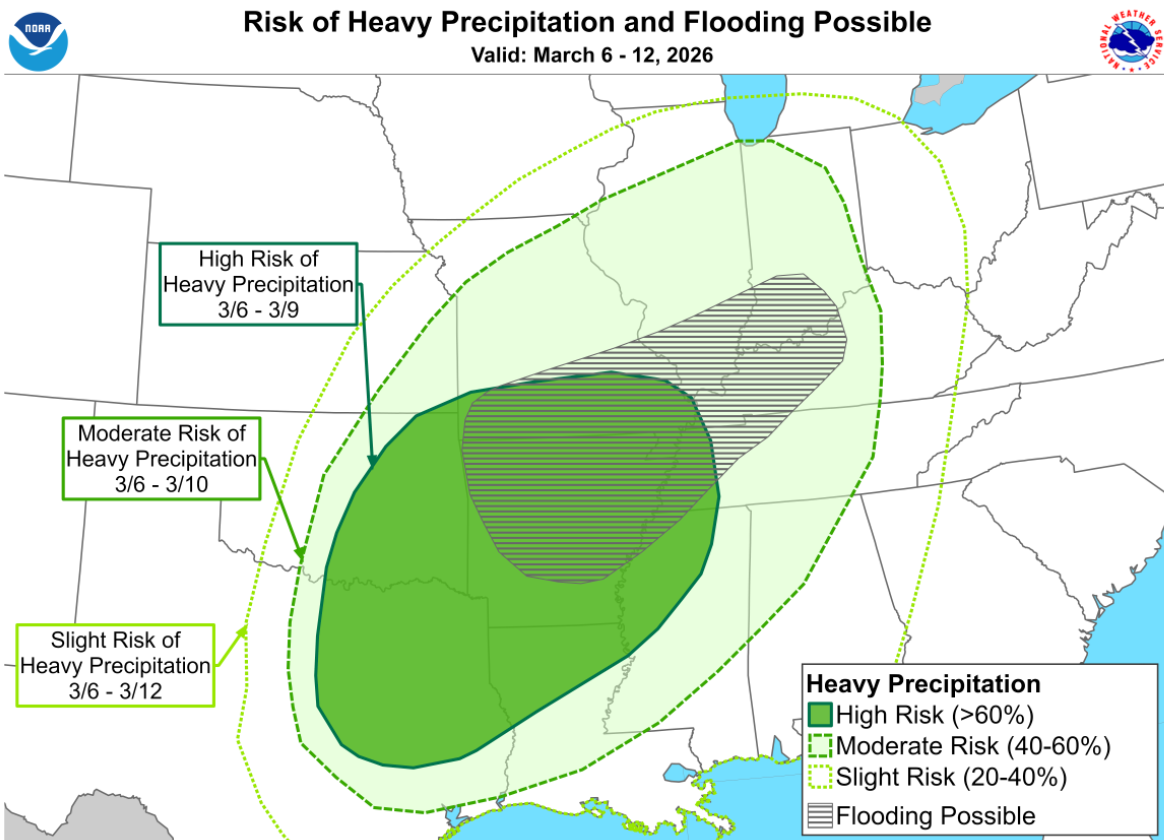
For a few weeks now, I’ve been very loud with my thought on this spring being a very wet one and I see no reason to change that thought. The Weather Prediction Center sees this potential cranking in early March. Here’s the risk for heavy rain and flooding for the March 6-12 time period…
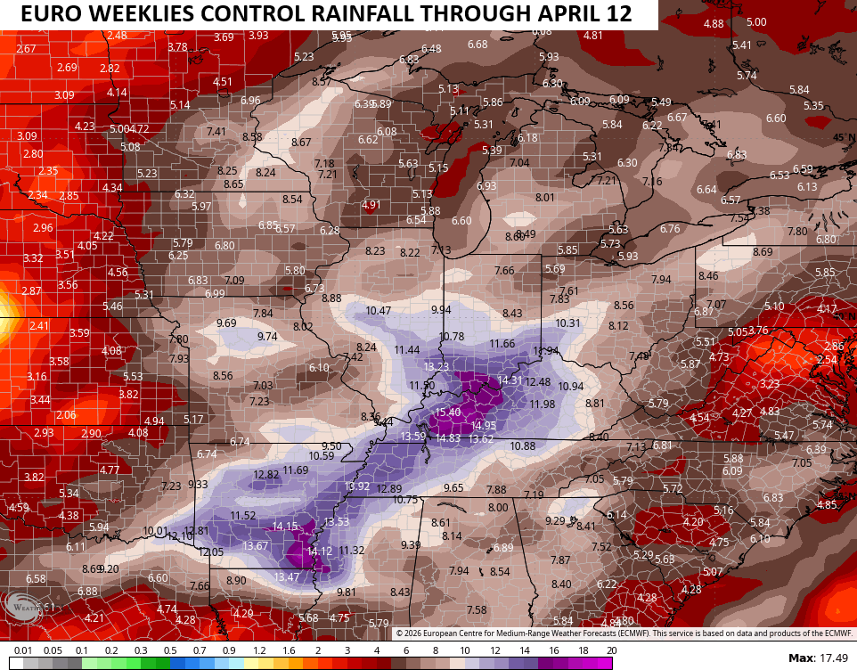
This is kicking off a super active setup that should take us all the way through March and into early April. Rounds of heavy rain and storms will target this part of the world with the EURO Weeklies show a lot of rain around here…
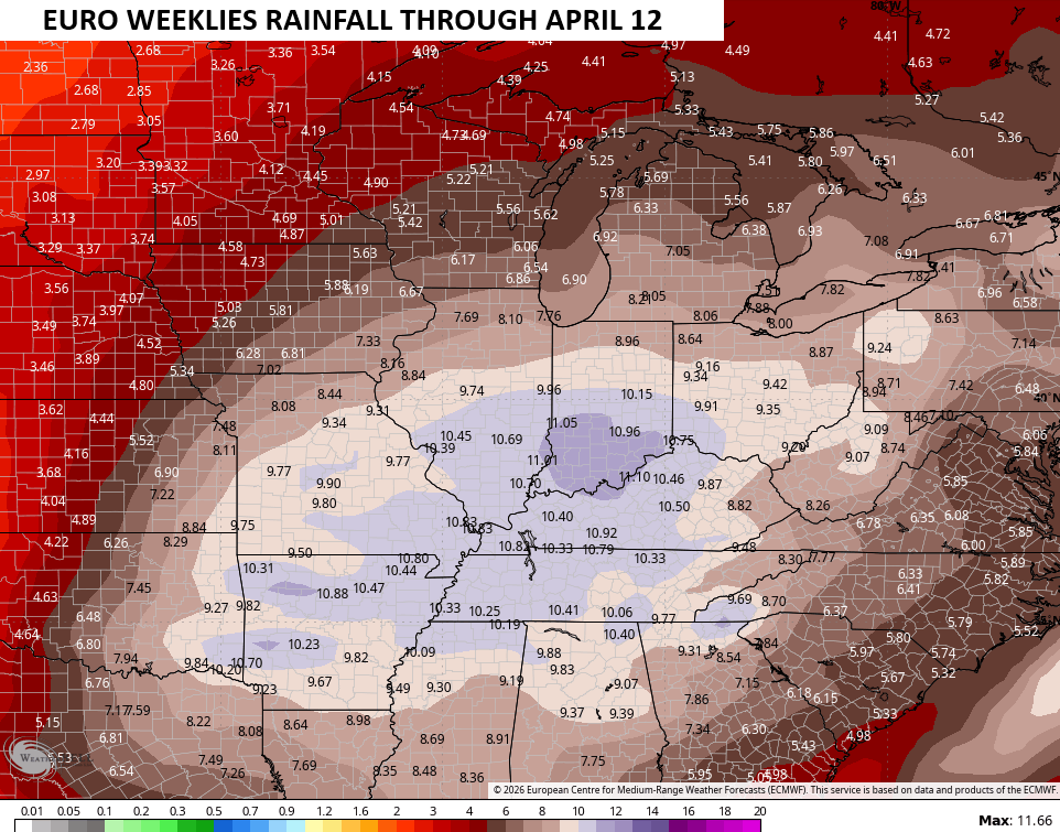
The single run of the EURO Weeklies have an even stronger rainfall look…
I’ll throw you another update later today. Make it a fantastic Friday and take care.

I’m starting to think we’re going to have a repeat of last year. We get way ahead in rainfall through the first part then mid year it shuts off and we go into extreme dry conditions.
I Totally Agree Dottie. Nothing In The Atmosphere Has Changed. We Really Need That ENSO / El Nino Plus A Positive Pacific Decadal Oscillation, To Rid Us Of This Boring Weather Pattern. It May Not Be That Wet Or Stormy In Our Area, Because Of The Southeast Ridge, Which Is Always Amplified When La Nina Is Present, Keeping Most Of The Severe Weather To Our Southwest, As Well As The Flooding Rains. I Think Spring Weather Is Around The Corner, But I Bet We Will Have A Late Freeze In April, And Then Summer Weather Will Take Over In May. Could Be Dry Too.
I hope we don’t get that much. We need sunshine at some point.
I Don’t See Us Receiving That Much Rain. Most Of Our Summers Are Sunny, Hot And Humid, With Drought Conditions Developing In Areas Of The State.