Good Sunday and welcome to March! It’s the first day of Meteorological Spring and we are starting things out with a winter system coming in later tonight and Monday. This will be followed by a MASSIVE sure of true spring temps that can lead to some trouble.
A cold front drops in here early today and slows down. Colder winds are showing up as morning showers taper off. A wave of low pressure then rolls eastward into the region tonight, bringing snow, sleet, freezin rain and rain across Kentucky.
The HRRR Model is really amped up with this and shows enough wintry accumulations to cause travel issues Monday morning…
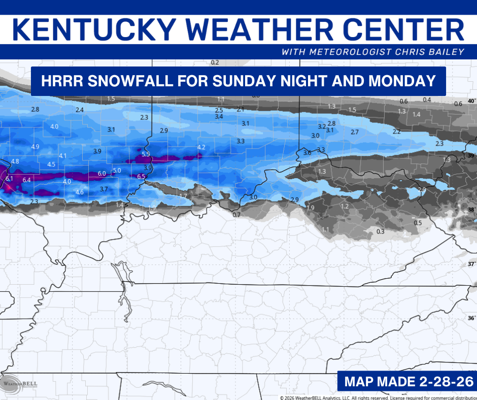
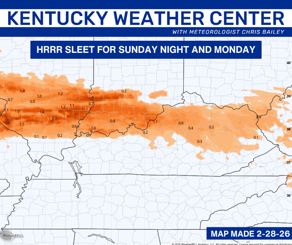
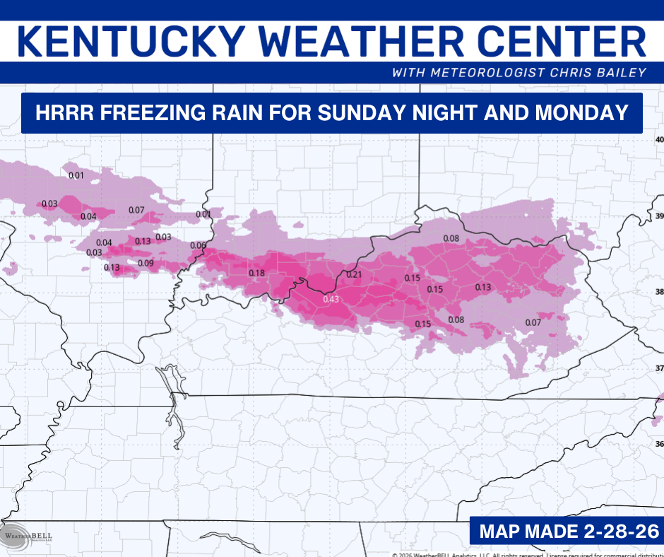
Whatever winter weather is with us early Monday should melt away pretty quickly during the afternoon with temps well above freezing. From there it’s full steam ahead to spring temps arriving on Tuesday. Temps surge into the 60s and 70s for highs…
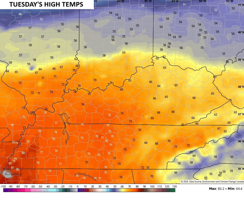
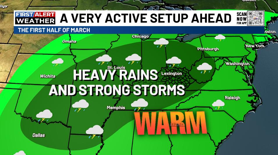
Temps stay very warm through next weekend with highs pushing into the 70s. Rounds of storms will also kick in from time to time and some of them will put down very heavy rains and could be strong.
This active setup shows no signs of letting up and the WPC continues to highlight the heavy rain and flooding potential into the second week of the month…
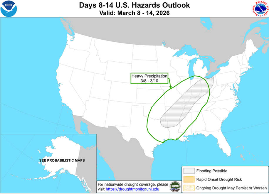
This pretty much matches the map I made more about a week ago…
This isn’t just limited to the first half of March, but it’s one likely to roll through the rest of the month and into the first half of April. The EURO Weeklies have a very concerning look with widespread heavy rains around here and from much of the Great Lakes through the Mississippi Valley…
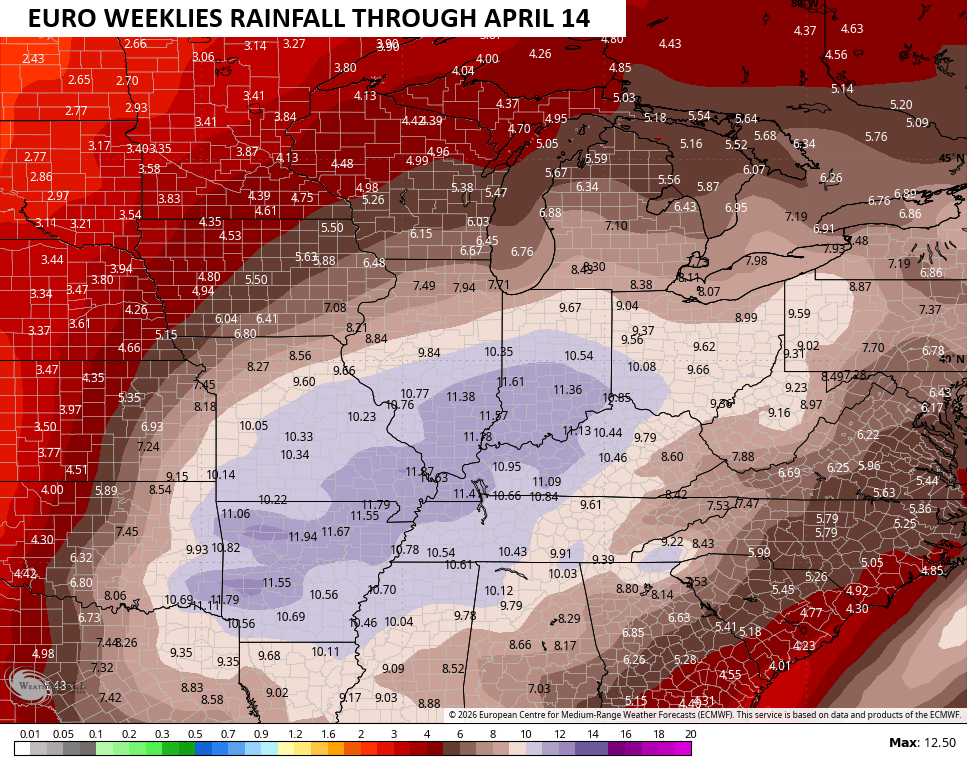
The potential for significant flooding is there, folks.
Another update or two comes your way later today. I’ll also have updates on my Meteorologist Chris Bailey Facebook Page
Until then, here are your tracking tools for the day…


Make it a great Sunday and take care.
