Good evening, everyone. We’re putting the wraps on the first day of March by tracking a quick-hitting winter weather maker. Once this rolls through, it’s straight to an April pattern with warm temps and increasing amounts of storms.
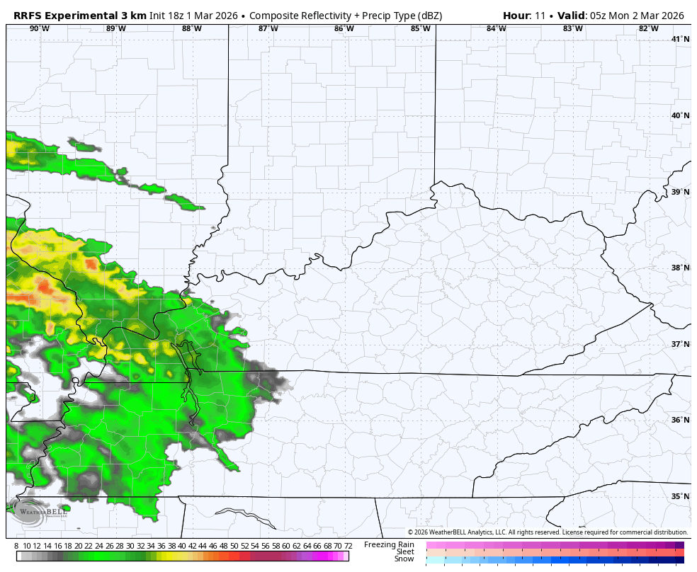
As expected, the northern half of the state has the best chance for snow, sleet and some freezing rain. We currently have a Winter Weather Advisory out through early Monday in the north and northeast…

I would probably pull that a few counties south, but the NWS offices in Louisville and Jackson are sitting this one out. I get it because I’m over winter, too, but they should still have a couple of their far northern counties in this since it’s a morning rush hour impact.
The future radar from the RRFS shows the wintry mix extending south of Interstate 64…
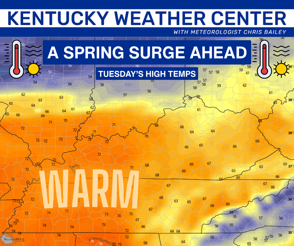
Whatever falls in the morning melts away by the afternoon with temps well above freezing by then. Temps rise all night Monday with readings reaching the 60s and 70s Tuesday…
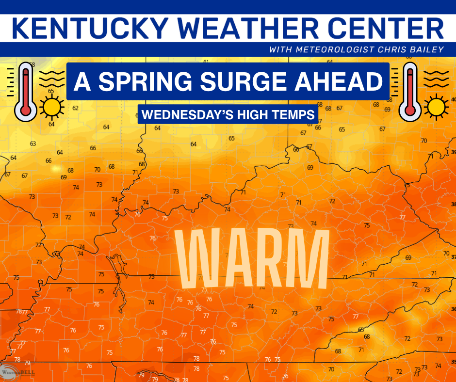
We are DEEP into the 70s by Wednesday…
Temps by the end of the week into next weekend may even reach 80 in many areas.
This will come along with some rounds of showers and storms and that’s a trend that should ramp up even more into the following week. I’ve made no bones about my thoughts on a very wet and active early spring.
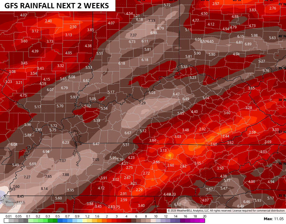
The operational Models only go out through the next 2 weeks, but they have a really ugly rainfall look…
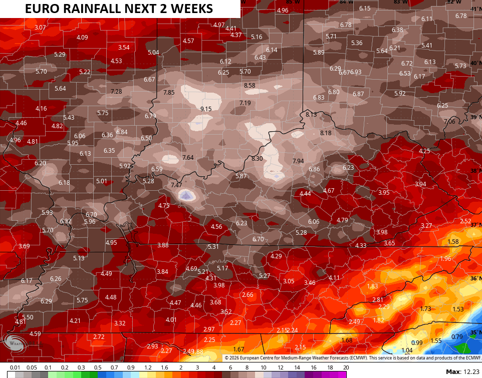
The warm temps are great this time of year, but that’s the only good thing coming from this pattern.
The full update comes your way later tonight. I’ll also have updates on my Meteorologist Chris Bailey Facebook Page
Until then, here are your tracking tools for the day…


Make it a great Sunday and take care.
