Good Monday to one and all. We have a quick hitting blast of winter weather starting the day across parts of the state. Once this blows through, a major blast of spring surges in with warm temps and the increasing threat for heavy rain and strong storms.
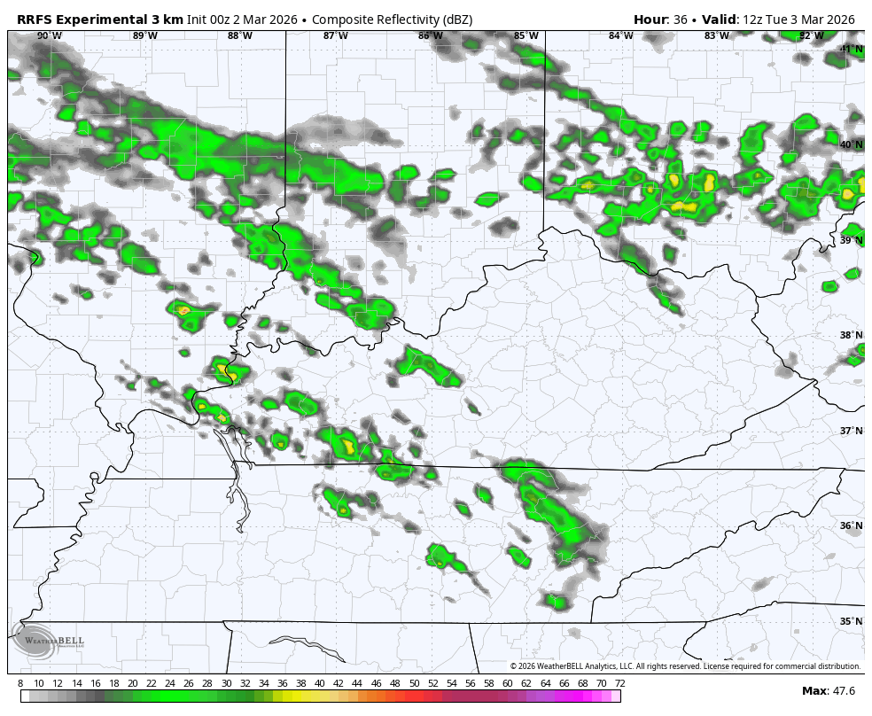
The northern half of Kentucky has the best chance of some snow, sleet and freezing rain this morning. This may cause some travel issues early on and that’s why parts of the region continue to be under a Winter Weather Advisory…

If anything accumulates this morning, it’s gone by the afternoon as temps go well above freezing.
All of this is in response to a stalled boundary with a wave of low pressure rolling along it. This boundary heads back to the north tonight and Tuesday, sparking scattered showers and storms as it does so…
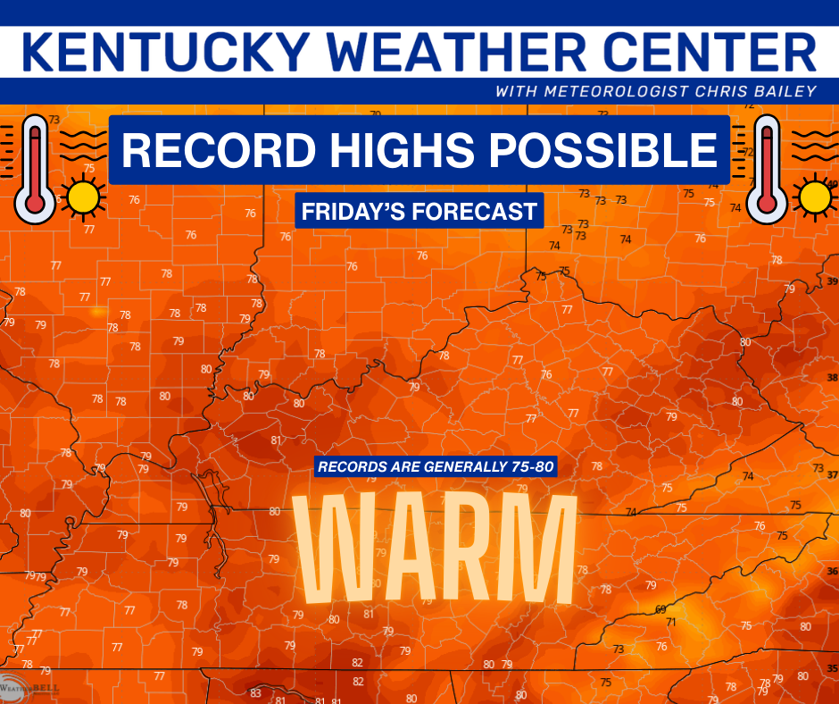
Temps will also surge into the 60s and 70s for highs.
Temps warm even more through the rest of the week into the weekend and may flirt with record highs…
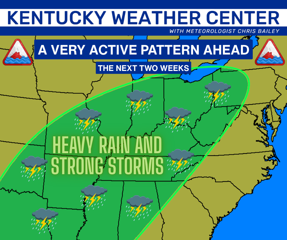
Scattered showers and storms will be noted during this time, especially in the north and west. This stormy pattern then ramps up even more later this weekend into next week. This is a setup that can cause flooding and produce a few rounds of strong to severe storms…
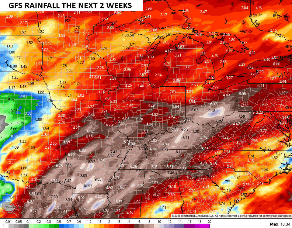
Check out the GFS rain forecast for the next 2 weeks…
Another update or two comes your way later today. I’ll also have updates on my Meteorologist Chris Bailey Facebook Page
Until then, here are your tracking tools for the day…


Make it a magnificent Monday and take care.
