Good evening, everyone. Milder air is surging in from the south tonight, setting us up with a pattern more typical of late April and early May than early March. Near record highs and rounds of storms will be the rule for a while.
As a warm front lifts northward through the state tonight and Tuesday, temps climb with the 60s and 70s for many on Tuesday. That boundary stalls near the Ohio River for the next few days and will be the focusing mechanism for rounds of showers and storms.
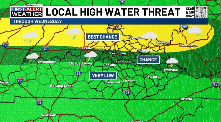
I’m highlighting the areas with the best chance for repeat showers and storms that can cause some flash flooding issues…
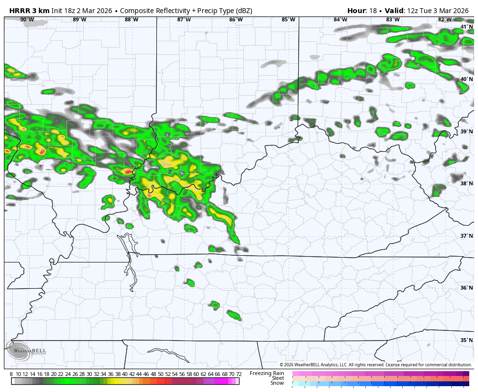
The future radar only goes through 1pm Wednesday, but shows this very well…
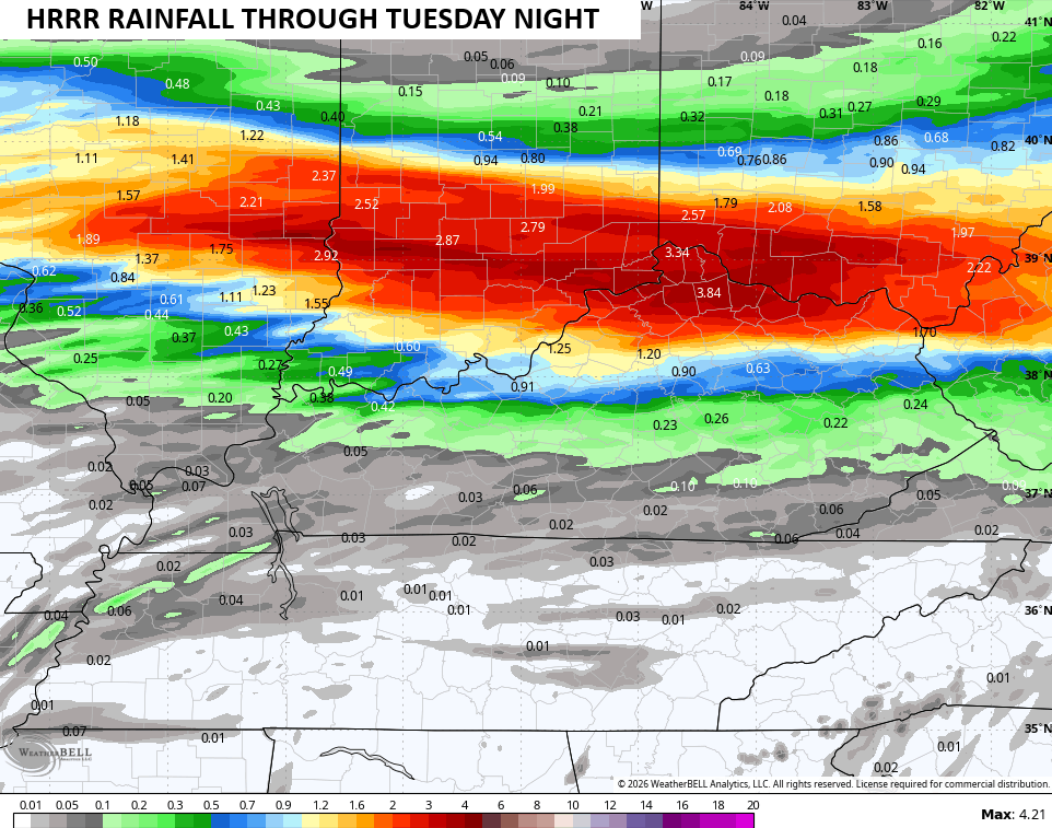
Look at the rain numbers from that run through the same time…
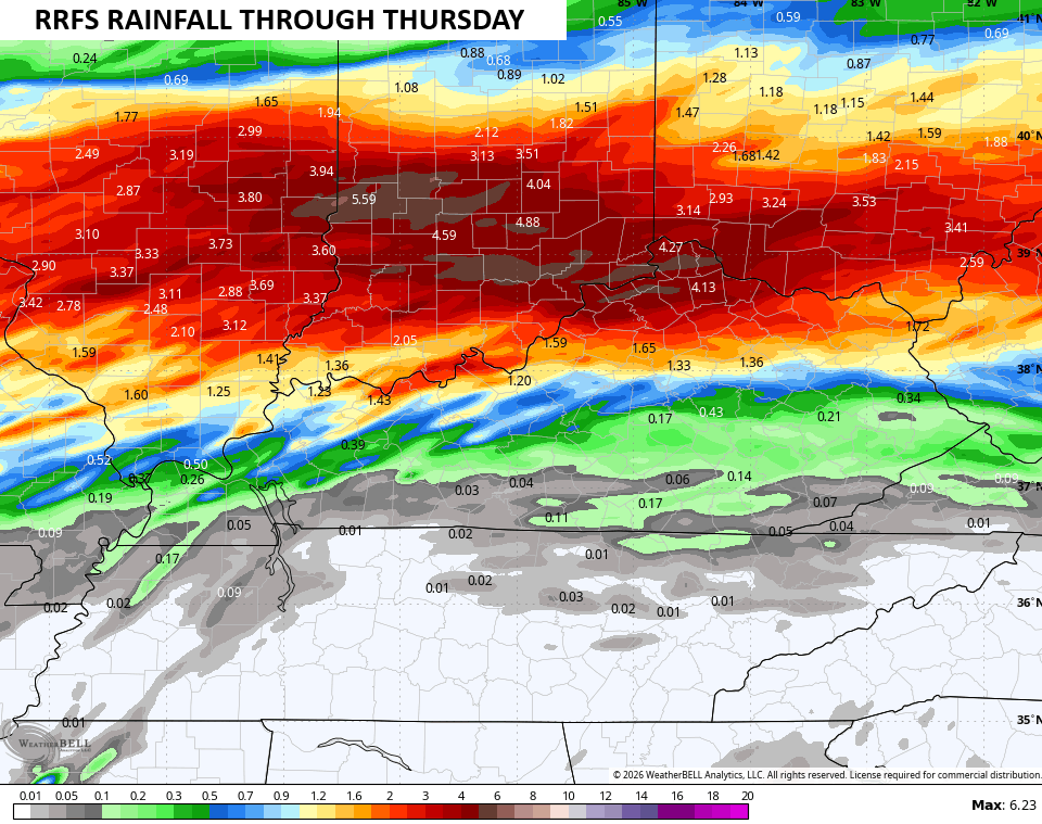
The future radar from the RRFS goes through 1am Friday and keeps those rounds of storms going into that time period…
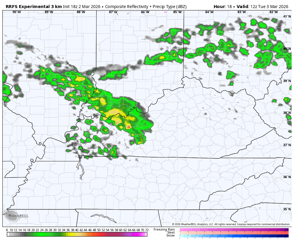
The RRFS Rainfall through that time period is even more pronounced…
Some of the storms on Wednesday may be strong or severe and the Storm Prediction Center now has a Marginal Risk for severe storms…

The full update comes your way later tonight. I’ll also have updates on my Meteorologist Chris Bailey Facebook Page
Until then, here are your tracking tools for the day…


Make it a magnificent Monday and take care.
