Good Tuesday to one and all. Much warmer air is surging in from the south today and it’s bringing a stormy setup along for the ride. We have the potential for strong storms and heavy rains as temps feel more like late April or early May.
A warm front is lifting through here today with temps warming into the 60s and even 70s in the far west and south. A wave of showers and storms is along and ahead of this boundary as it lifts through.
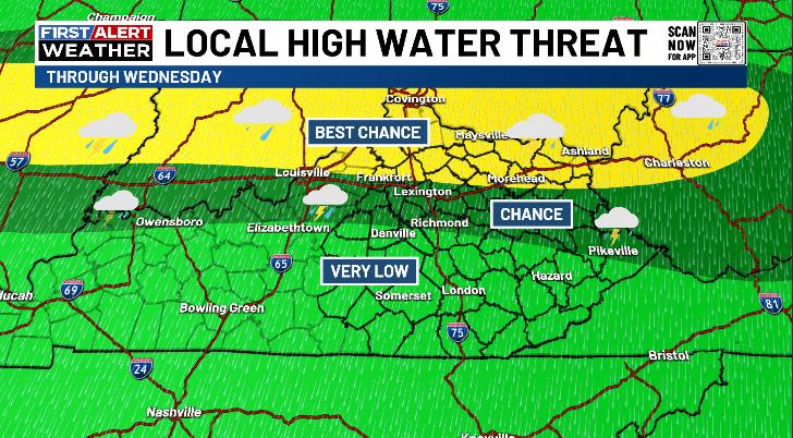
The boundary then slows down across far northern Kentucky leading to waves of showers and storms along it through Wednesday and into Wednesday night. This has the chance to produce local flash flooding issues, and I’ve highlighted the areas most at risk…
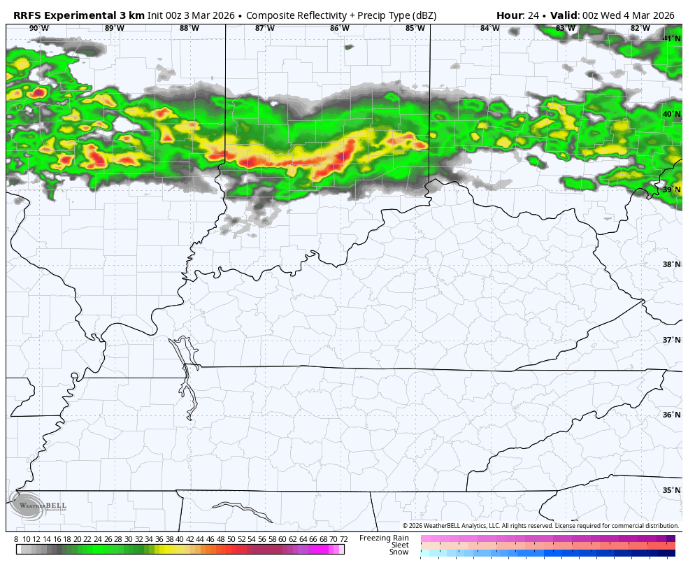
The future radar from the RRFS shows these waves of showers and storms through Thursday evening…
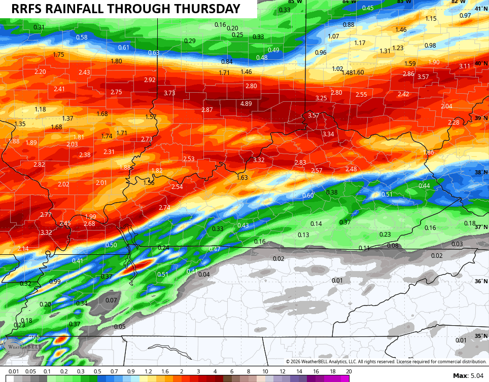
Here’s the rainfall forecast from that same run…
The storms on Wednesday have the chance to become strong or severe during the afternoon and evening hours. The Storm Prediction Center is highlighting this low-end potential with Wednesday’s Severe Weather Outlook…

Here’s a look at the individual threats from the SPC…


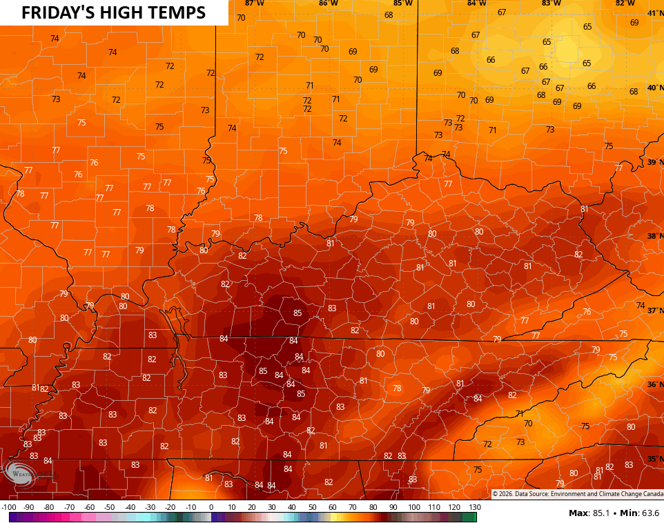
Temps continue to climb through the end of the week into the weekend. Record highs will be possible, especially on Friday when 80 degree high temps are a real possibility if we get enough sunshine…
Another update or two comes your way later today. I’ll also have updates on my Meteorologist Chris Bailey Facebook Page
Until then, here are your tracking tools for the day…


Make it a terrific Tuesday and take care.
